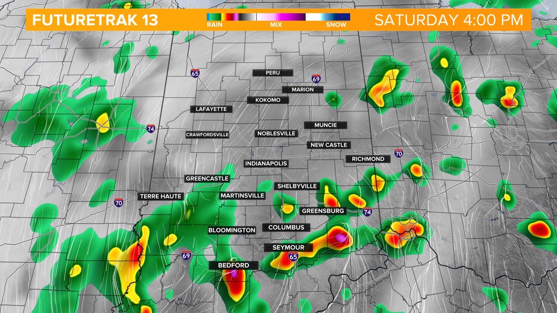
INDIANAPOLIS — Spotty rain showers continue into the early afternoon but the threat of heavier downpours and thunderstorms ramps up as a center of low pressure tracks through central Indiana in the late afternoon/early evening. The severe threat is low but areas of flooding will be possible, as well as lightning.
The heavier downpours move into southern Indiana after 4 p.m. then into the Indianapolis metro after 6 p.m.


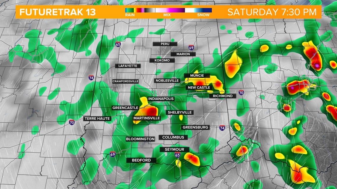
Scattered showers and isolated storms continue through the overnight and taper off during the morning hours Sunday. Expect more dry time tomorrow afternoon as we sit in between two storm systems.
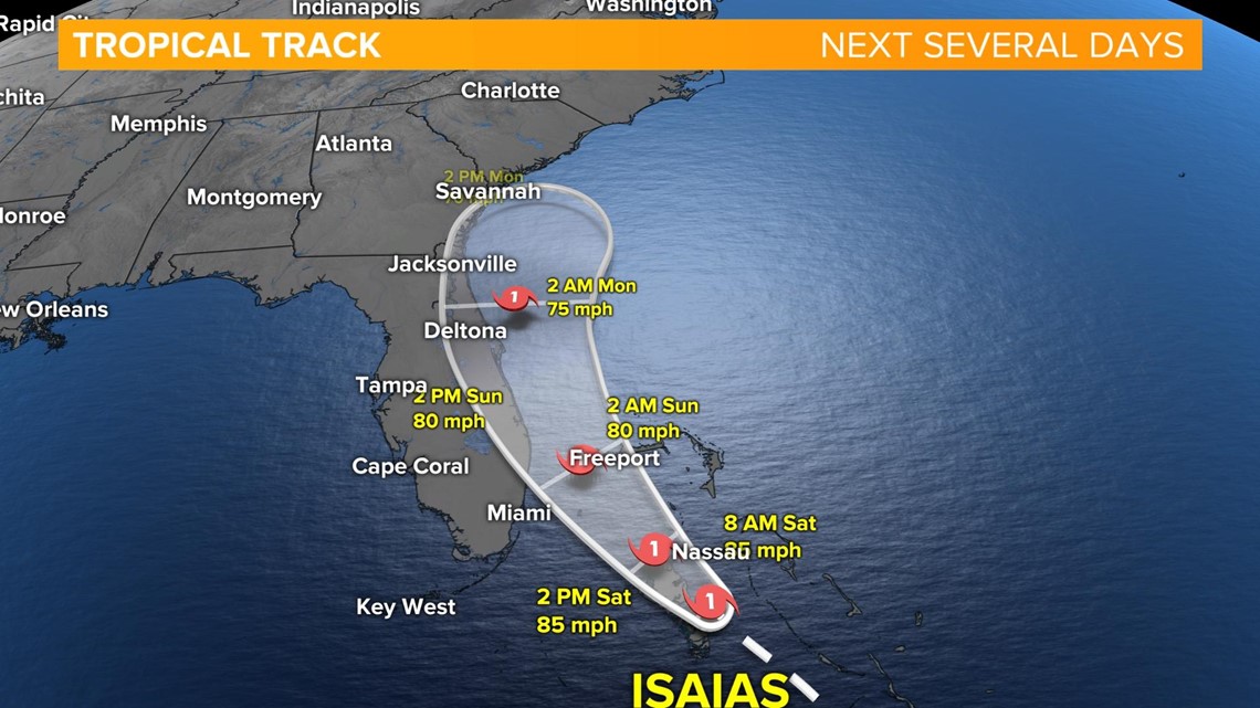
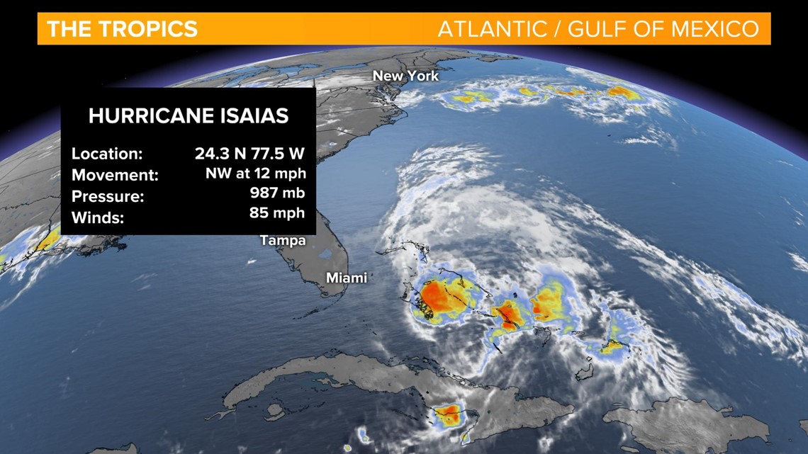
We're also watching the tropics this morning as Hurricane Isaias tracks toward south Florida as a category 1 storm. It has sustained winds of 85 mph as it moves across the Bahamas.

The storm will move up the east coast of Florida Sunday bringing heavy rainfall, a storm surge of 2-4 feet, flash flooding and the threat of tornadoes. The storm track is forecast to follow the east coast of the U.S. and should not have any impact on central Indiana.