

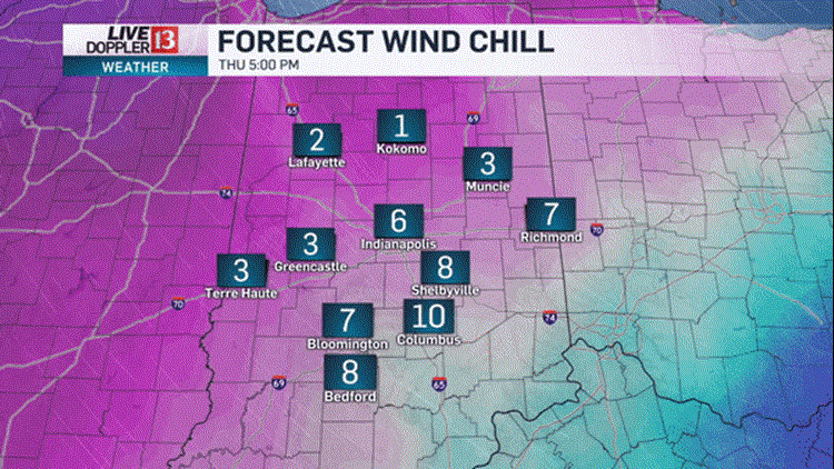
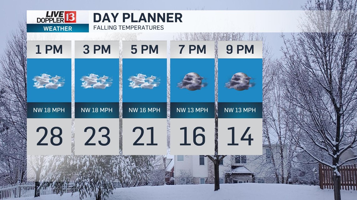
An Arctic cold front will move through today, causing temperatures to crash today. Temperatures have been holding near steady in the low 30s but will tumble into the low 20s by late afternoon. Winds will also increase, creating wind chills in the teens. A few snow squalls, or quick hitting snow with gusty winds, will be possible this afternoon too. Most areas will be dry but cloudy.

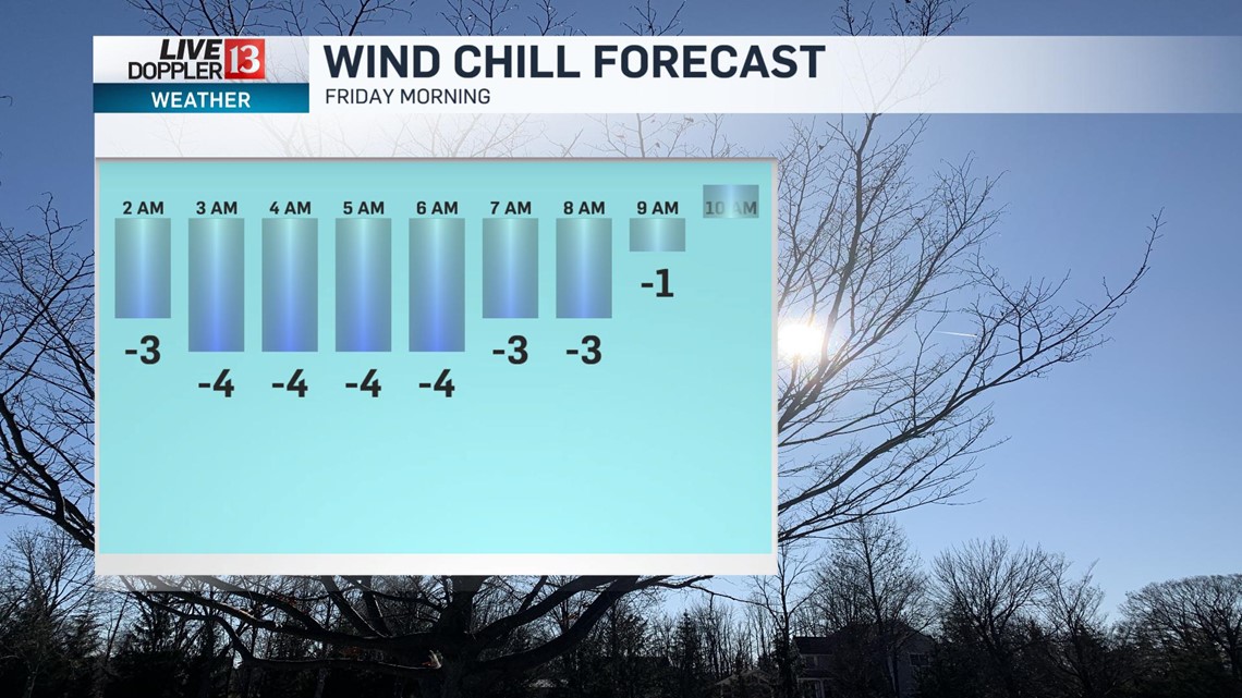
It will be mostly cloudy and bitter cold into Friday morning. Temperatures will fall to around 5° Friday morning with wind chill values running 5 to 10 below zero.


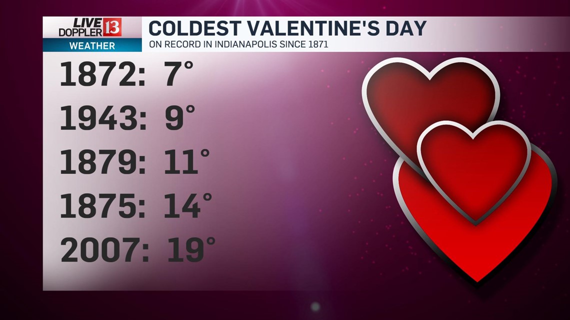
Valentine’s Day will be frigid but sunny and dry. Temperatures will only climb into the upper teens, running 20 degrees below average. The wind will relax a bit by afternoon but wind chill values will be in the single digits.

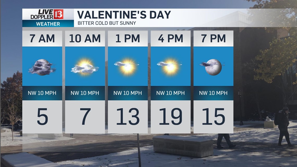
It will be the coldest Valentine's Day since 2007!

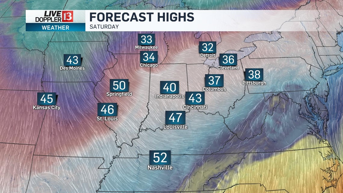
There will be an improvement in temperatures this weekend. It will be partly sunny and dry with highs in the low 40s.

Monday will be mild with highs near 50°, as temperatures rise through the day. A few scattered showers will be around too.
More widespread rain will be around on Tuesday. Temperatures will climb to an early high in the low 50s, and then fall during the afternoon, as another cold front arrives.
Wednesday will be below normal with breezy winds and highs in the mid 30s.
