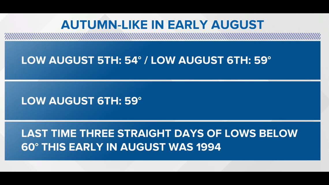
INDIANAPOLIS — Indianapolis has a chance tonight to do something that hasn't been done in over 26 years.
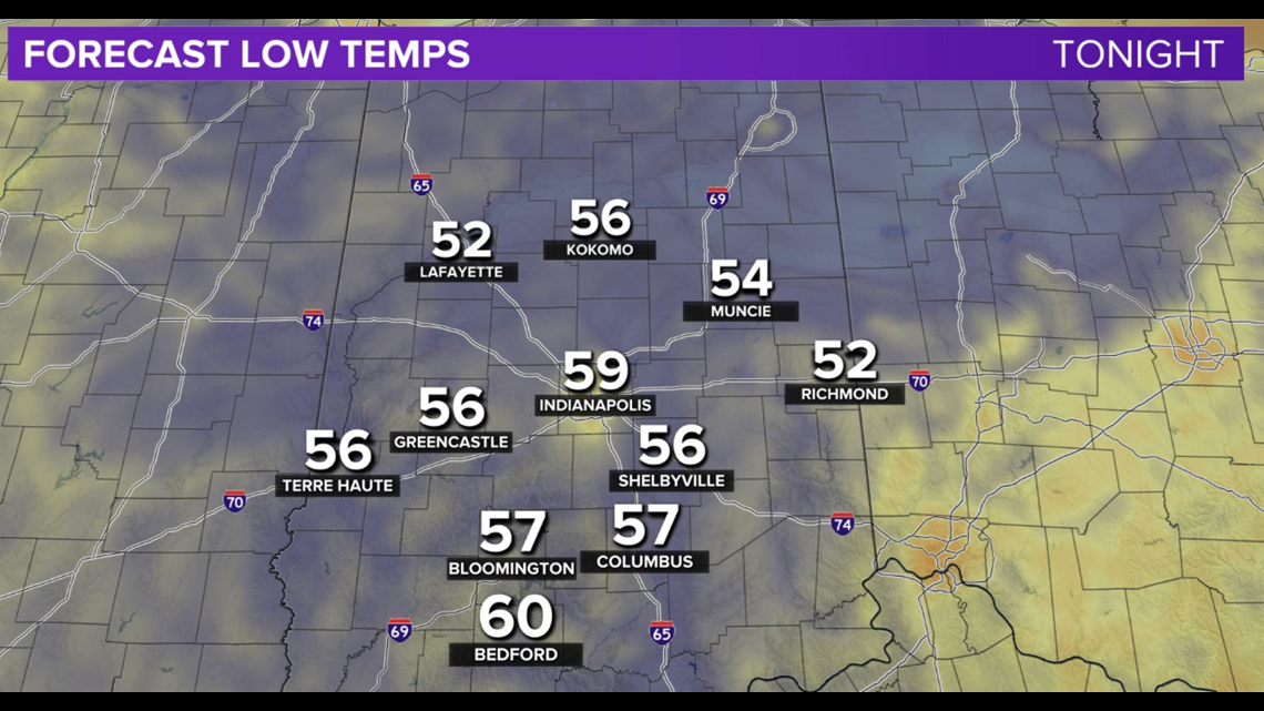
If the temperature drop below 60 at the NWS office in Indy, it would mark the third straight morning for that to happen. That hasn't happened this early in August (1st-7th) since 1994, and would be only the 22nd time on record to happen since 1871.
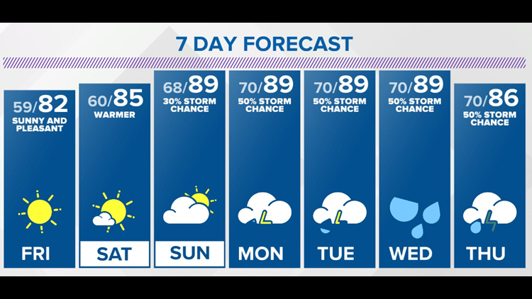
With or without sub-60° lows, it's going to be another comfortable start Friday morning.
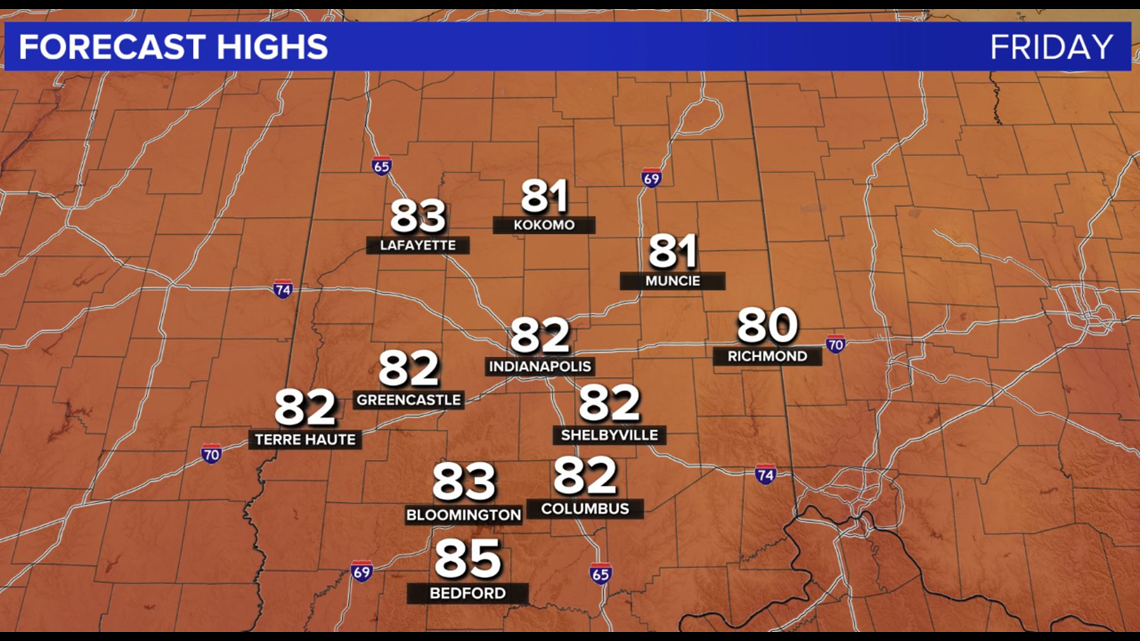
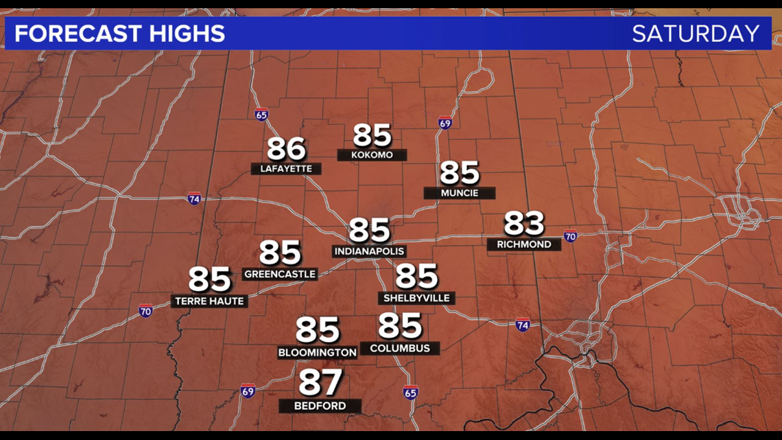
We're expecting less in terms of low cloud cover and afternoon highs to creep into the lower 80s, but the muggy meter remains comfortable, not only on Friday but most of Saturday when highs get into the mid-80s.
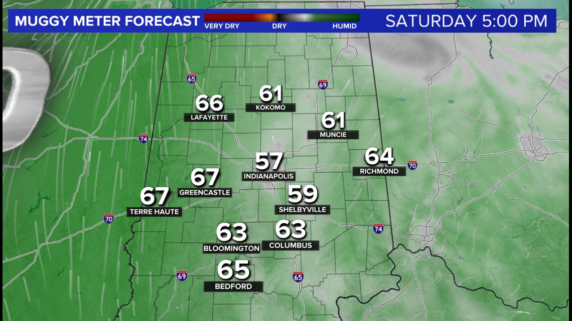
By late Saturday, however, dew points start surging into the 60s and near 70° (oppressive) Sunday into the middle of next week.
This rise in moisture eventually helps spark some thunderstorms, possibly Sunday but more likely Monday and into the middle of next week.