
The forecast of a stormy and soggy Sunday is certainly playing out over the I-70/74 corridors today. Not coincidentally, this is an area near/just north of a warm front that's slowly drifting north.
It's serving as the track for "training" downpours and occasional rumbles of thunder. Thus far, the atmosphere in central Indiana remains rain-cooled and stabilized near the surface.

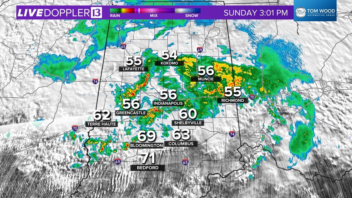
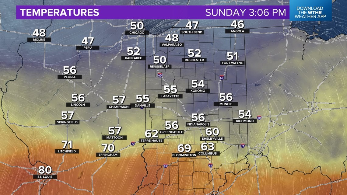
However, south of the front, temperatures are warming into the 60s/70s, and combined with higher dewpoints, is becoming sufficiently unstable to promote new storm development south of the warm front. We'll be monitoring the location of that front closely this evening with the potential of some storms near/south of the front possibly rotating due to the increasing wind shear/spin around that boundary.

While areas of flooding are the most probable severe weather element in our viewing area between now and Monday morning... rotating storms along the warm front and localized severe gusts embedded with a storm line overnight remain possible.

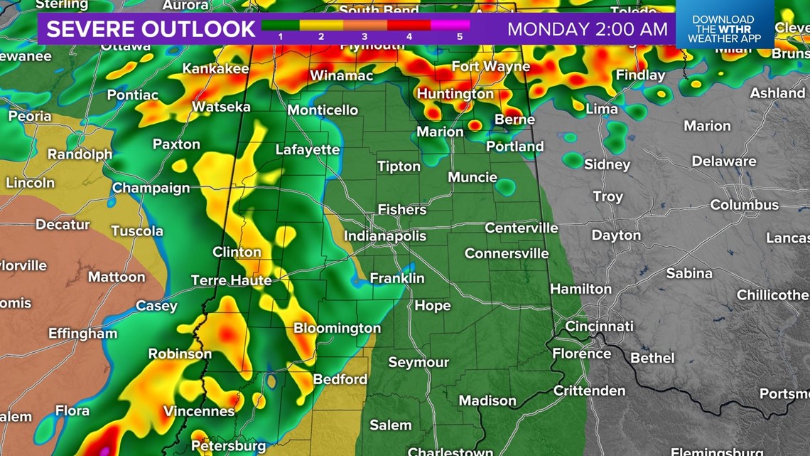
Continue to be Weather Aware and know that area roads are already rain-covered and in some places flooded. Watches and/or Warnings could be issued so please have multiple ways to receive them for your area.
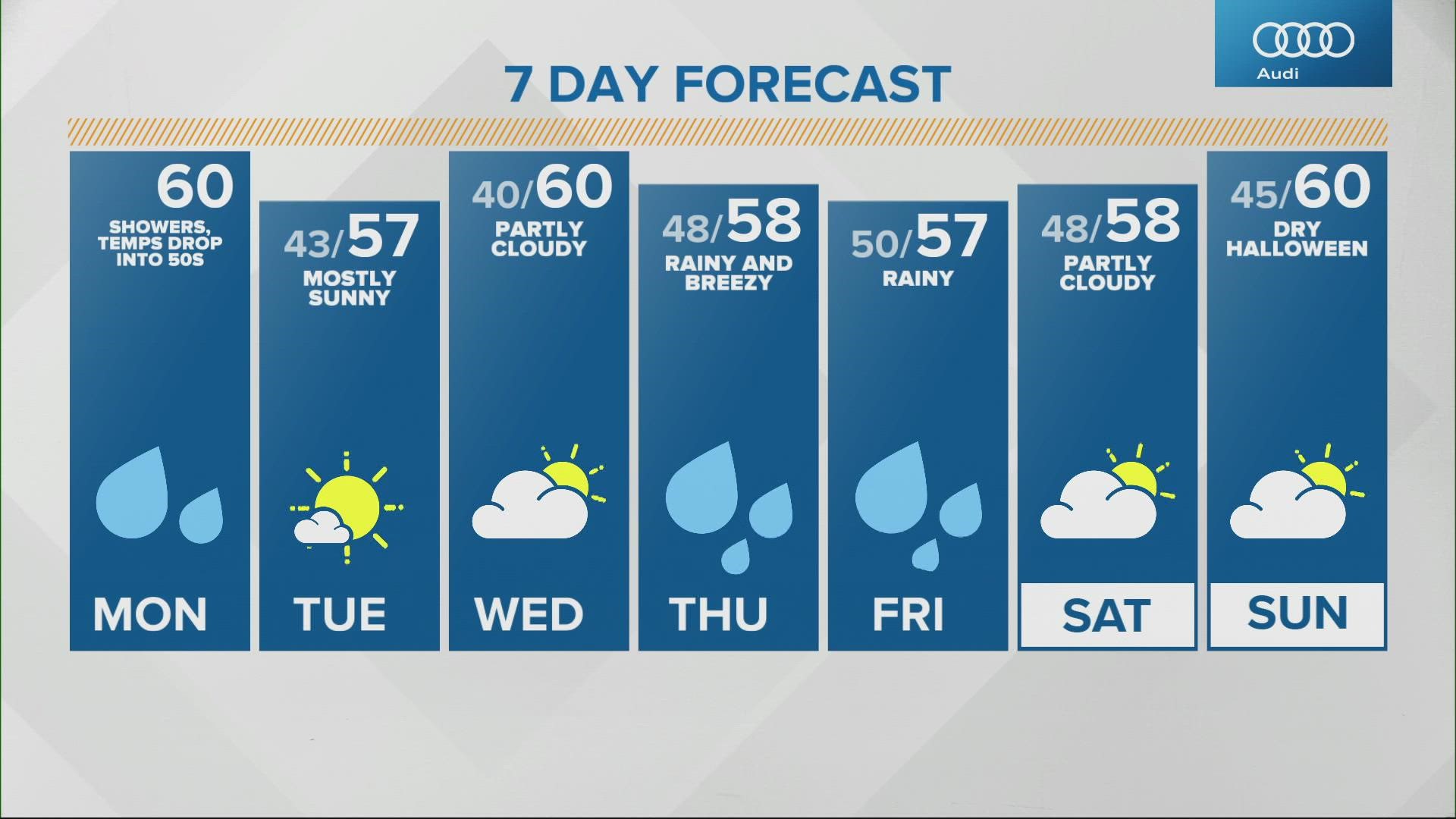
The threat of severe weather ends by 6 a.m. Monday, but rain showers linger into Monday afternoon.