

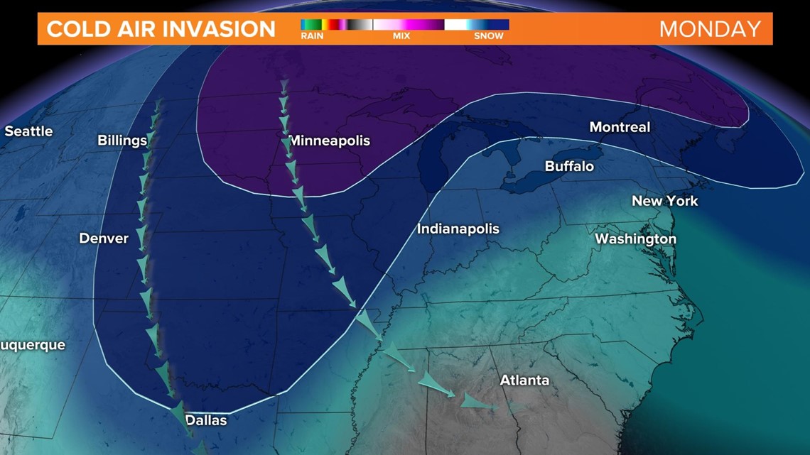
INDIANAPOLIS — While there are a lot of questions regarding the next storm system, there is higher confidence that cold air will invade the Ohio Valley.

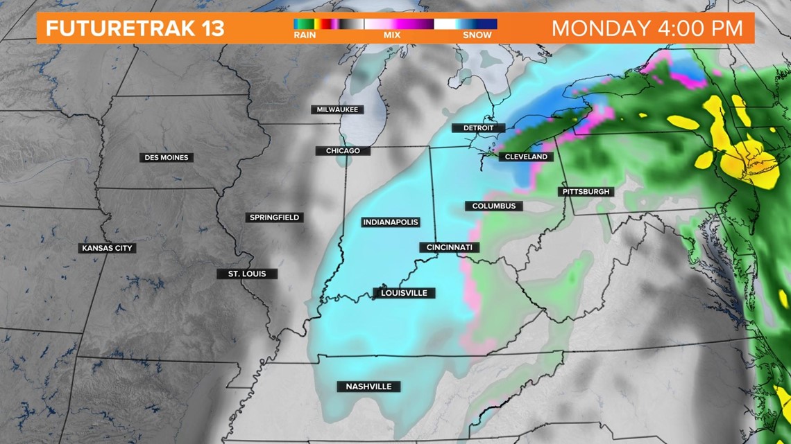
Right now, precipitation should start out as rain in southern Indiana late Sunday night.

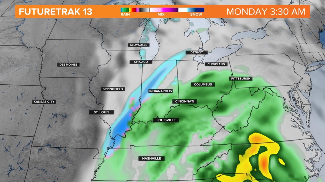
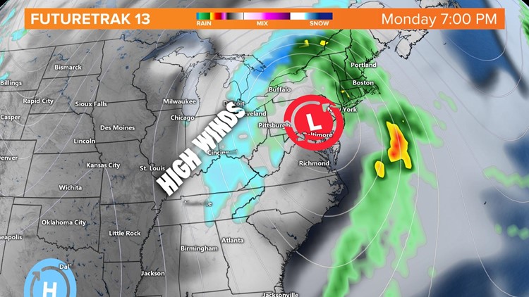
Precipitation will push in from south to north, with much colder air arriving Monday morning. Depending on where the low sets up, rain could change over to sleet and then to snow by sunrise Monday.

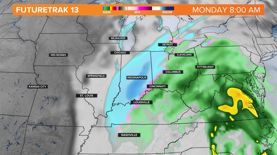
If this system stalls out, like a couple models are depicting, the low could sit and spin, keeping central Indiana in a snow zone.

The Jetstream and an upper level low will phase together on Monday.

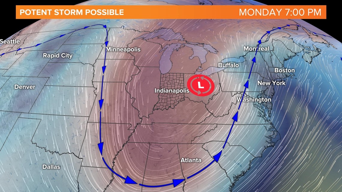
If it moves a bit farther east, then this could change the entire scenario. There are many uncertainties this far out, but keep checking back this weekend, as confidence will increase with each model run. Accumulating snow will be possible, with windy conditions likely Monday.


As mentioned, there is confidence that cold air will impact central Indiana next week. Afternoon temperatures will run more than 10 degrees below normal, with highs in the low to mid 30s.
