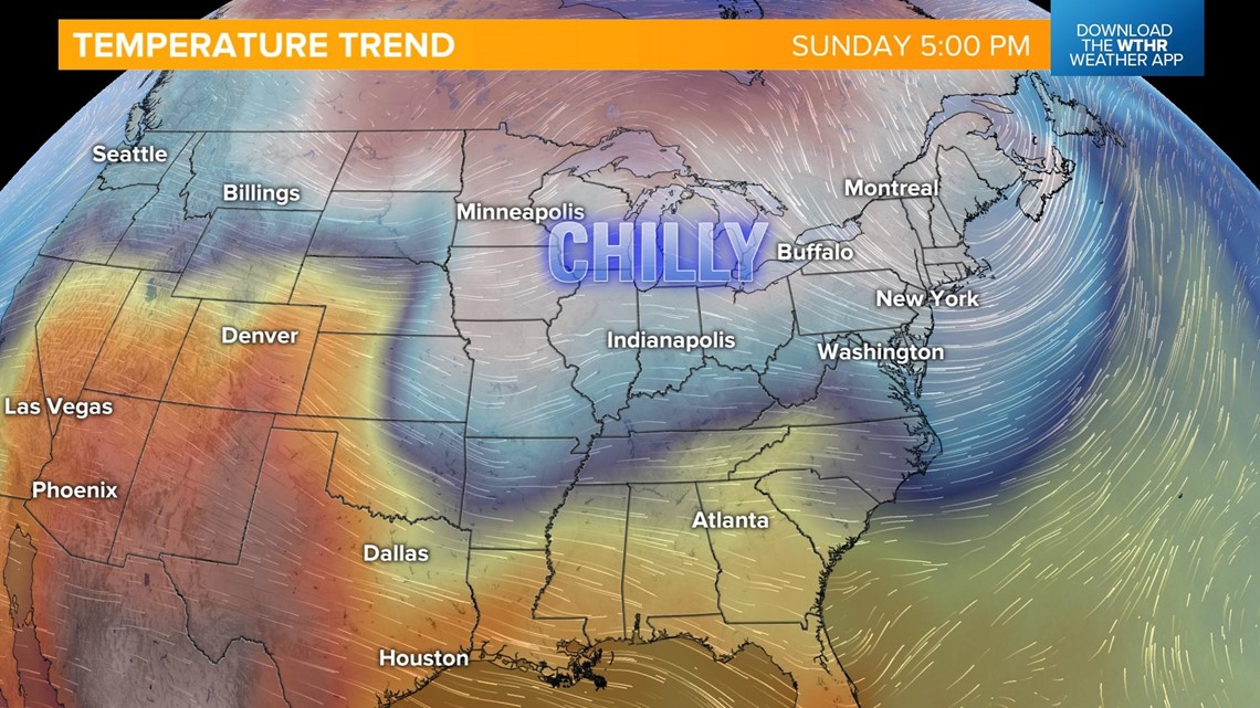
INDIANAPOLIS — Chilly air returns for the holiday weekend. We're now sitting on the backside of a cold front which will keep temperatures unseasonably cool throughout the weekend.

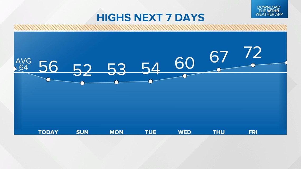
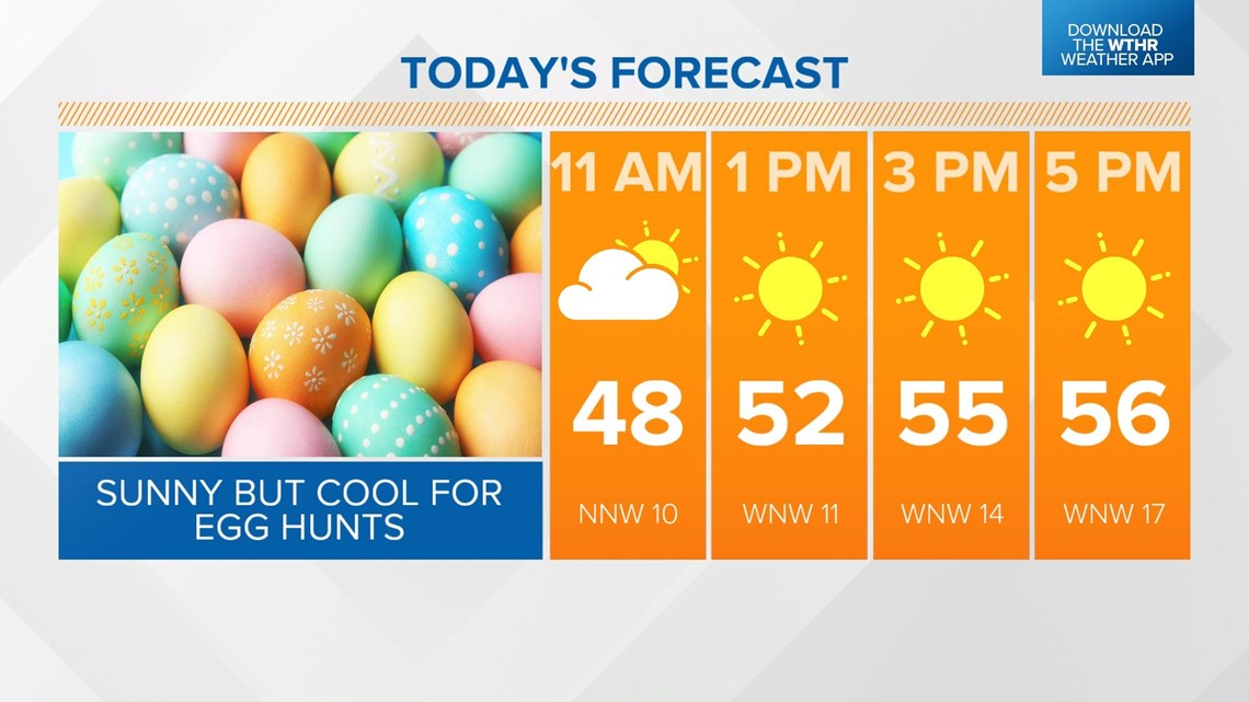
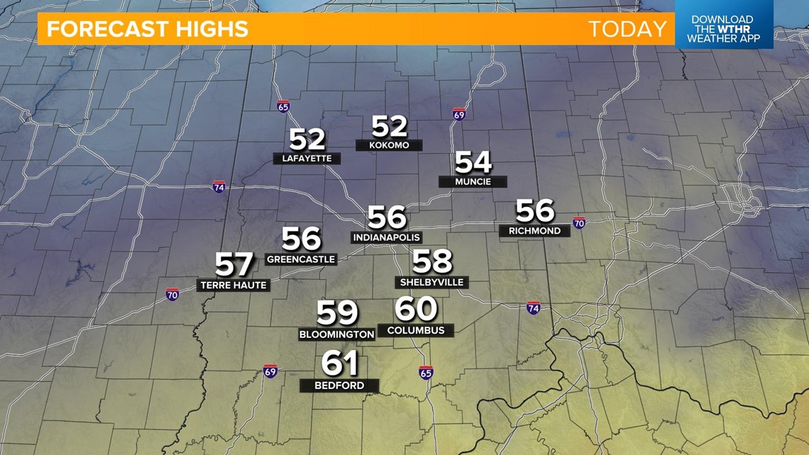
The sky will clear making way for plenty of sunshine but high temperatures will only be in the mid 50s. Central Indiana should be in the mid 60s at this point in the season. It'll also stay breezy with 30 mph wind gusts from the northwest today making it feel even cooler.


Temperatures will rapidly fall this evening and overnight into the low 30s.

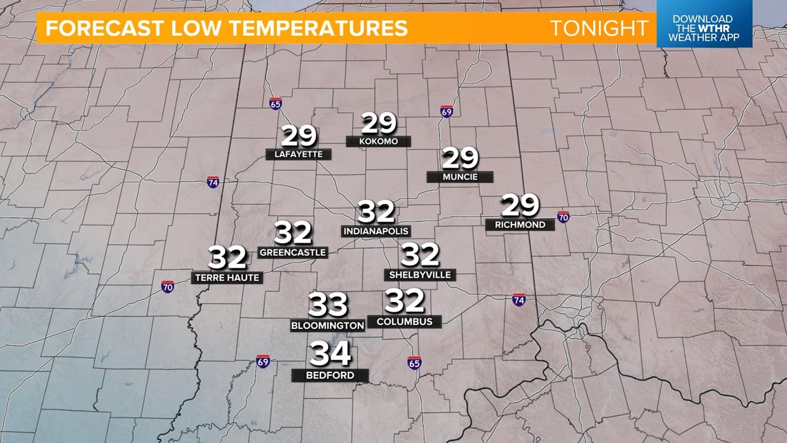
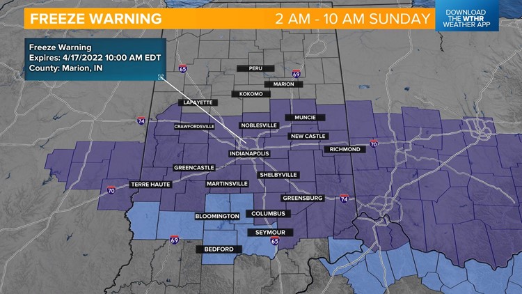
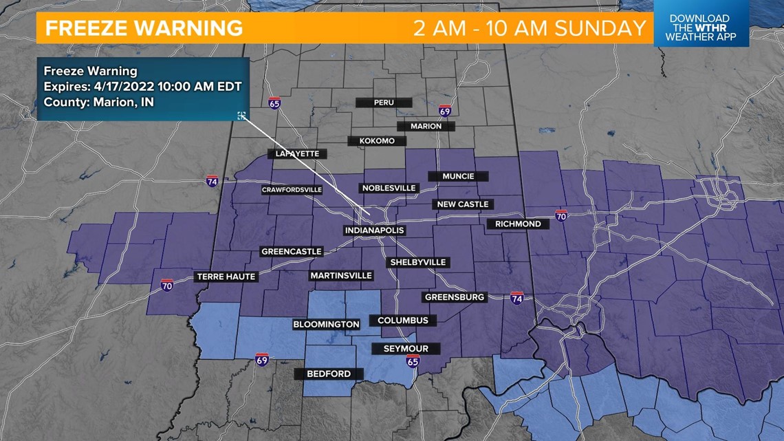
Since most of central Indiana is now officially in the growing season, the National Weather Service has issued a Freeze Warning overnight for the risk of damage to sensitive crops and vegetation.

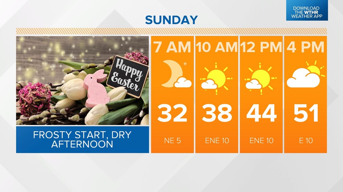
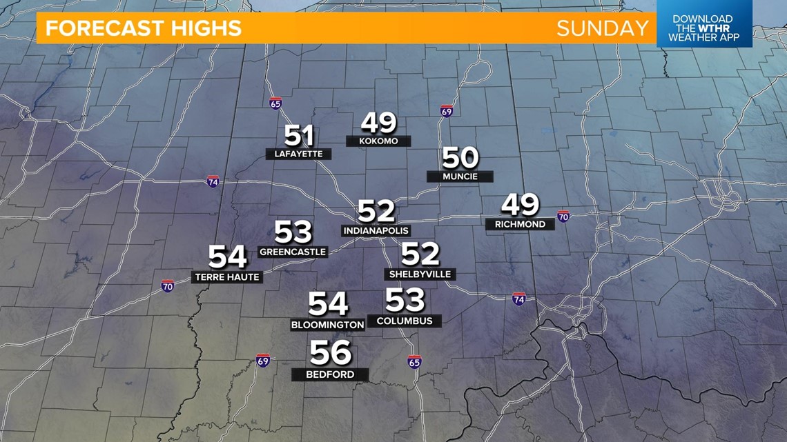
After the frosty start to our Easter Sunday, temperatures rebound to the low 50s under a mostly sunny sky.


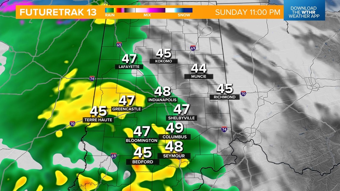
Clouds increase in the latter part of the day with rain returning after 10 p.m. Showers will be likely overnight with a few snowflakes mixing in as temperatures drop back into the 30s.


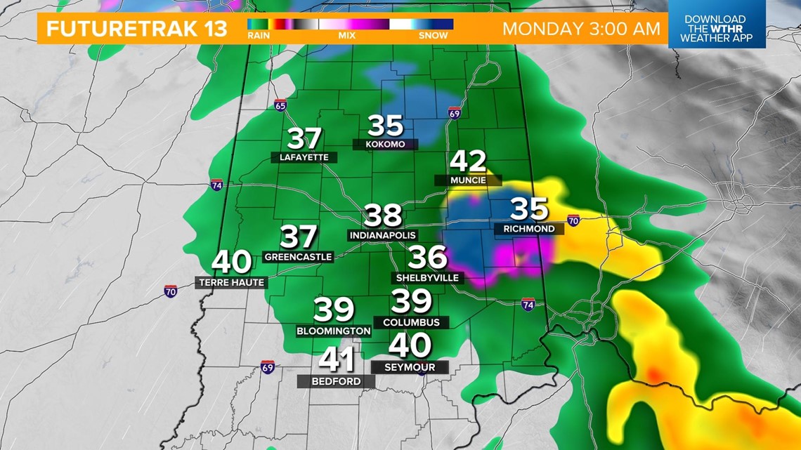
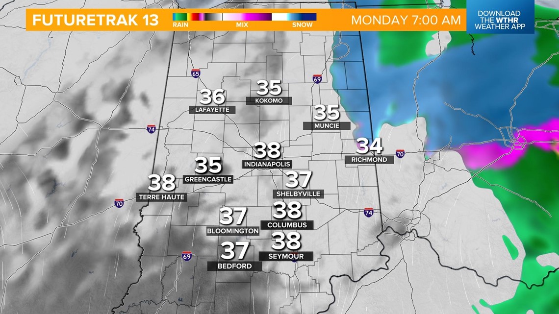
Most of the precipitation will be out by the morning rush Monday, but a few slippery roads will be possible.

The sky will clear in the afternoon but it remains unseasonably chilly with highs in the low 50s. More sunshine is in store for Tuesday but we don't see much of a warming trend with highs still in the mid 50s.
We'll finally start to warm-up come Wednesday with highs nearing 60. Late day showers and storms will be possible as we flip the switch to a warmer air mass. We'll be in the upper 60s Thursday and into the low 70s for highs by Friday.