INDIANAPOLIS — It's hard to imagine what's ahead of us while many are enjoying a beautiful, sunny January afternoon. You'd better enjoy it if you're not a fan of winter weather because the pattern is very winter-ish over the next 10 days.
Snow amounts
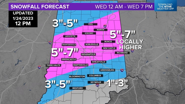
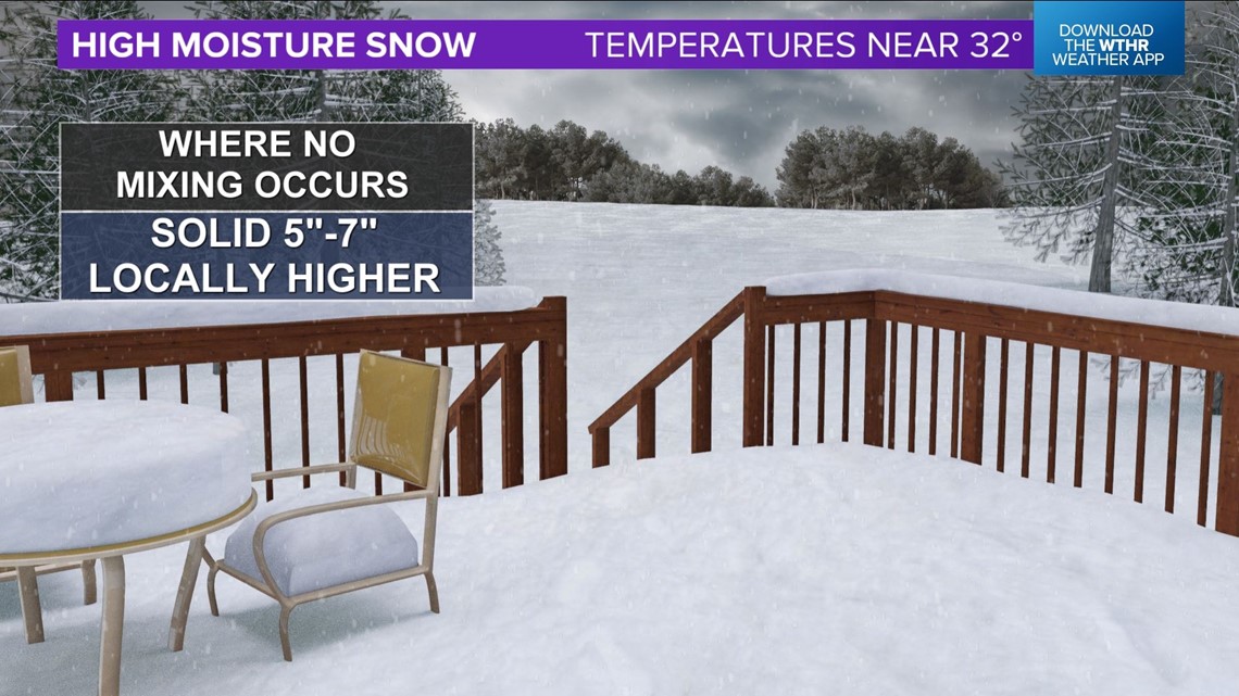
It all begins with a heavy snow event in central Indiana from a winter storm hitting Wednesday. There's no significant change to our forecast over the past few days, but we have slightly adjusted the southern portion of the broad 5-7-inch snow zone to include more areas south of I-70, with modeling today coming a bit colder.
With that said, south of I-70 remains the area of greatest forecast uncertainty with regards to snow amounts due to the wildcard potential of rain/sleet mix possibly cutting down totals. Remember that less mix means more snow.


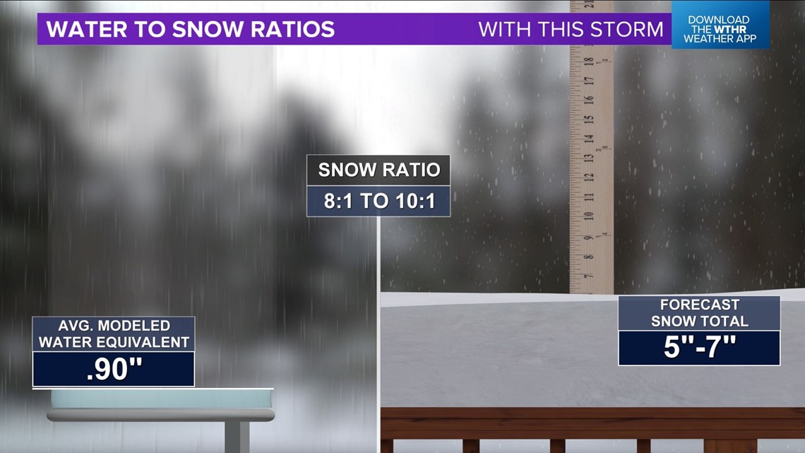
Average modeled liquid equivalent with this storm is near 1 inch. At a 10:1 ratio, that would typically produce 10 inches of snowfall. However, we're anticipating a blend of 8:1 to 10:1 ratios, and not all of the modeled liquid becomes snowpack.
Model guidance has aligned on two "thumps" of heavier snow rates that hit at different times and different locations.
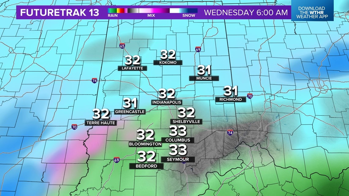
Timing
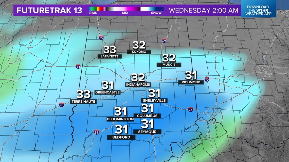
The first occurs between 1 a.m. and 5 a.m., and mostly impacts areas along/south of I-70, with potentially 1-2 inches per hour snow rates. Roads should become rather messy within the heaviest snow rate areas.

There may be a "lull" in steadier, heavier snow rates around 5 a.m. to 6 a.m. to allow some of the snow to melt on the roads, but this will be short in nature.


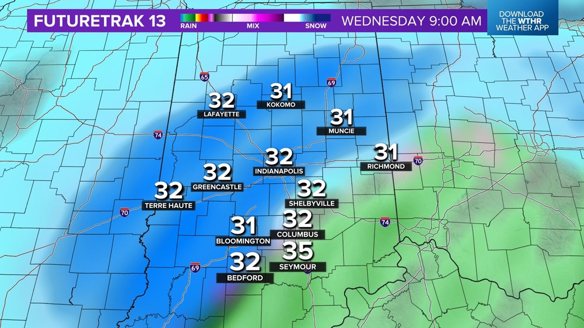
The second "thump" occurs between 7 a.m. and noon, and mainly impacts central and north-central Indiana within a heavy band on the northwestern side of the storm track. This too may produce 1-2 inches per hour snow rates where it tracks.
Farther southeast of this heavy snow zone will be the "mixing bowl" that complicates snow amounts and melting for places south of I-70 and east of I-65.

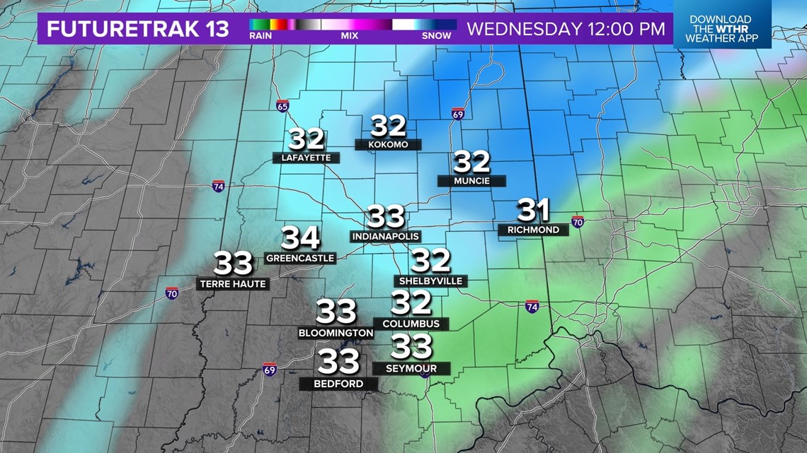
Steadier, heavier snow departs from southwest-to-northeast quickly from noon to 3 p.m. As this occurs, temperatures elevate into the mid-30s. That sounds minimal, but in reality, it makes a world of difference for road crews and how roads respond to treatment/plowing.
Impacts

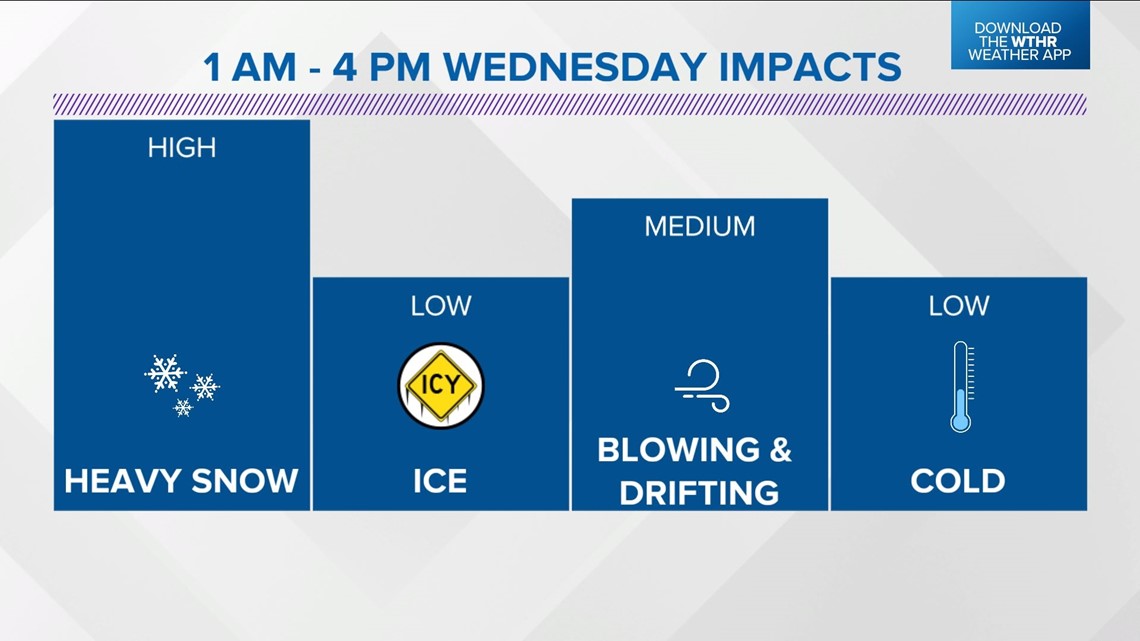
Road conditions outside of heaviest snow rates may only be wet. During and where it snows heavily, they'll be slushy and slow to require added travel time.
Wind will be easterly in the morning with varying speeds of 5-10 mph to 10-20 mph, then shifting to westerly 10-15 mph in the afternoon. Due to the heavy weight and high moisture content of the snow, we don't anticipate much drifting and minimal blowing.
Windchills will be in the 20-25-degree range. This won't be pleasant, but it's certainly not nearly as bitter as the setup we had in late December.
We're advising folks to have contingency plans in place for child care, pet care, etc. with delays and/or cancellations possible, if not likely.

The weight of the snow will make it a very challenging snow to shovel, and you should be very careful when clearing the sidewalk and/or driveway. Listen to your body, and take frequent breaks.
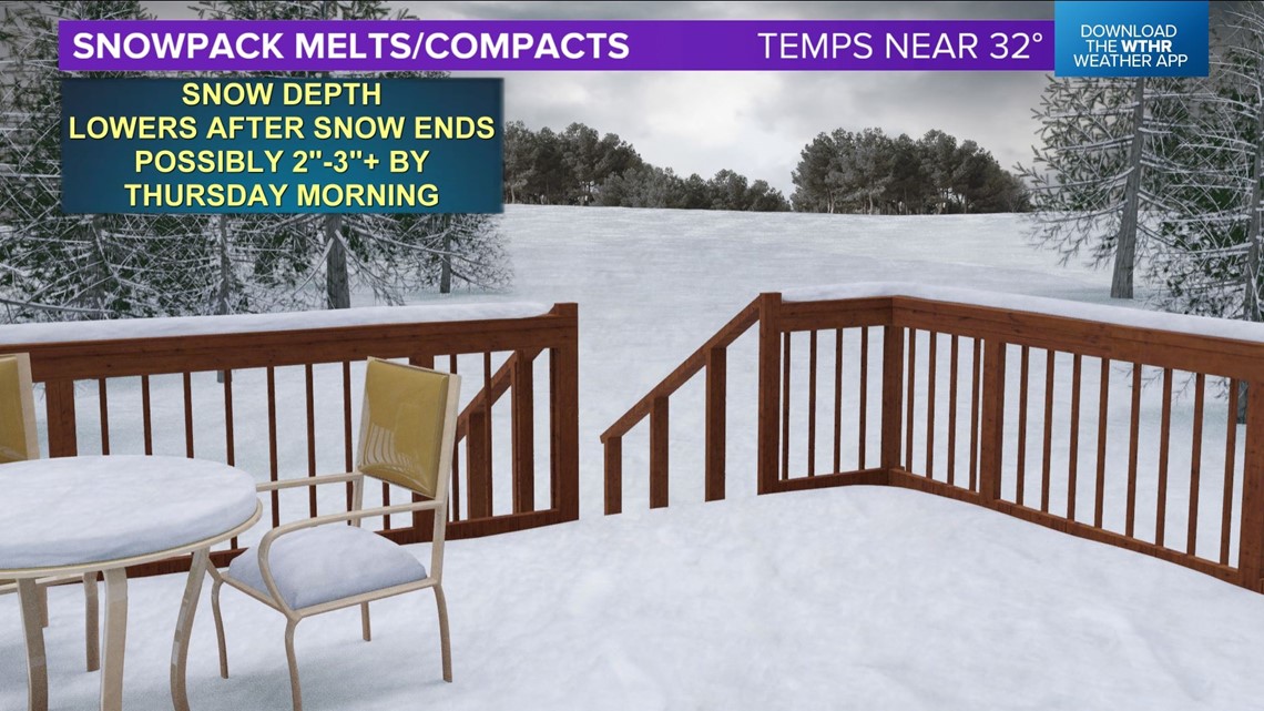
High moisture content, heavy weight of snow, and temperatures near/above freezing could also cause the snowpack to compact and melt, possibly considerably after the heavier snow departs. Don't be surprised if the snow depth at your location drops 2 inches or more by Thursday morning.

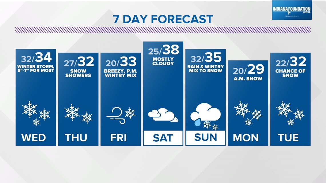
Extended forecast
Snow showers and some slick spots will stick around Thursday, but the "warmer" setup of this storm should allow for a quick road cleanup — even in areas of the highest snow totals.
Another quick-moving system arrives Friday afternoon, with the potential of a wintry mix.
The pattern remains active into early next week with modeling showing a "juicier" setup Sunday into Monday — and another potential winter event Tuesday to Wednesday.
Buckle up, friends.