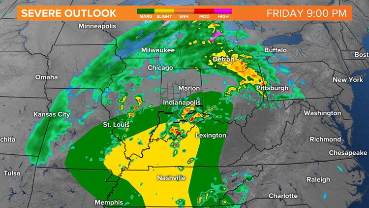
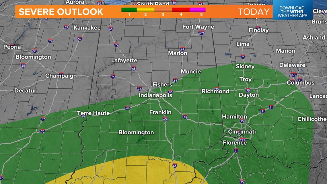
INDIANAPOLIS — Active weather will move in today with showers and the potential for strong to severe thunderstorms possible.

A warm front will lift through central Indiana this afternoon. This will trigger showers this afternoon, becoming widespread by mid-afternoon.

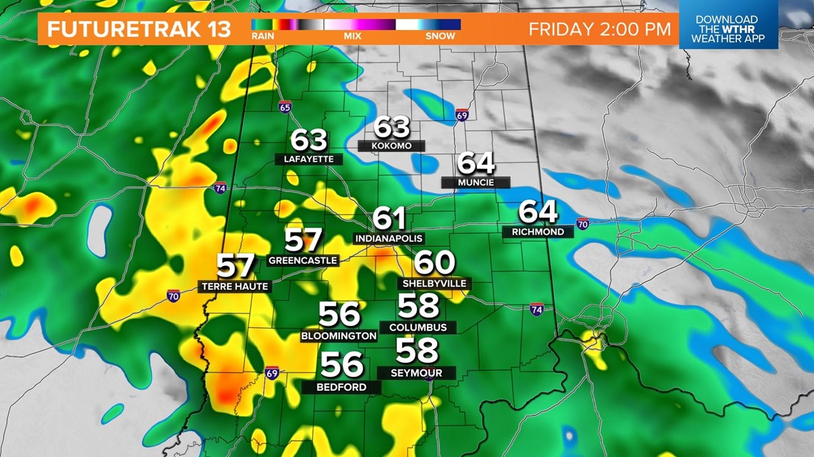

Temperatures will still climb into the mid-60s, with winds gusting around 25 mph.

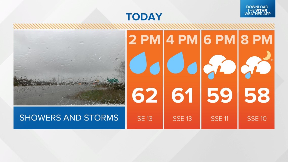
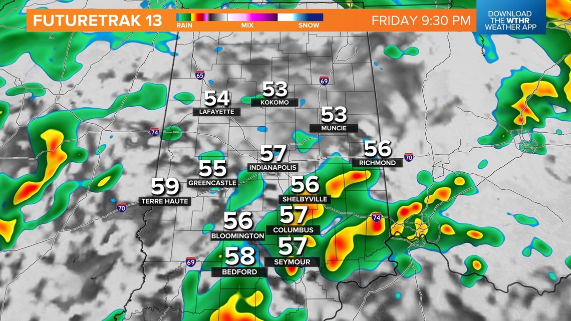
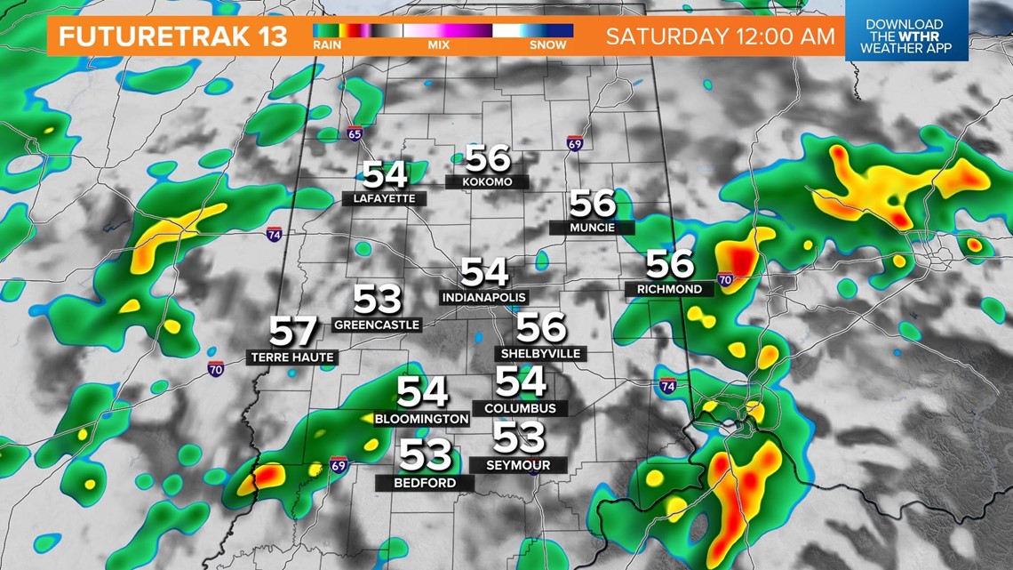
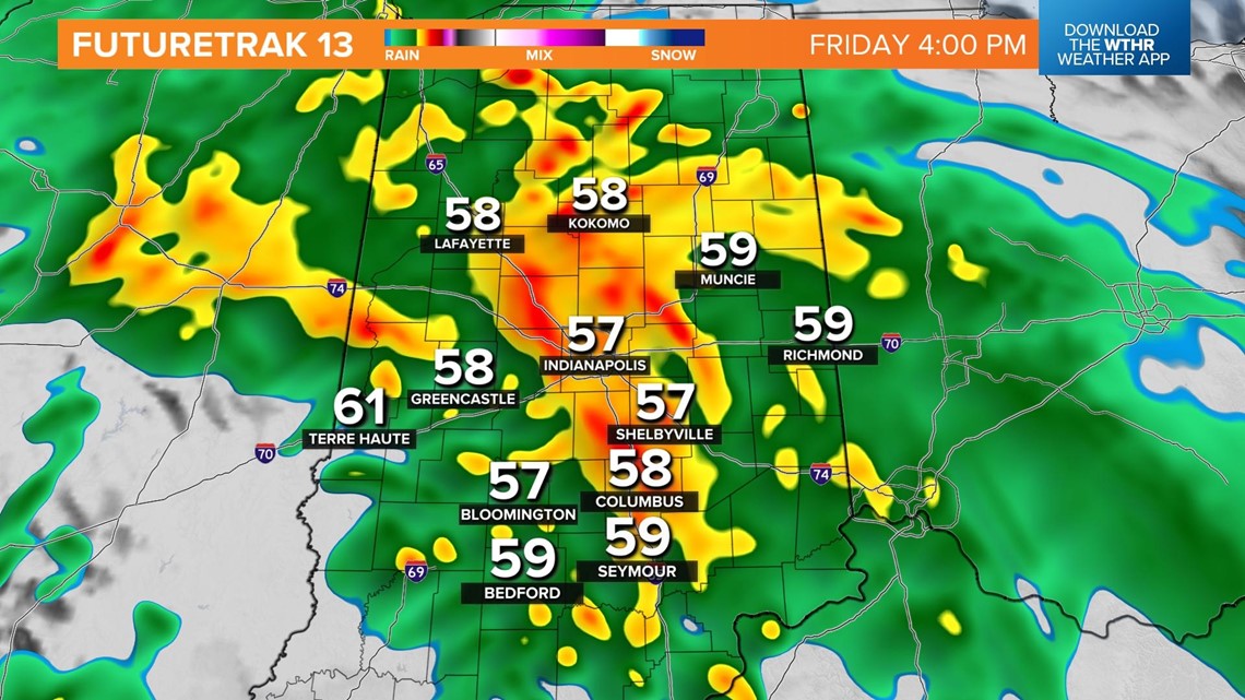
There will be a lull in the rain early evening with another round moving in later this evening.

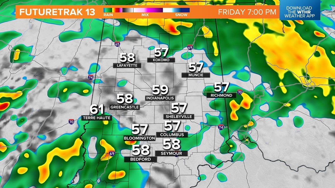
This round has the potential to be severe. All severe threats will be on the table, including damaging winds, large hail and isolated tornadoes.

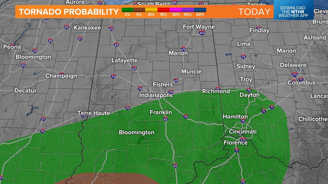
The best timing for the strong to severe storms will be from 8 p.m. until 1 a.m. Saturday.