The forecast of wet and windy Sunday in central Indiana definitely verified.
Wind gusts exceeded 40 mph in some areas and rain amounts ranged from a half-inch to near one inch. Rainfall was definitely welcomed for the parched landscape in central Indiana that's experiencing moderate drought conditions.
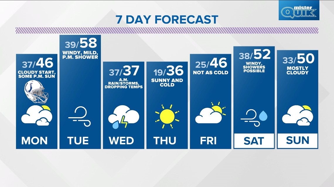
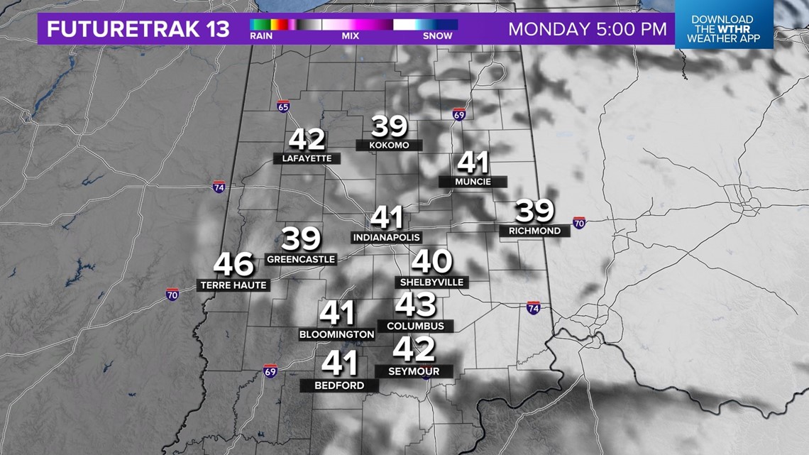
At this hour, drizzle continues to keep it damp and likely lingers around for another couple of hours at least. You've likely noticed a chillier feel to the air now after the passage of a cold front. A wind-shift to the northwest pushed out the 50s and pushed in the 40s.
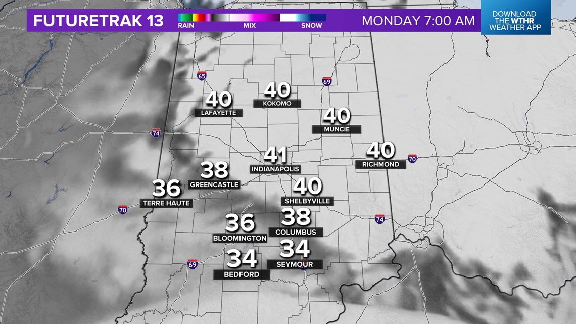
Low cloud overcast keeps temperatures from dropping too much overnight but lows in the upper 30s will be colder than Sunday morning. You'll need to be patient Monday, as a mostly cloudy sky is expected to linger into at least midday.

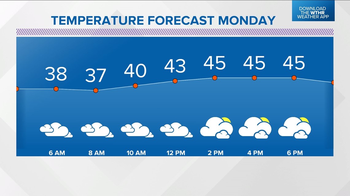


The wait for peeks of sun and gradual clearing lingers into Monday afternoon but we expect a clearing sky just in time for tailgating outside Lucas Oil Stadium for the Steelers-Colts Monday Night Football game. Dress for 30s coming out of LOS.
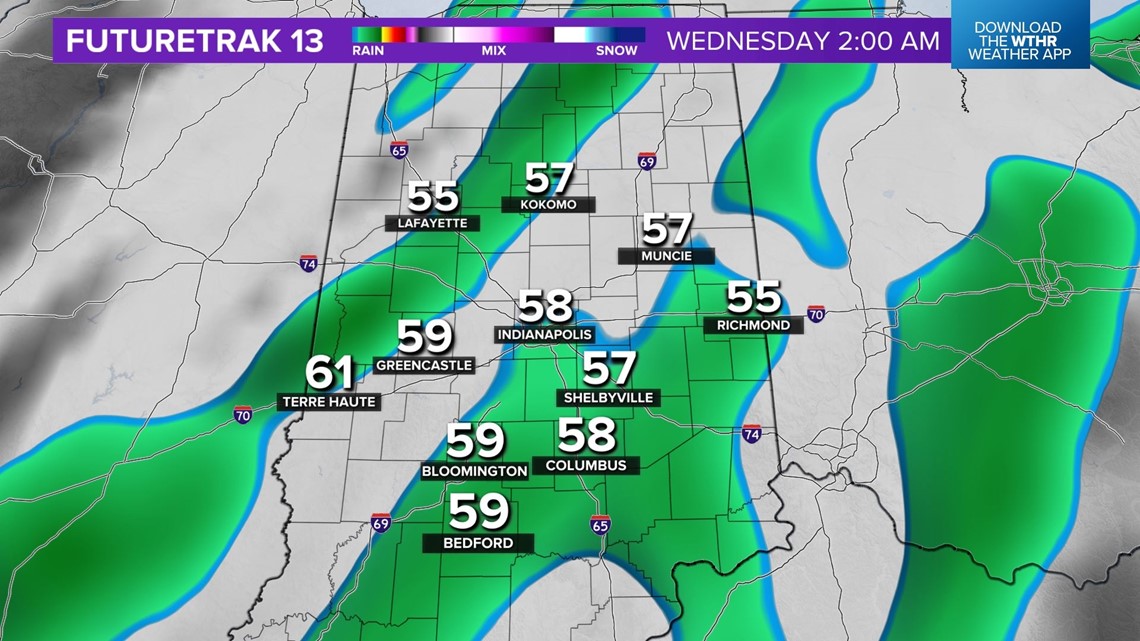
A warmer wind returns Tuesday with south-southwesterly gusts of 40+ mph delivering unseasonably mild highs in the upper 50s to near 60°.
The stiff wind keeps temperatures elevated near 60° even after dark Tuesday and pre-dawn Wednesday.
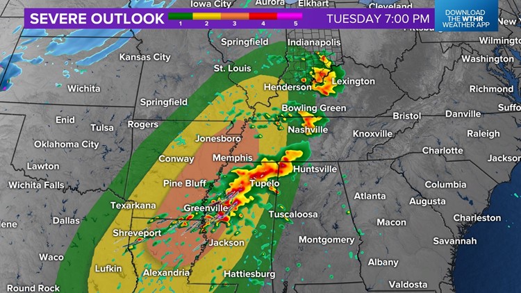
We'll be monitoring the atmospheric set-up closely during that time with the potential of enough wind shear/instability to allow some storms to become severe and/or rotate.

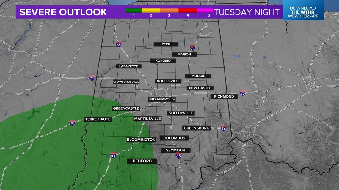


The greater severe weather set-up will be farther south of the Ohio River, but a potent jet stream and strong cold front moving through the state deserves our attention.
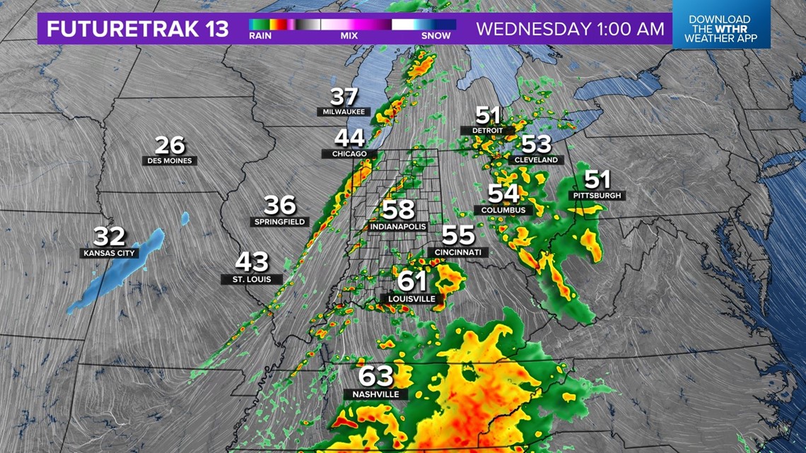
In the wake of this cold front, rain may mix with and/or changeover to period of snow showers/flurries by midday Wednesday to serve notice on another jab of cold air arriving.


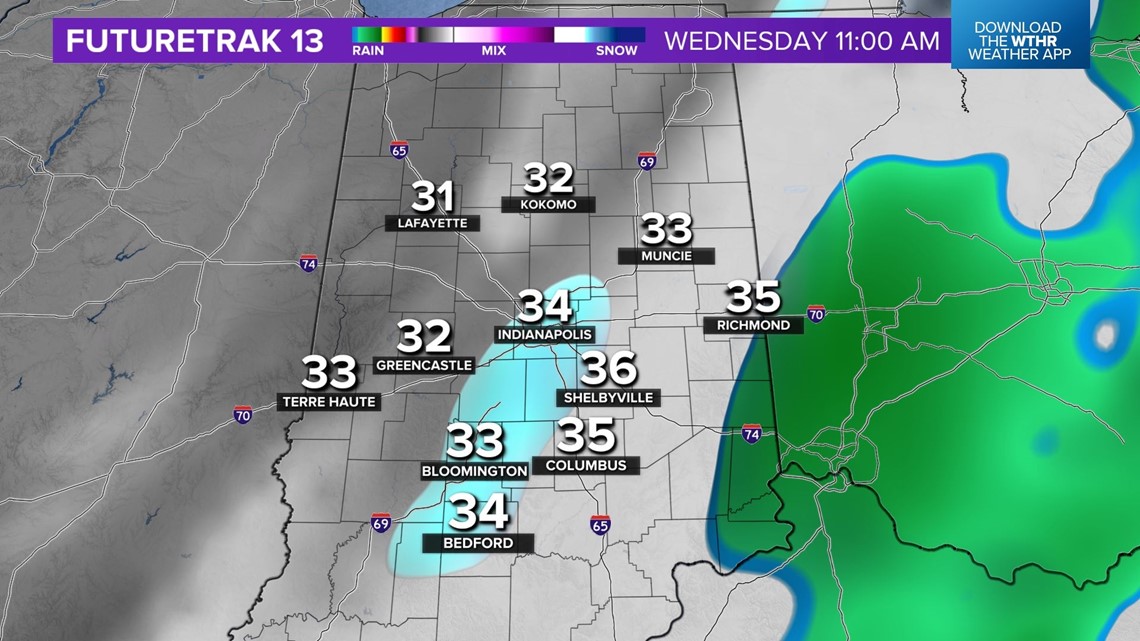
Wednesday high temperatures actually occur before sunrise as temperatures fall and hold steady in the 30s the remainder of the day. In addition, windchills drop to near 20° to make it feel some 40° colder in just a few hours. Please check back for updates on severe weather potential locally.