
INDIANAPOLIS — It will be a beautiful day across central Indiana. Humidity has fallen, and high pressure has moved in. It will be mostly sunny with highs in the mid 80s.

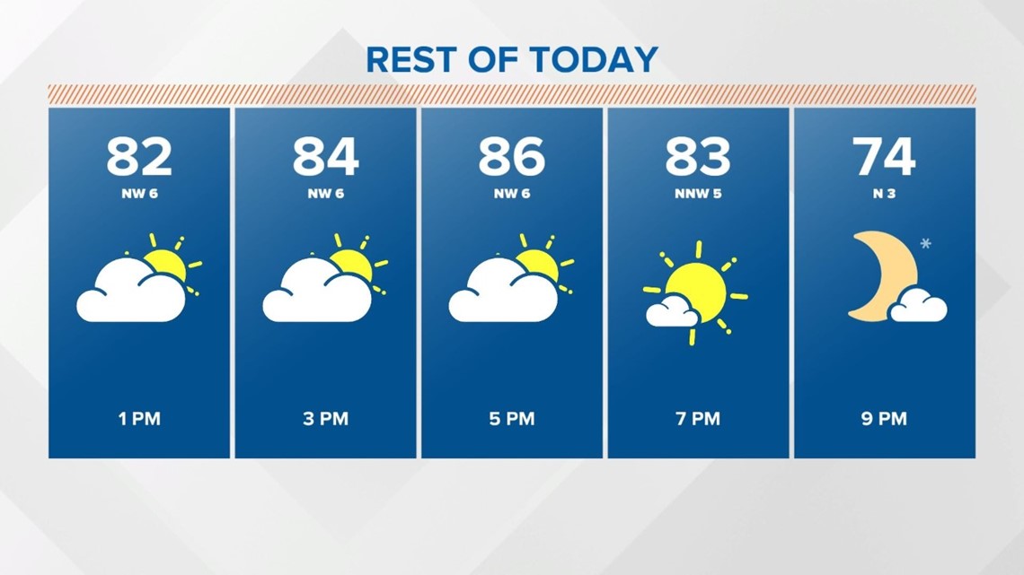
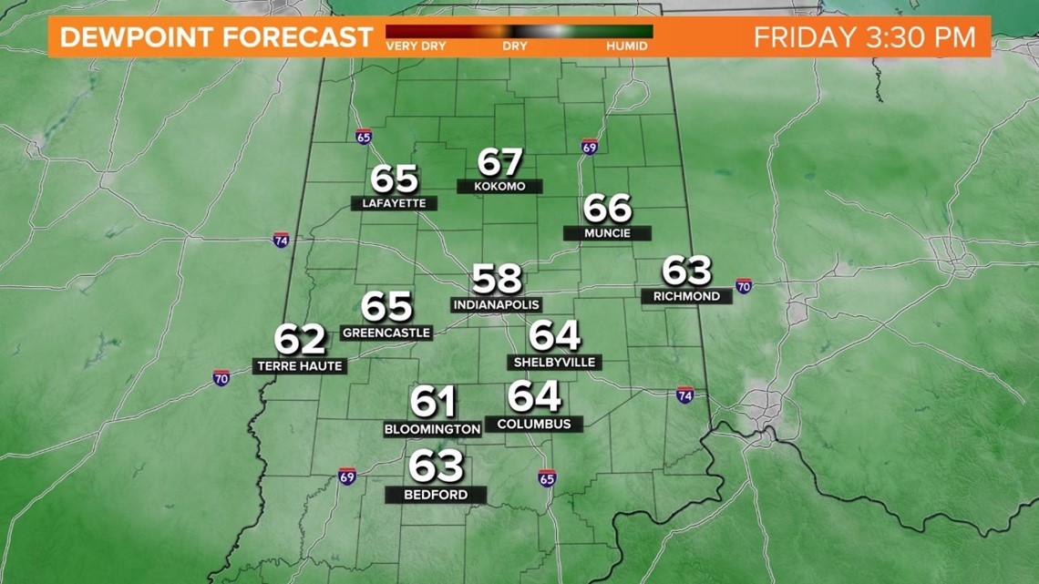
Winds will be light, out of the northwest, keeping the humidity down. Dewpoints will be in the upper 50s and low 60s.

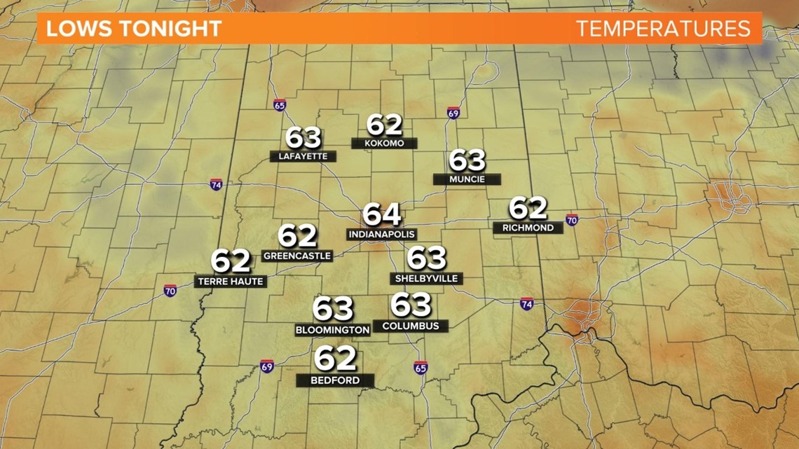
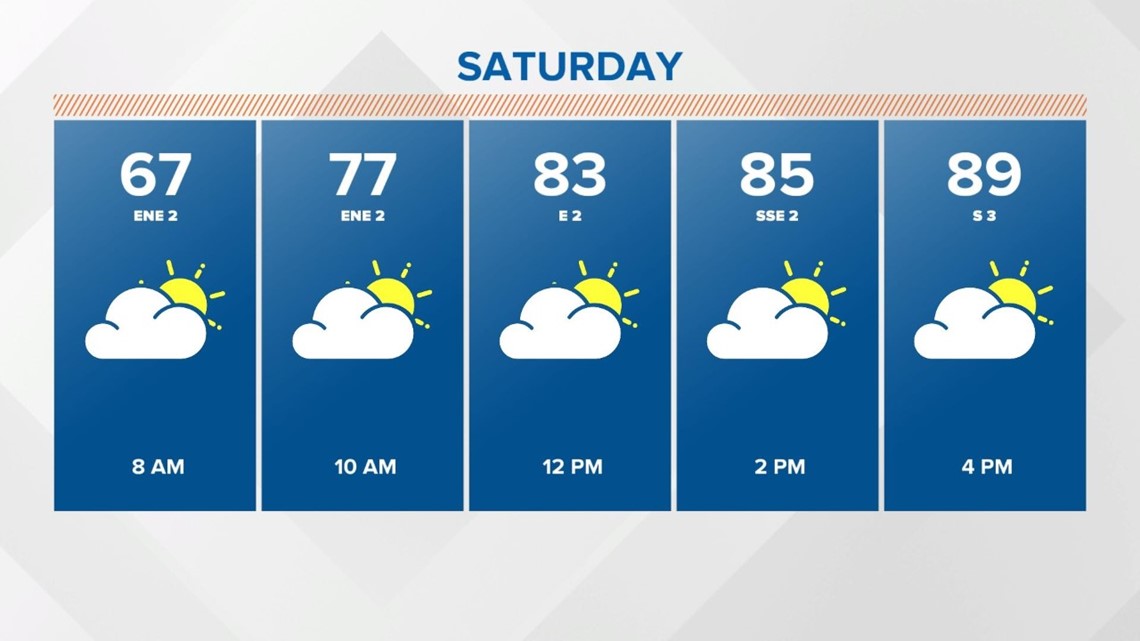
Clear skies and dry air will allow temperatures to fall into the low 60s Saturday morning.

A ridge in the upper levels will allow warmer air to push in. It will be mostly sunny Saturday with afternoon highs climbing into the upper 80s to near 90°.

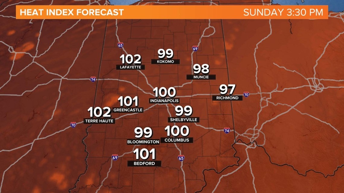
Sunday will be hot, hazy and warmer, with afternoon highs in the low 90s.

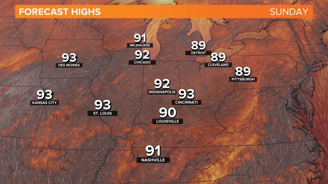
More humidity arrives too, feeling like the upper 90s to 100°.

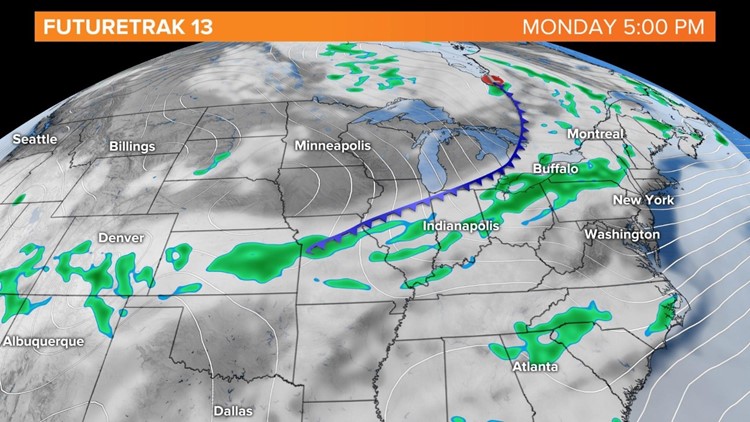
A cold front will bring changes for the start of the work week. Scattered showers and thunderstorms will be likely by mid to late afternoon. Afternoon highs will climb into the mid to upper 80s.


An upper level system will move over the Great Lakes on Tuesday. Clouds will be around and perhaps a few spotty showers. It will be cooler too, with highs in the low to mid 80s.
The average high for the end of July is 85°. Right now, the cooler than normal trend will continue into next weekend.
