
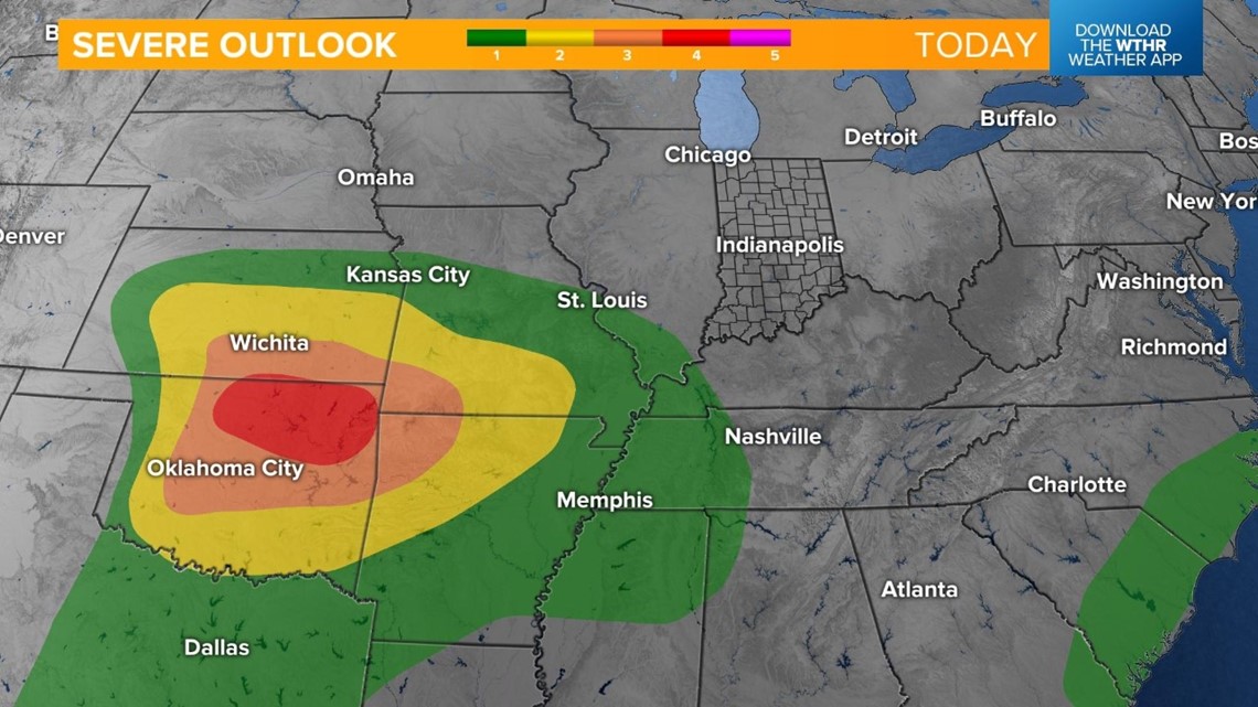
INDIANAPOLIS — A developing storm system to our west poses a severe risk across several states today. The target zone for widespread severe weather is contained to the Great Plains, including parts of Oklahoma, Kansas, Missouri and Arkansas.

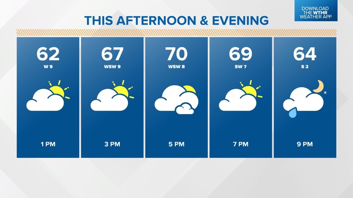
Locally, it'll be a mainly sunny and seasonal afternoon with highs near 70 degrees.

Our next storm system arrives late Monday evening with scattered rain showers mainly after sunset.

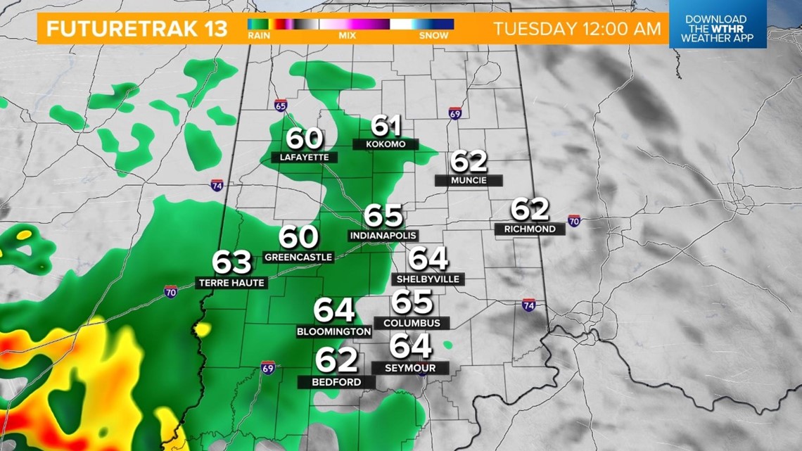
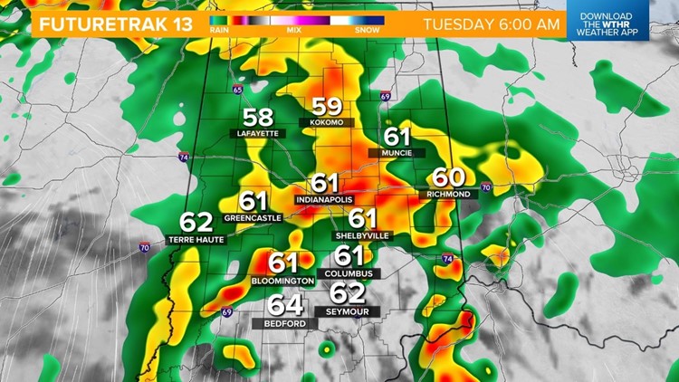
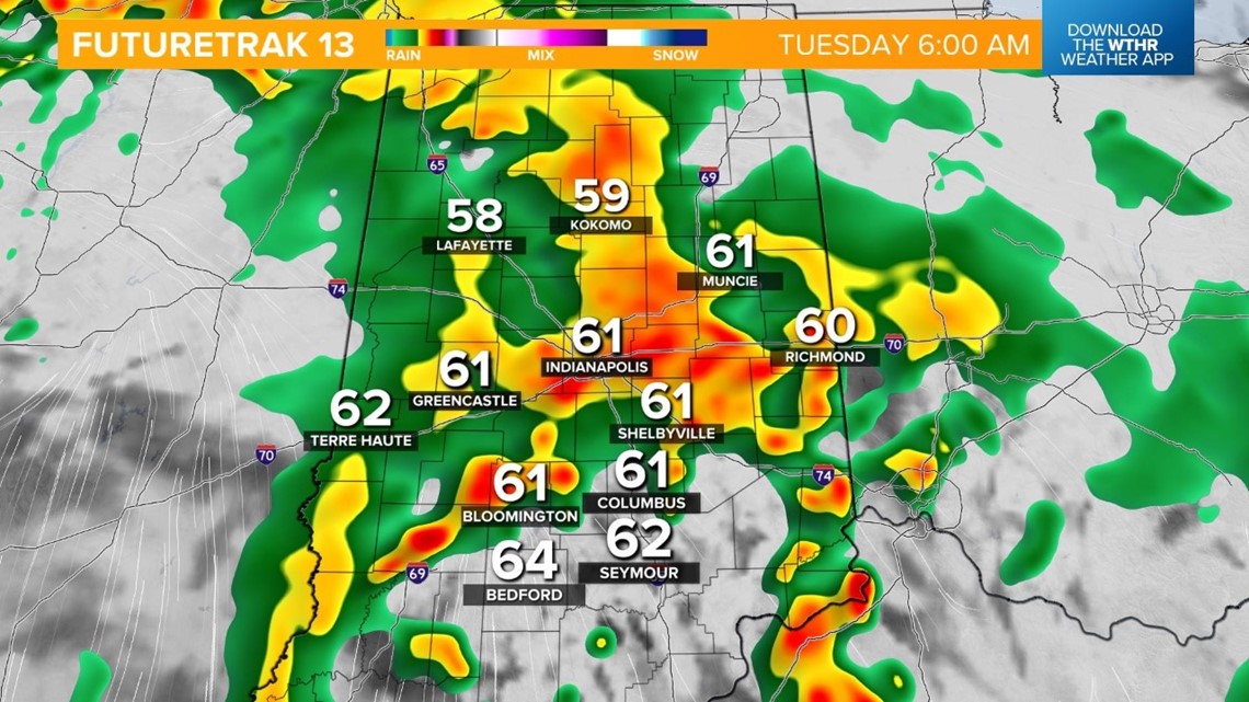
A warm front will lift through overnight, keeping rain showers and a few storms in the forecast through the morning. This will have an impact during the Tuesday morning rush as heavy rain will make for tricky travel.

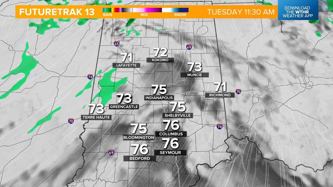
Temperatures recover to the mid-70s in the late morning and afternoon in advance of a cold front that arrives in the evening. Winds become rather breezy with southerly gusts reaching 30 mph at times.

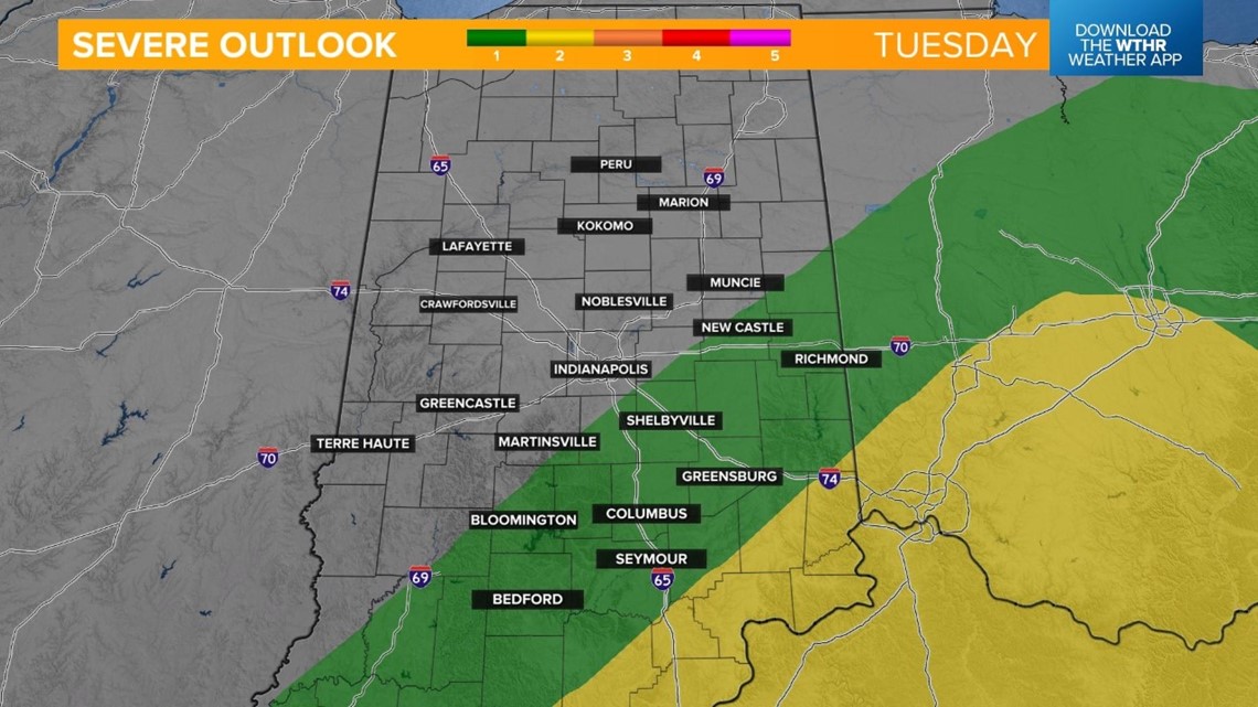
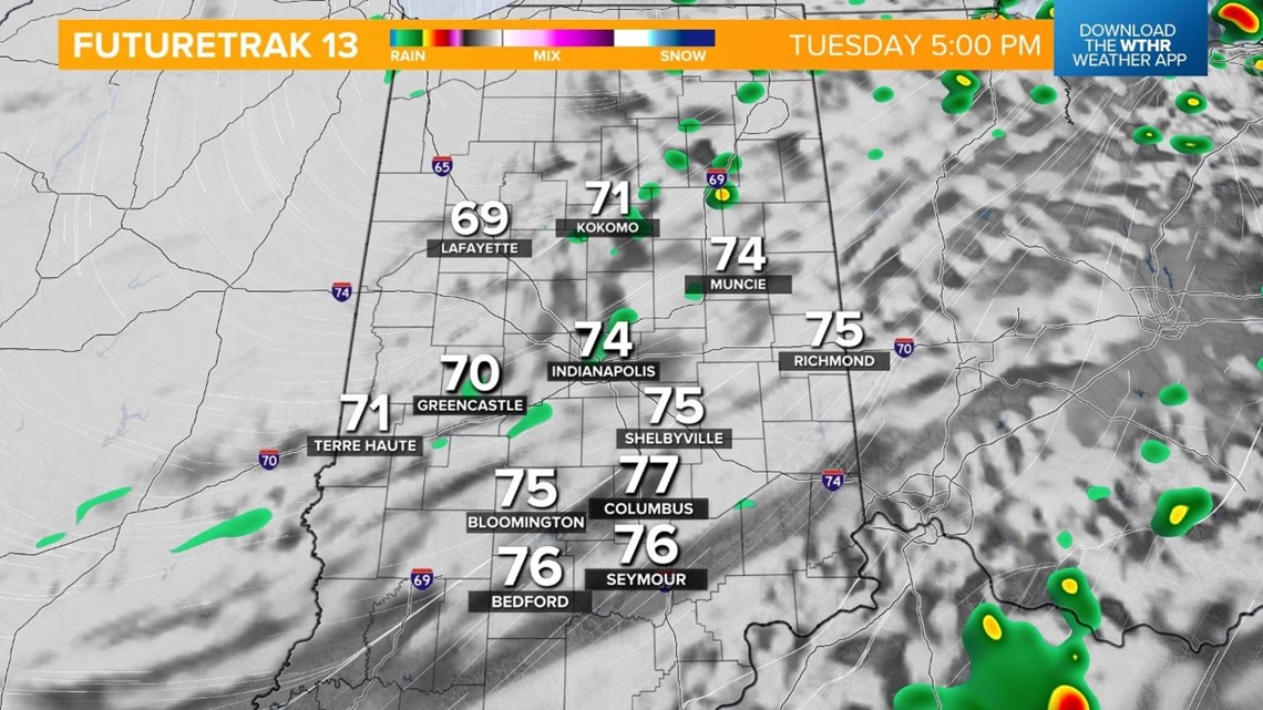
This cold front will bring another round of rain showers and storms, some of which could be strong to severe in the south and southeastern parts of Indiana, closer to the Cincinnati/Ohio River Valley area.


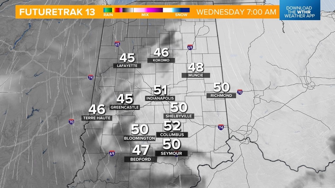
The rain exits by Wednesday, but skies remain mostly cloudy. Temperatures will be slightly cooler as well, with highs in the mid-60s.

We're not finished with rain chances for the week just yet. Thursday starts dry with rain returning in the afternoon. Highs will be near 70 degrees.
Showers continue with storms returning to the forecast on Friday. Temperatures will be slightly cooler with highs in the mid-60s.
What other people are reading:
- Local respiratory therapist climbing Lucas Oil Stadium steps in memory of her mother
- Indiana task force tracks down predators, calls on parents to emphasize online safety with their kids
- Speedway community pitching in to paint mural on Main Street
- 3 meteorology students killed in car crash on way home from storm chasing
- Indiana crews rescue man from cliff over Ohio River
