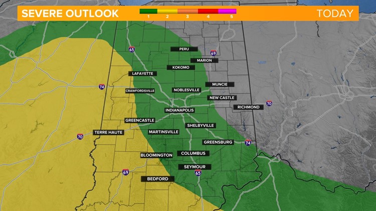
INDIANAPOLIS — After an unseasonably warm day with highs in the 70s while we sit in the "warm sector" of our next weather system, an approaching cold front Saturday night brings the risk of a line of potentially strong to severe storms, especially to areas west and south of Indy.


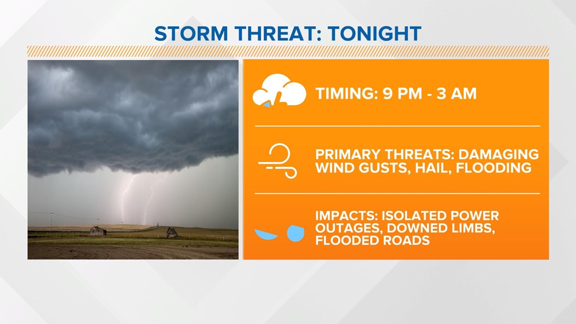
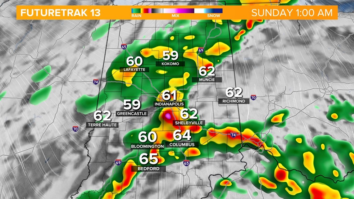
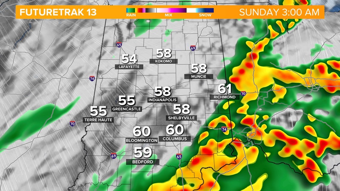
The severe storm risk will be highest from 9 p.m through 3 a.m. from west to east as the cold front comes through. Damaging wind gusts and large hail will be the primary threats with isolated power outages and downed trees and branches possible. Heavy rain along the boundary will also bring a risk of localized flooding.

Here's the timeline:
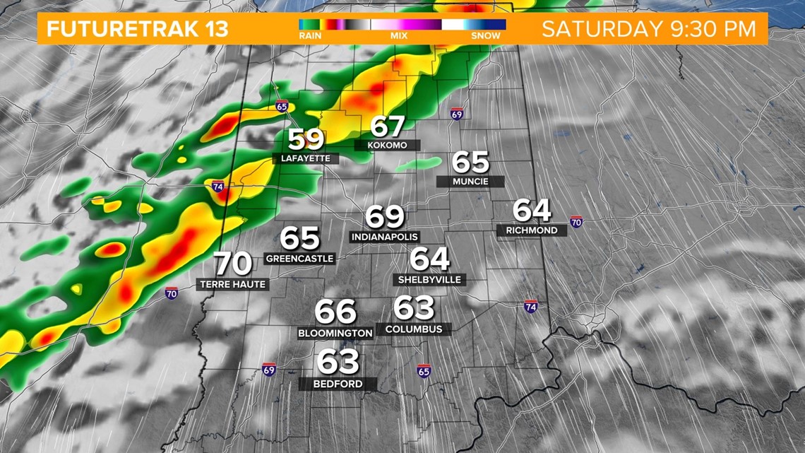
The storm line initially moves into northwest parts of the state around 9 p.m.

The line approaches the Indy metro area closer to 1 a.m. Sunday.

The severe threat will dwindle as the line exits the eastern side of the state around 3 a.m. Sunday.

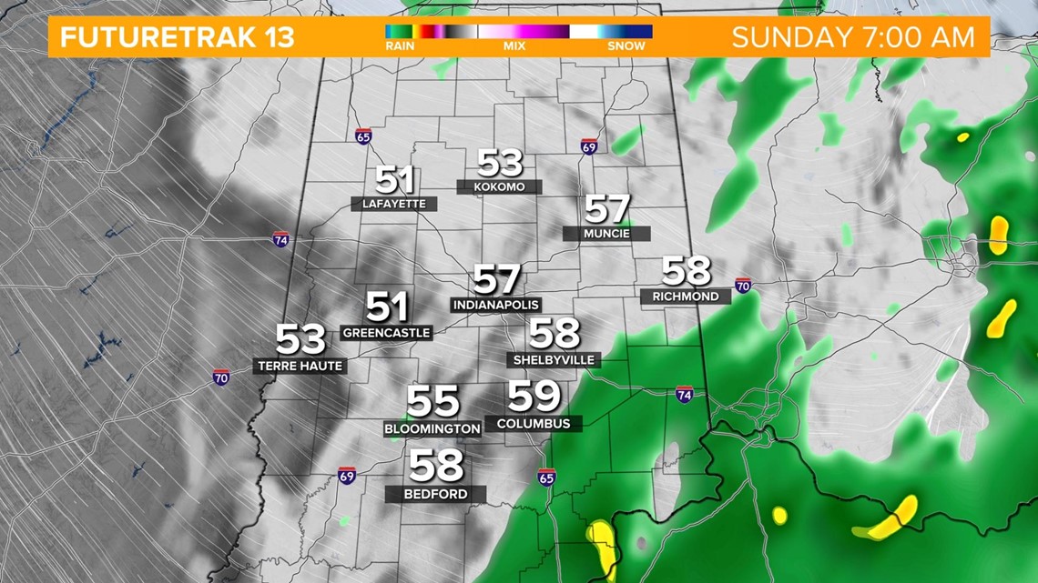
Rain showers exit early Sunday with a gradually clearing sky in the afternoon.