INDIANAPOLIS — A warm front will stall in central and northern Indiana and will bring the heaviest axis of rainfall this afternoon.

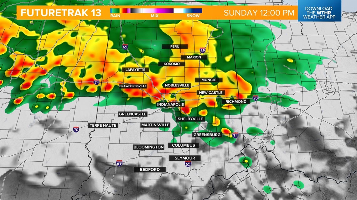
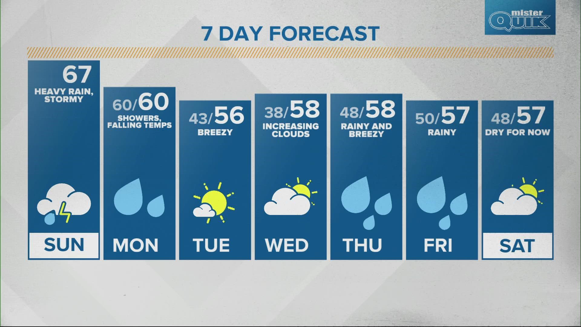
With the boundary stalling north, areas south of I-70 will see some dry time this afternoon and will be in the warm sector of this weather system which will take temperatures potentially as high as the low 70s.

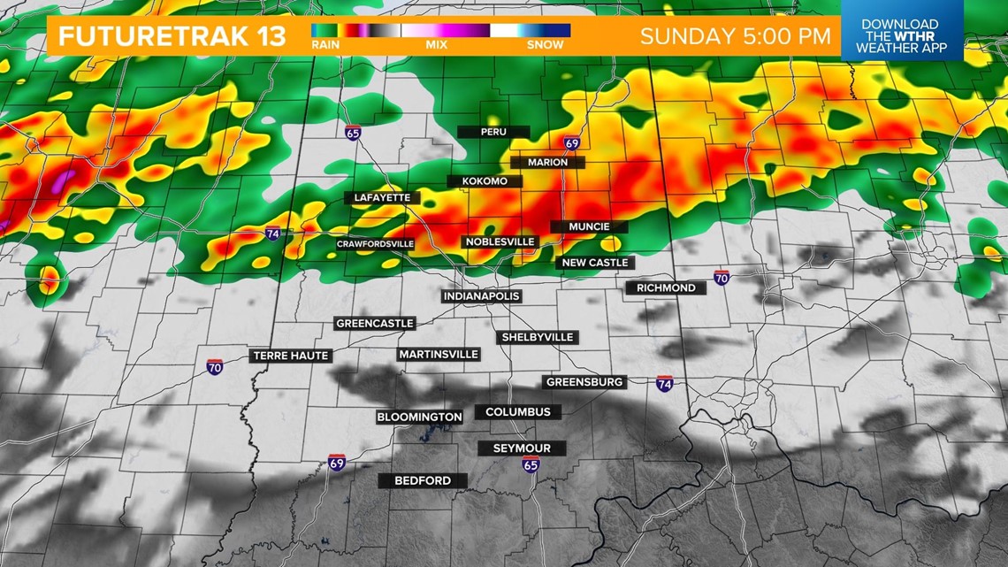
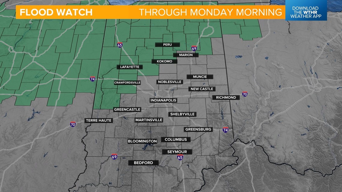
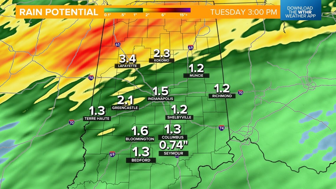
Northern parts of the state could see 2"-4" of rain with this system leading to a localized flooding threat. A Flood Watch has been issued for northwest region of the state including Crawfordsville, Lafayette, Kokomo and Logansport.


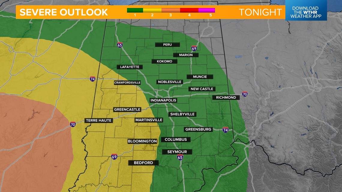
The cold front associated with this system will move through late Sunday night and will prompt the risk of stronger storms, especially on the western side of the state. Damaging wind gusts will be the primary threat. With already saturated ground, the threat of downed trees and power lines increases. Large hail and a few rotating storms can't be ruled out, as well.

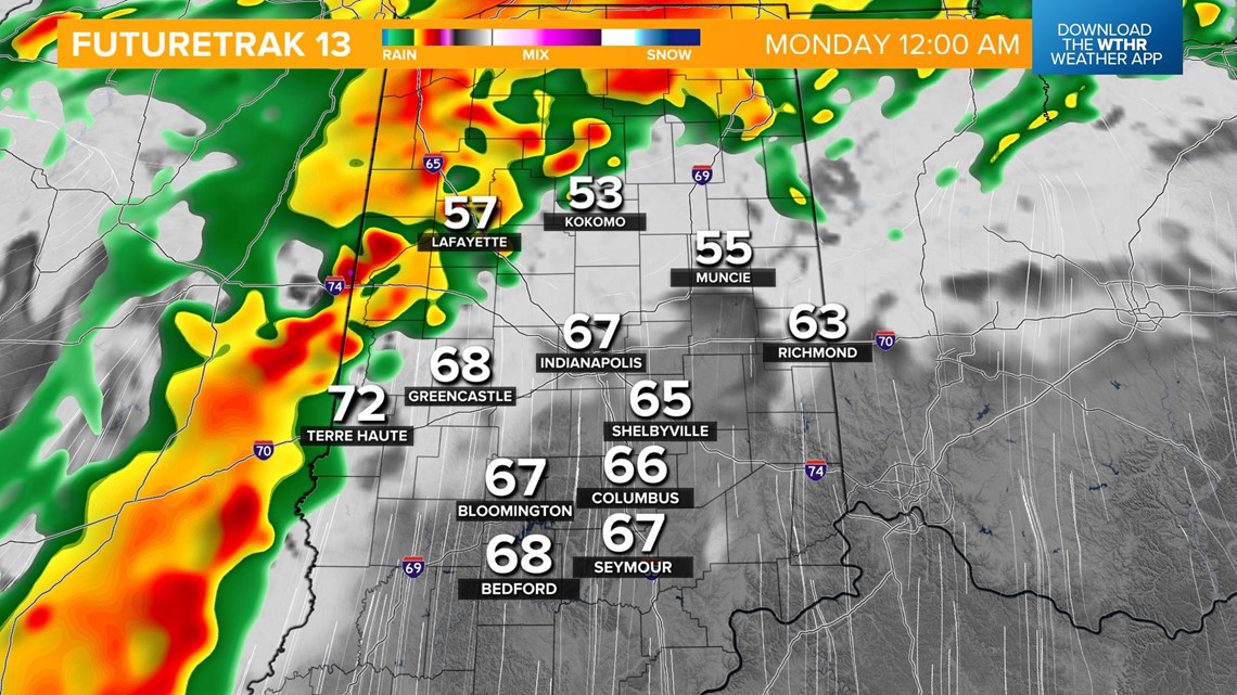
The line crosses the Illinois-Indiana border around midnight and arrives in the Indianapolis metro area around 3 a.m.

The severe threat comes to an end by the morning rush on Monday.

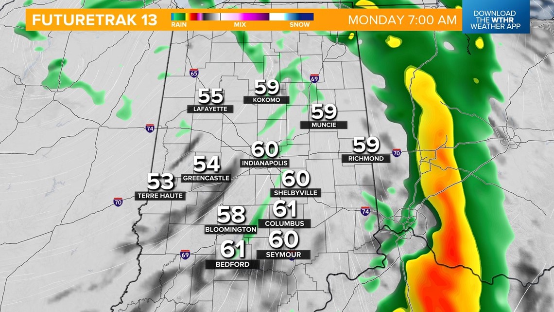
Light, lingering rain showers will be possible throughout Monday.

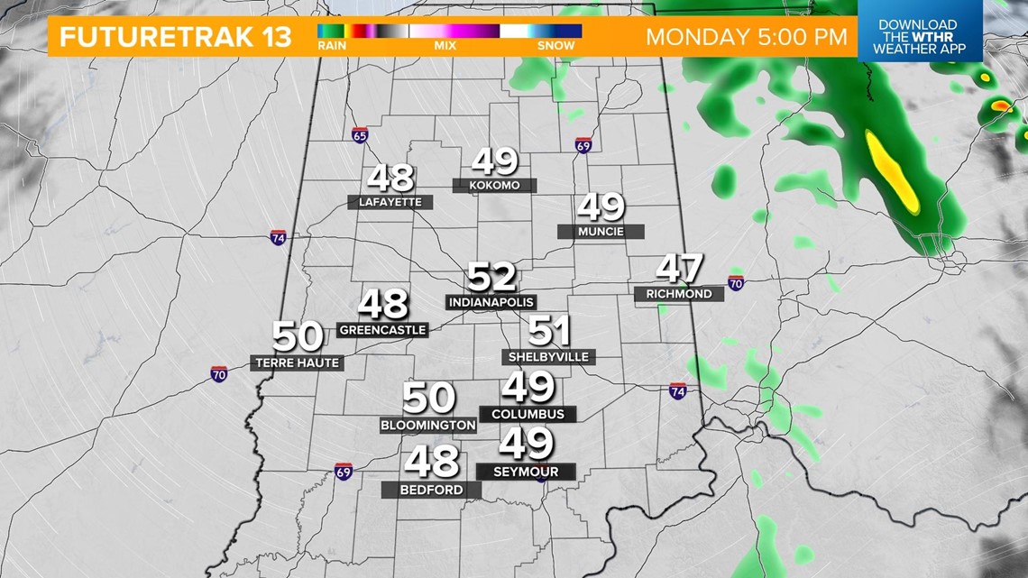
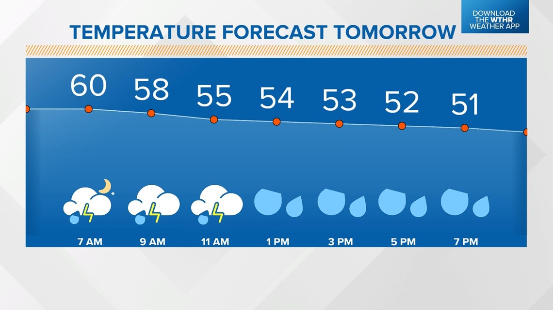
Temperatures will gradually fall on the backside of the cold front. We'll see our high for the day reach the low 60s in the morning and most of the day will be spent in the 50s.