INDIANAPOLIS — For now, it's "severe clear" with no severe weather threats to central Indiana. That blue sky comes with a pleasant feel to the air with dewpoints in the 40s/50s, dropping the muggy meter to a comfortable level.
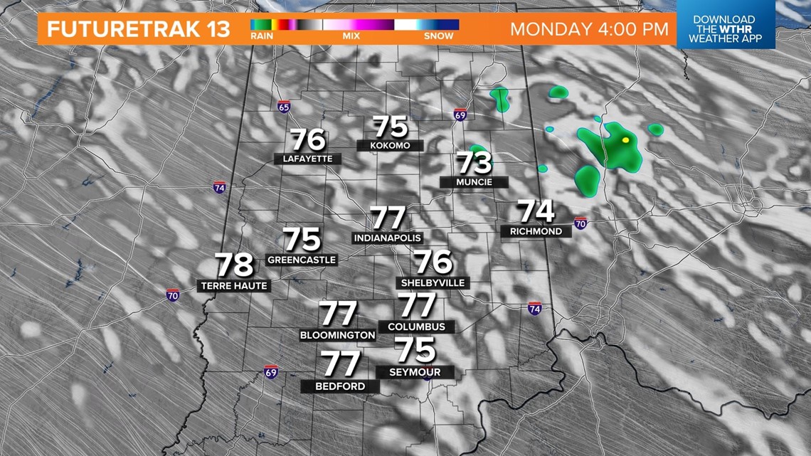
Midday Monday temperatures equate to about 10° cooler than the past 24 hours. This puts the afternoon high in the 75°-78° range. Scattered fair weather cumulus clouds develop and there is the slimmest chance of spotty, quick-moving sprinkles or showers popping. But 90-95% of the WTHR viewing area won't see a drop of rain until Wednesday morning.


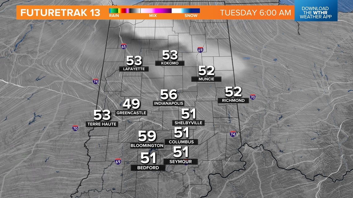
You can keep the A/C off overnight as lows drop to pleasantly cool levels in the lower/mid 50s.
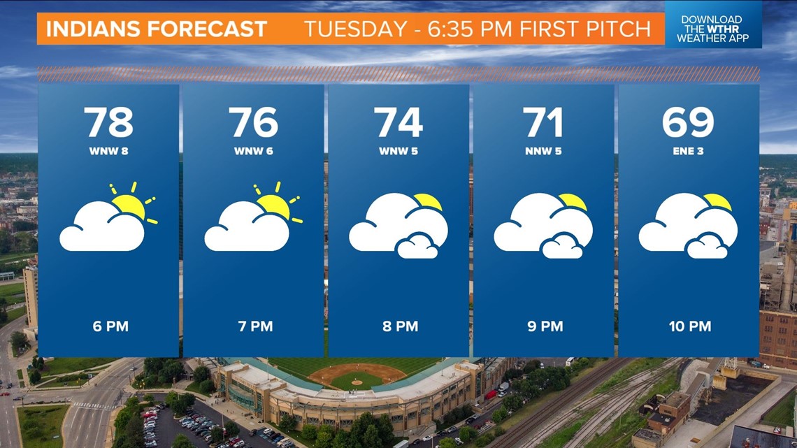
The dry air sets the stage for a pleasant evening which is timed out nicely with the return of the Indianapolis Indians. Their latest homestand begins Tuesday at The Vic with a 6:35 p.m. first pitch against the Toledo Mudhens with game time temperatures in the mid-70s. It will be a perfect evening at the ballpark.

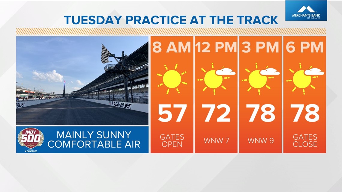
Tuesday will be equally as nice and an ideal day for the opening Indy 500 practice at IMS. Gates open at 8 a.m. with temperatures in the 50s and close at 6 p.m. near 80°.

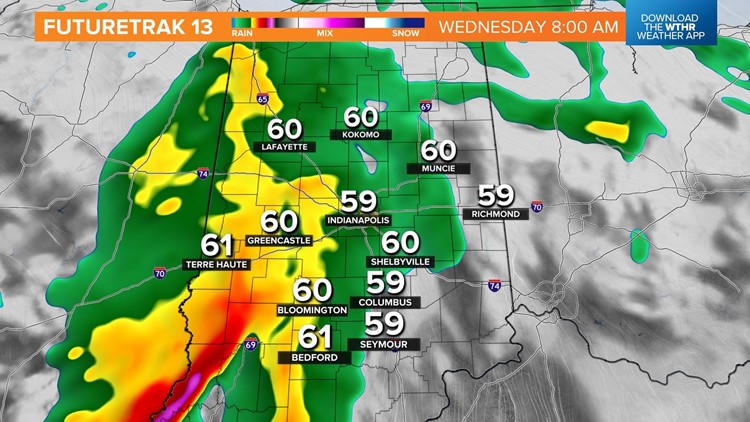
Central Indiana remains rain-free until late Tuesday night into Wednesday morning when the remnants of a storm complex bring widespread rain to start hump day. How quickly this feature exits and whether or not we'll have any sun/heating/destabilization during the late-afternoon is uncertain.
Some modeling is bullish on the atmosphere becoming suitable for severe storms, especially over the southern half of the state. As such, this region is in a Level 1 (out of 5) risk. Check back for updates and plan on at least multiple rounds of heavy rain/thunderstorms Wednesday into Thursday morning.
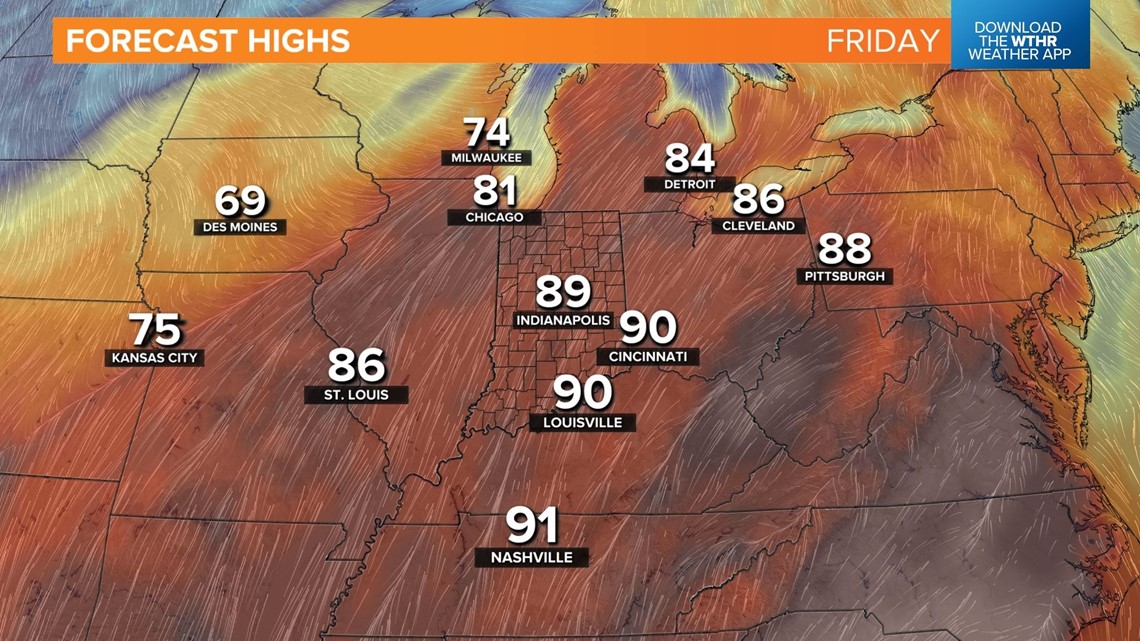
Friday still looks like the hottest day of the week with highs surging to near 90° as a muggy southwest wind emerges. The atmosphere should be plenty unstable Friday afternoon but atmospheric lift for widespread, potentially severe storms seems lacking as an approaching cold front will be focused more in Illinois.


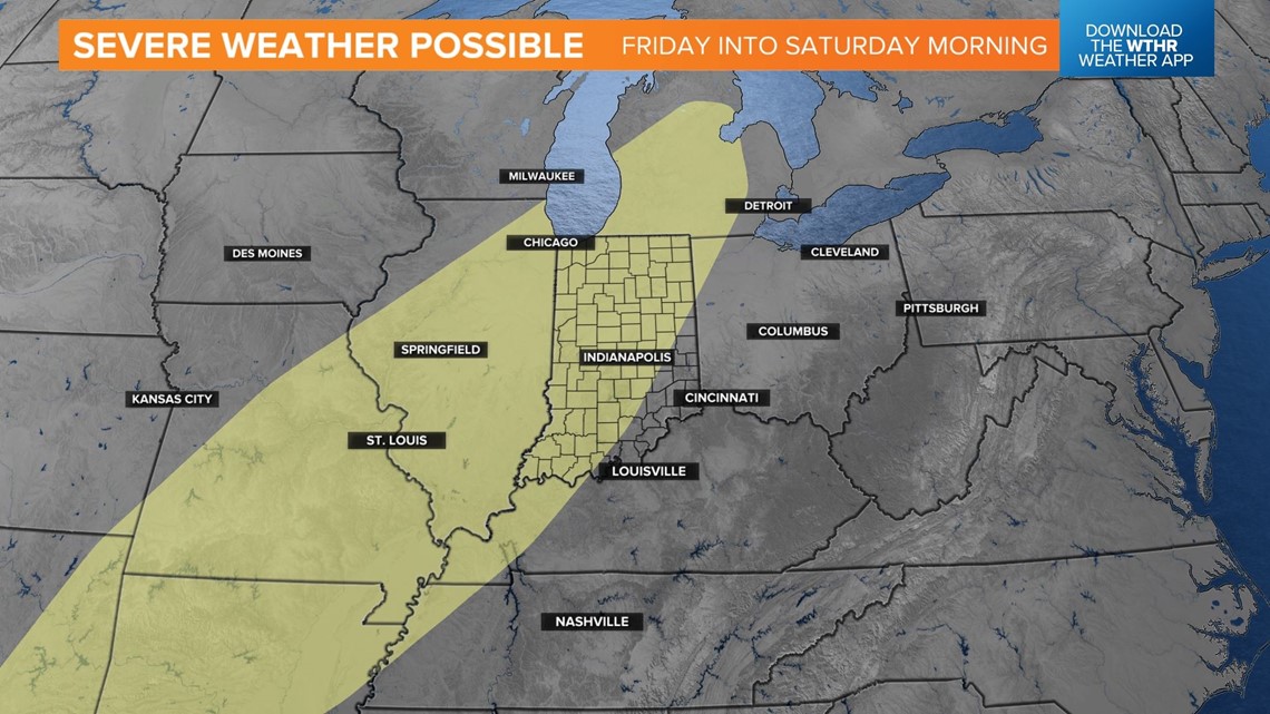
This front brings widespread rain/thunderstorms Friday night into Saturday morning. Right now, we're expecting rain to diminish around midday Saturday and for the sky to brighten. But it should be noted there's at least one solution that's much slower and more volatile for heavy storms Saturday afternoon. We'll iron out details in the days ahead, but at minimum, there will be time to dry the track for Indy 500 qualifying Saturday afternoon.
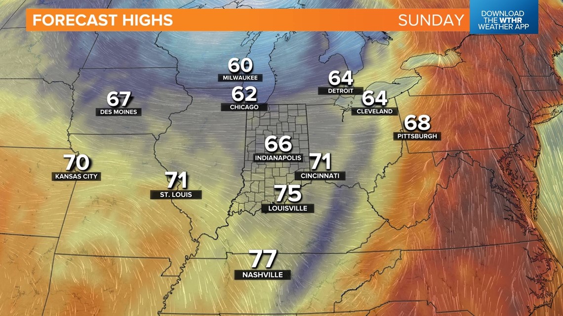
Sunday looks unseasonably cool despite a mainly sunny sky with highs in the 60s.