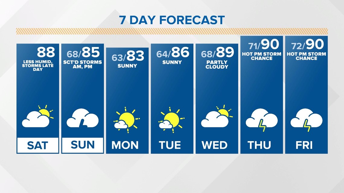
INDIANAPOLIS — We're sitting on the backside of a cold front Saturday which means a less humid air mass in place to start the weekend. We'll be enjoying plenty of sunshine for most of the day with temperatures in the upper 80s around the Indy metro and near 90 to areas south.

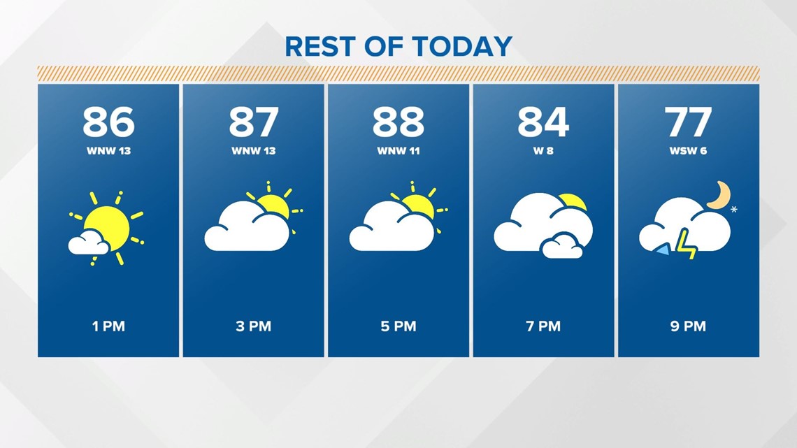
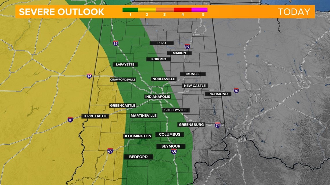
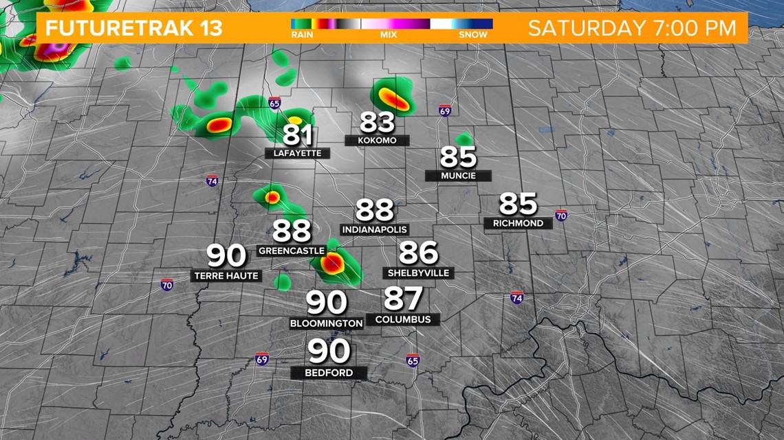
Rain chances return Saturday evening as scattered thunderstorms move in along our next weather system. A few strong to severe storms will be possible overnight, especially on the western side of the state, with damaging wind gusts and large hail as the primary threats.


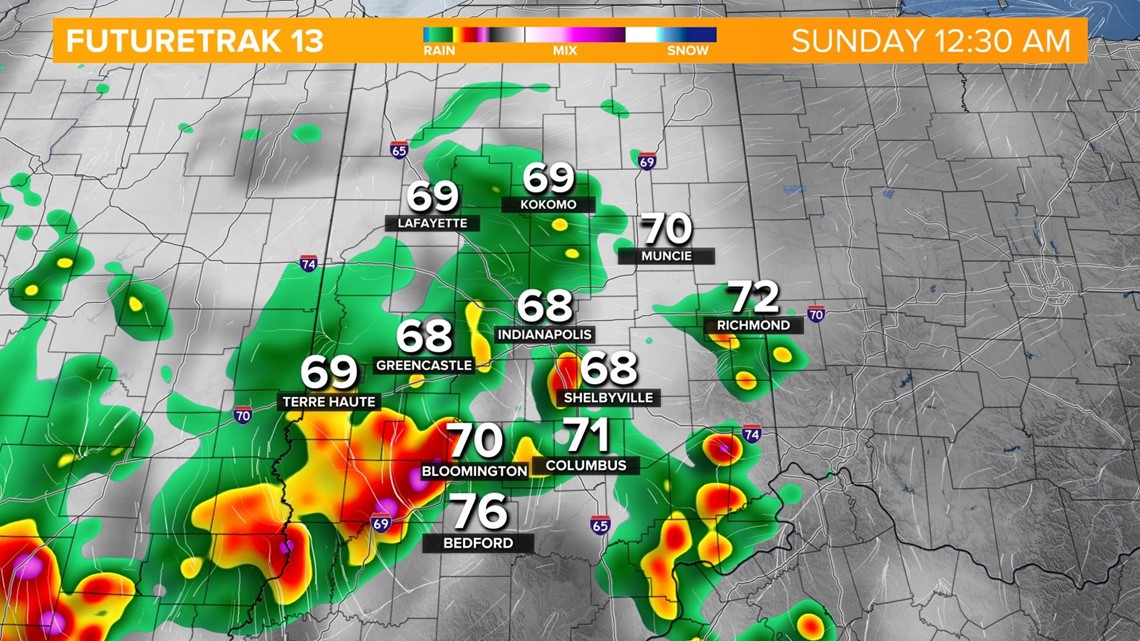
Overnight lows remain steady in the upper 60s.
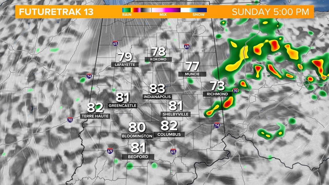
Scattered thunderstorms will be likely through the first part of Sunday. There will be more dry time in the late morning and early afternoon before pop-up storms will be possible along another cold front in the early evening. Temperatures will not be as hot as Saturday with highs in the mid 80s.

We're heading into a dry stretch starting on Monday and staying dry through Wednesday. Comfortable high temperatures in the low to mid 80s.
We bring back rain chances starting Thursday with scattered storms in the forecast through the start of next week. We also bring the heat back with highs near 90.