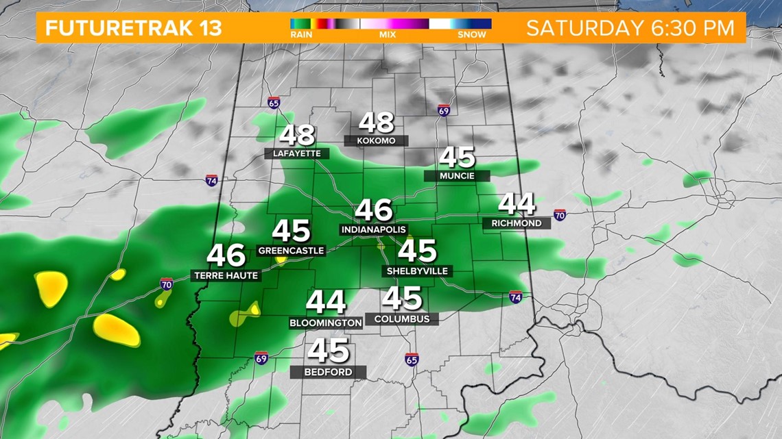
INDIANAPOLIS — A boundary will stall in the Ohio River Valley today and tomorrow with a round of rain associated with that moving in tonight.
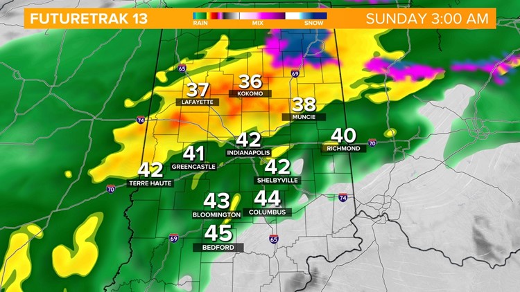
Widespread rain takes over after sunset around 6 p.m. with heavy rain continuing through the night.

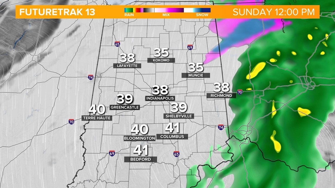
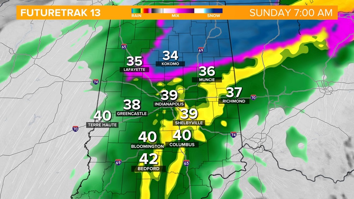
Temperatures will drop into the 30s during the overnight. While most of central Indiana remains too warm, far northern parts of the state drop close to the freezing mark bringing the potential of a brief wintry mix.


The best chance for any wintry accumulation will be north of the Indianapolis viewing area from Warsaw to Ft. Wayne. Temperatures will be just warm enough that places like Kokomo and Muncie shouldn't see the changeover. Also keep in mind the ground is very warm, so any frozen precipitation that does fall will melt on contact and not stick around.

The batch of precipitation exits the state by noon with a clearing sky in the afternoon. Temperatures stay chilly in the 40s through the day.