INDIANAPOLIS — Welcome to the one of the "picks-of-the-week" for weather in central Indiana. If you're a fan of cooler-than-average air, then you'll likely agree.
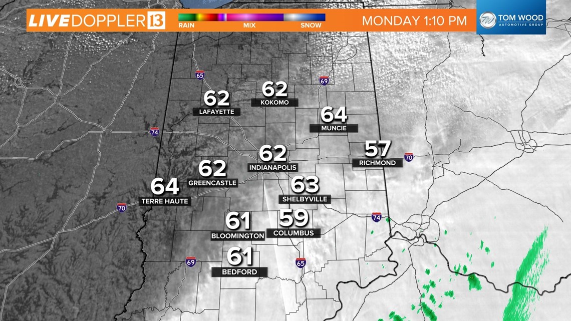
A dry northeasterly wind undercutting mid/high level cloud cover keeps temperatures in check today with afternoon peak highs staying below 70 degrees for most of us.
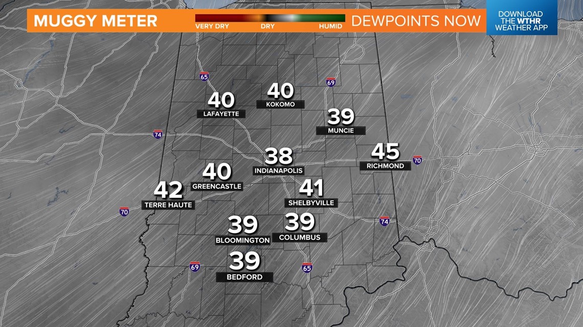
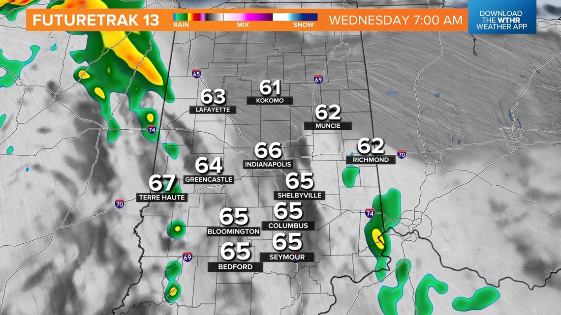
Cloud cover remains more prevalent and thicker in eastern-southeast Indiana where temperatures struggle into the 60s. Dewpoints in the 30s mean the Muggy Meter remains very dry, and it will stay that way until Wednesday, which is our next chance of rain and thunderstorms.


The dry air leads to another evening and night of efficient cooling with seasonably chilly lows in the 45-to-near-50-degree range.
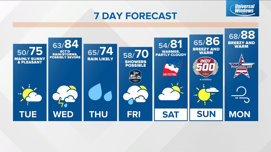
Tuesday will be the other "pick-of-the-week" weather day in central Indiana with milder highs in the 70s under a mainly to partly sunny sky.
Wednesday won't be washout, but it's fair game for scattered showers around in the morning. There should be plenty of dry time to allow temperatures Wednesday afternoon to warm into the mid-80s, allowing for ample destabilization to support the potential of severe weather within storms that develop in the 4-9 p.m. window Wednesday.
Stay tuned for updates to coverage and intensity in what could become a Weather Aware day.


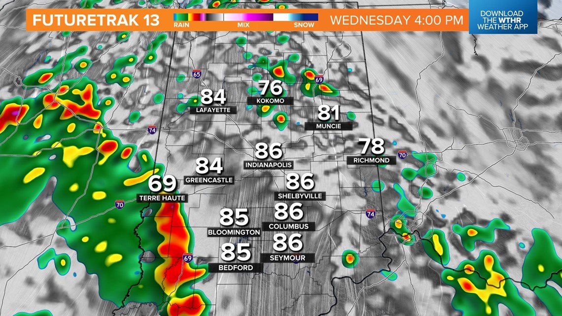

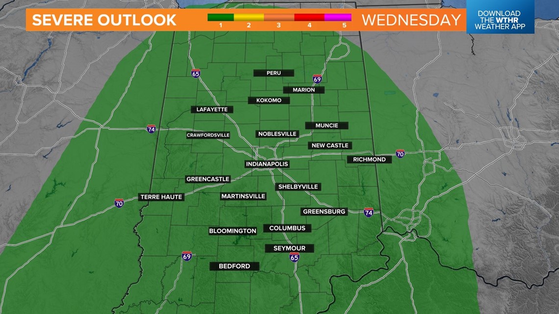
Stay tuned for updates to coverage and intensity in what could become a Weather Aware day.
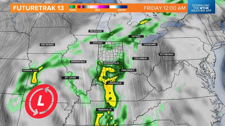
The departure time of the upper level low bringing the unsettled mid-week weather makes or breaks the weather for Carb Day on Friday. Some modeling suggests a quicker system that exits to the east by Friday afternoon.
However, there's also plenty of guidance showing a slower upper low that could possibly be spinning over central Indiana during the day Friday. That latter solution will be a cloudy, showery setup for Carb Day with temperatures in the 60s.


For now, it's expected to be clear of the Ohio Valley during race weekend, but with the caveat, it could be far enough removed from upper level wind to still be turtling around Saturday.
Race Day looks unseasonably warm with highs in the mid-80s, courtesy of sunshine and a strengthening southwesterly wind. Please follow our forecast for any changes between now and then.