
INDIANAPOLIS — Overnight storms caused some power outages and reported damage through central Indiana.
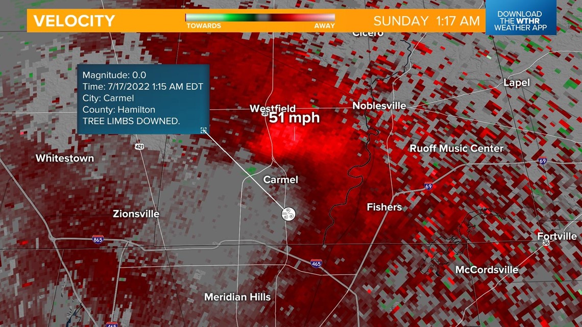
At 1:15 a.m., reports of trees/limbs down were received from the National Weather Service from the Carmel area. Radar at the time indicated peak wind speeds of 50-55 mph and the velocity scan shows the potential of a weak downburst.

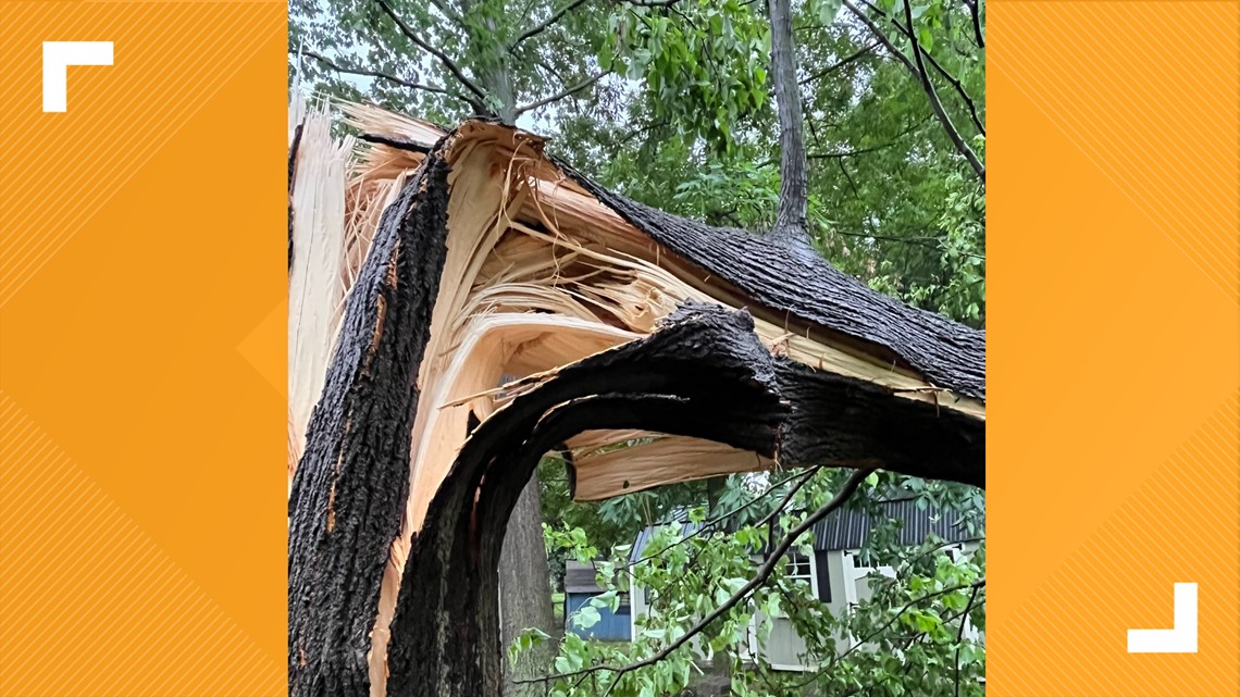
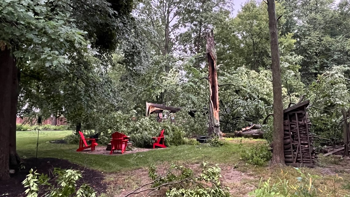
Darla Leversen of Hamilton County tweeted these images to WTHR meteorologists showing snapped trees and damage to fences.


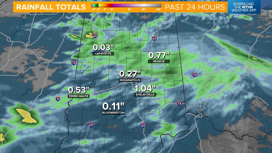
Heavy rain associated with these storms lead to some areas receiving substantial amounts of rain and localized flooding.

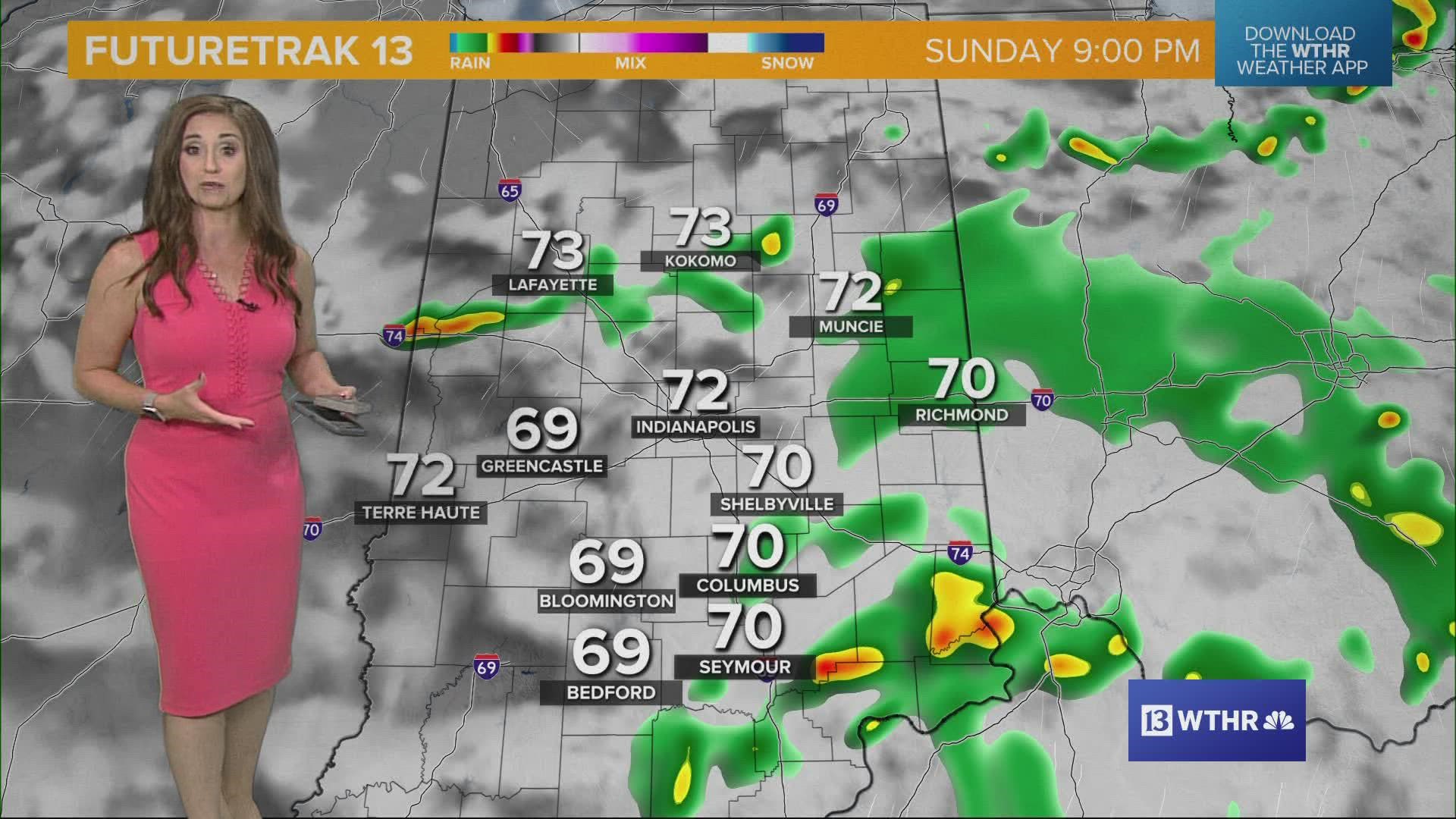
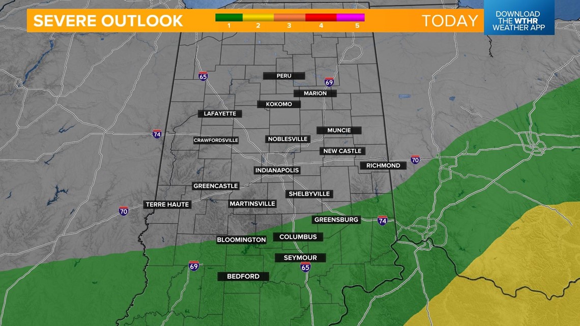
A few stronger storms will be possible Sunday, especially in southern Indiana, but widespread severe weather is not expected. The biggest threat will be heavy rain leading to localized flooding as many spots could see upwards of an inch of rainfall through this evening.

This slow-moving storm system will serve as a trigger keeping more widespread rain and storms in the forecast through the day today. After a slight lull in the mid-morning for the storm coverage area, storms will ramp up in the afternoon.

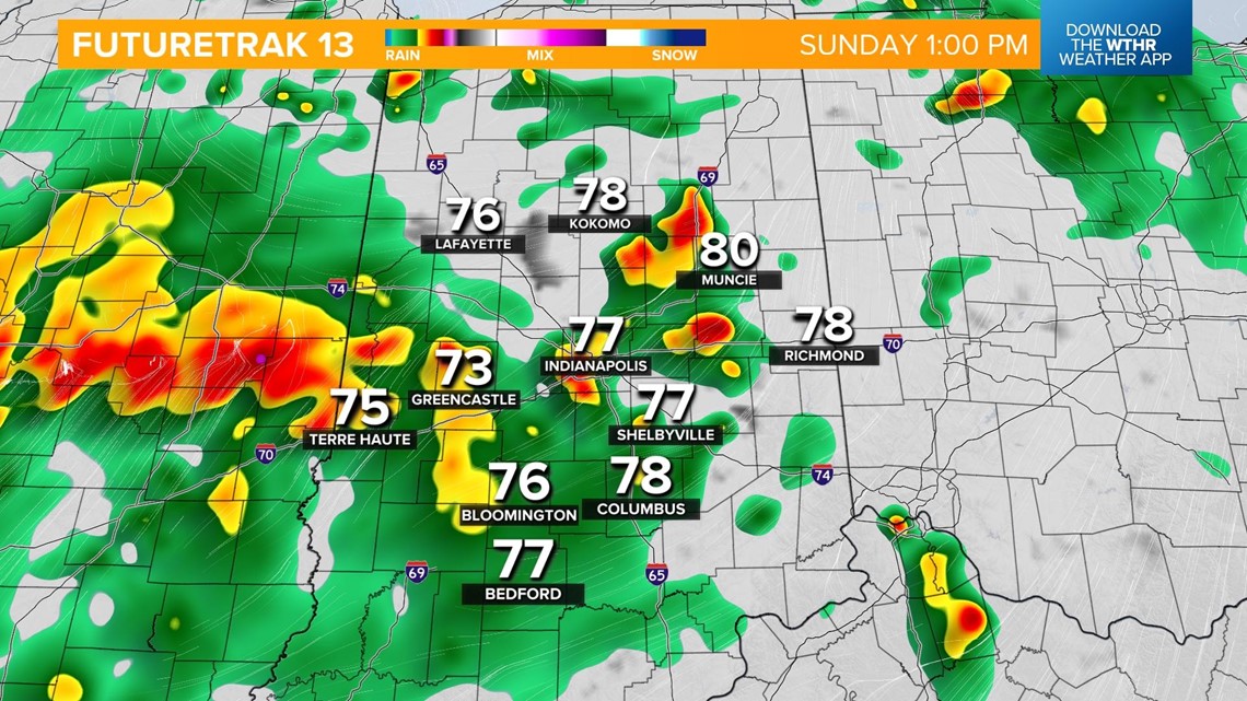

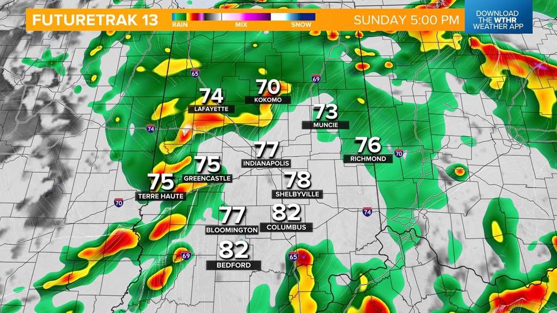

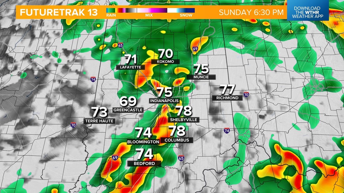
Temperatures will hold steady through the afternoon in the mid to upper 70s. Rain and storms will taper off closer to sunset and continue to clear out overnight.

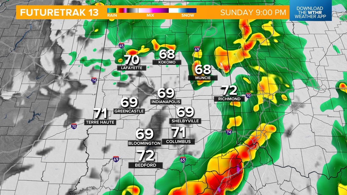
Expect low temperatures in the upper 60s heading into Monday. While this storm system continues to exit, we'll see just enough lingering moisture and heat to prompt a stray shower or storm Monday afternoon.
Highs will be in the mid 80s.