

INDIANAPOLIS — As most of Indiana falls into a 3"+ rainfall deficit for the month of June, some much-needed rain chances increase as we head toward the holiday weekend.

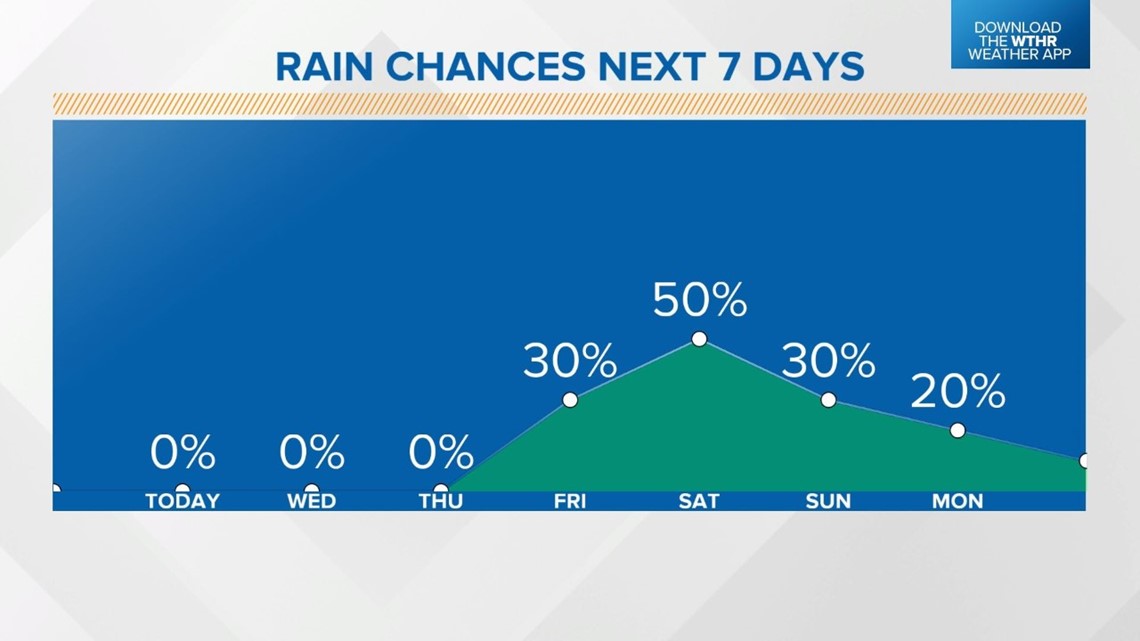
A slow-moving cold front will move through central Indiana on Friday, prompting a few scattered showers starting in the afternoon.

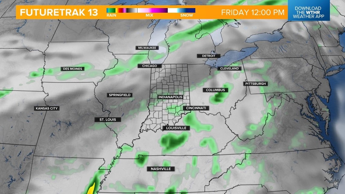
As this boundary stalls in the evening, showers and isolated storms will become slightly more widespread.

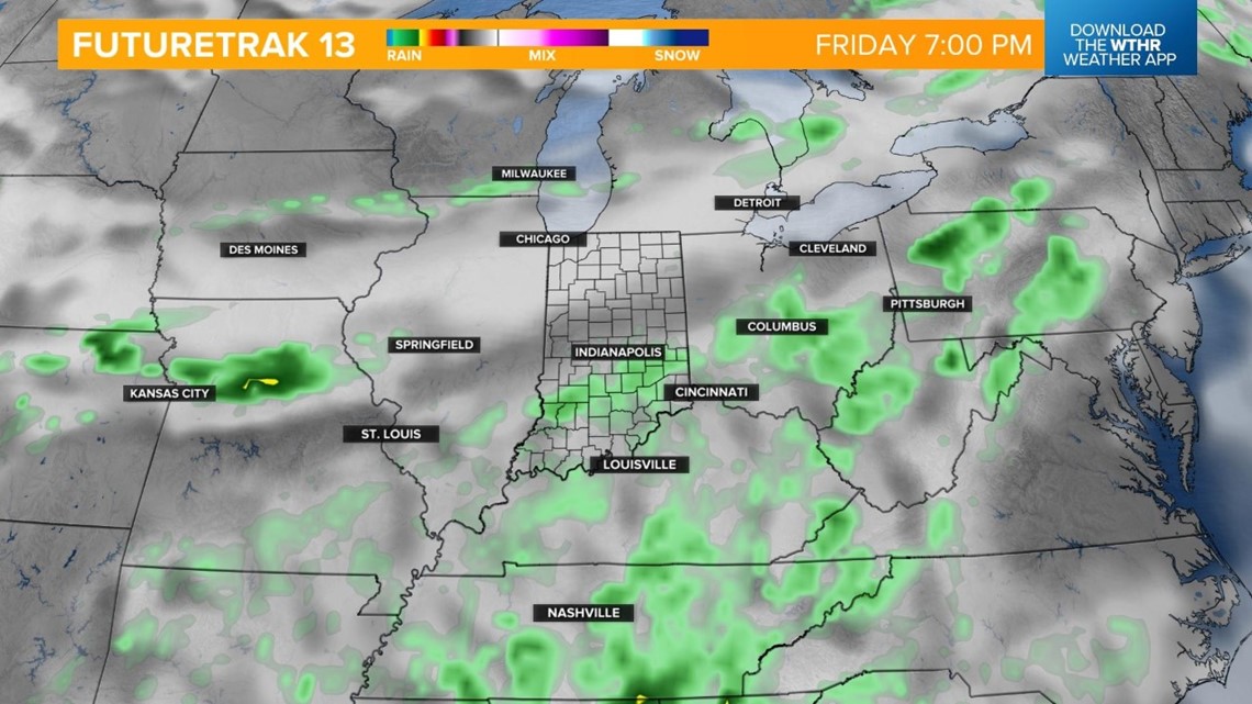
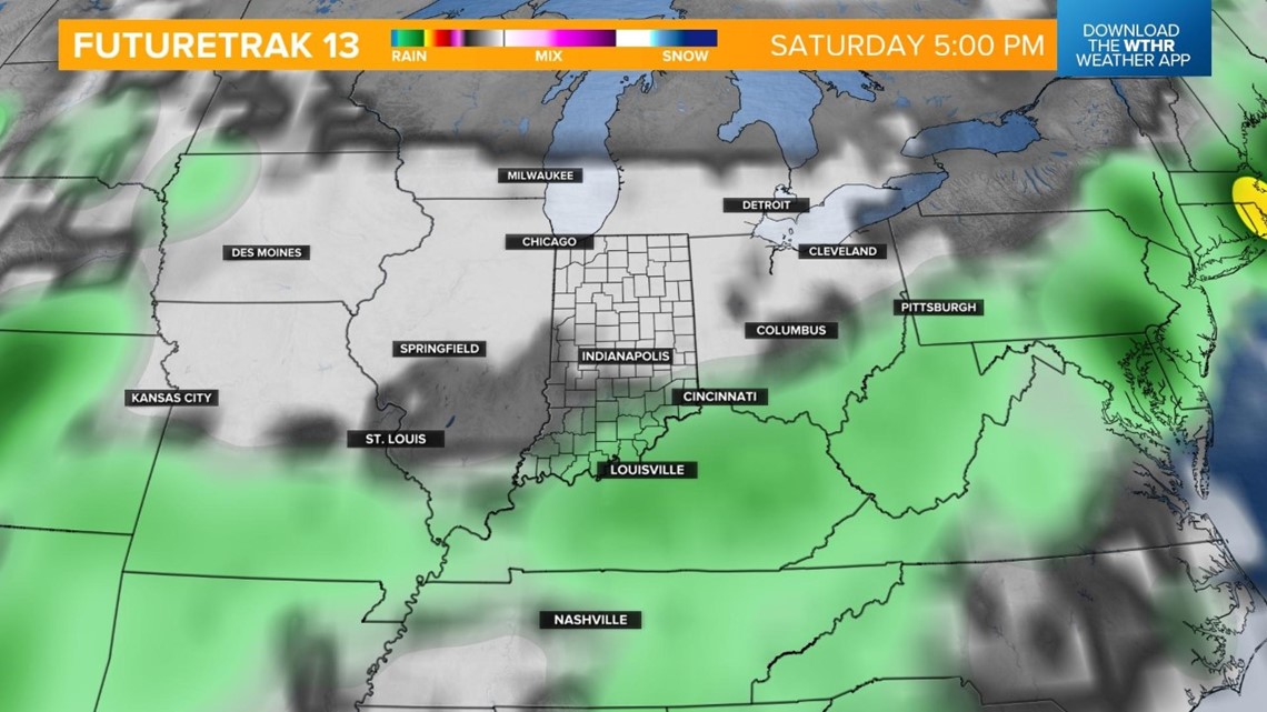
The best rain and storm chance will occur during the overnight hours Friday into Saturday morning.

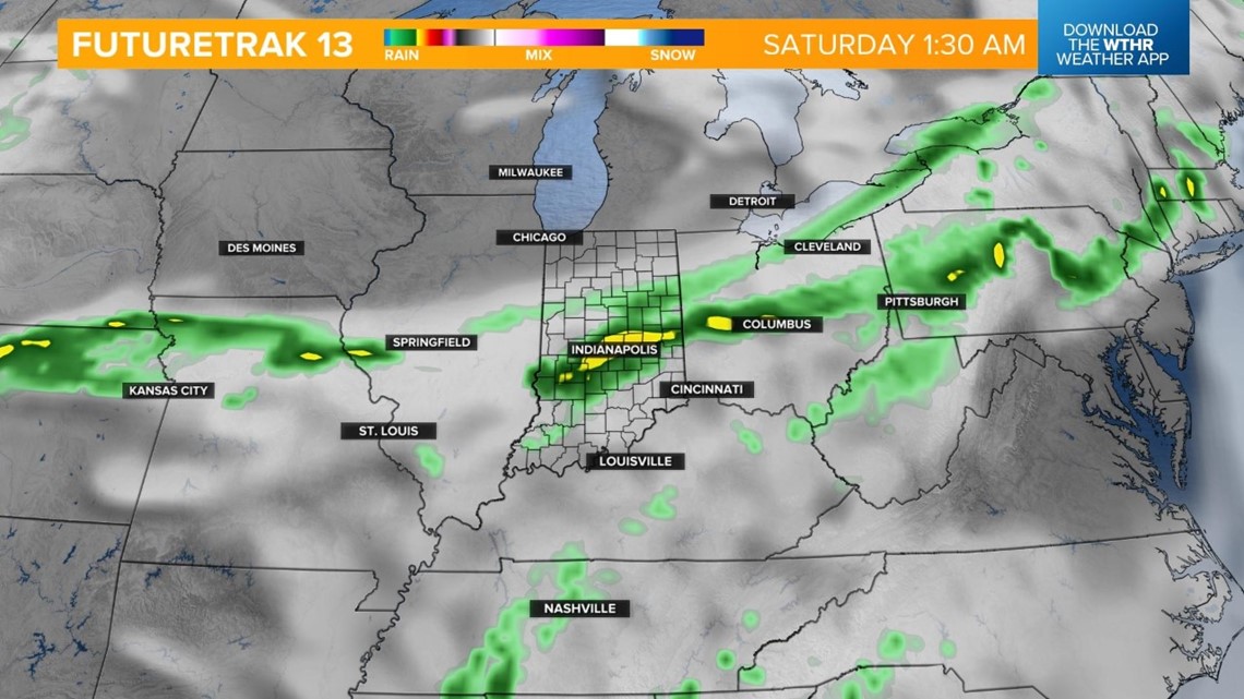
This boundary will then push south during the day Saturday, setting the southern tier of the state up for the better chance of lingering rain showers.

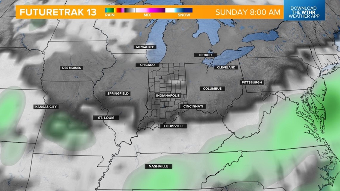
Rain chances become more uncertain for the remainder of the holiday weekend, but a more humid, summertime setup could prompt pop-up storms with the heat of the afternoon on Sunday and Monday. Temperatures will top out in the upper 80s, near 90 degrees both days.
Check back for the latest forecast if you're planning any Fourth of July celebrations.

What other people are reading:
- Lawmakers discuss upcoming special session, future of abortion in Indiana
- Police department, community rally around Trafalgar officer critically injured in crash
- Victims learn they were not alone in being hit by Indianapolis woman charged in fatal crash
- Thorntown 5-year-old gets new wheelchair ramp, thanks to $5 donations
- Here's what you (and your neighbors) need to know about Indiana's fireworks laws
- Indianapolis firefighter arrested for kidnapping, confinement
- Vermont man tried to use excavator to stop son's arrest, police say
- Yes, vasectomies are reversible
