INDIANAPOLIS — Thus far, the forecast today has played out as expected. Heat indices peaked in the 100-105° range and now heavy storms are increasing around the I-70/74 corridors.
Please be Weather Aware if you have outdoor evening plans as these storms are in an environment conducive of excessive rain rates greater than 2"-3"+ per hour and frequent cloud-to-ground lightning strikes. Localized street flooding is likely in heavier cells that will be slow-moving due to the little upper-level wind to move them.
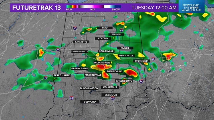
These storms will slowly diminish after sunset, but not before some areas get a quick 1"-2"+ rainfall. The cool front helping trigger these storms will linger over central Indiana Tuesday morning to keep showers and some downpours around to start the day.
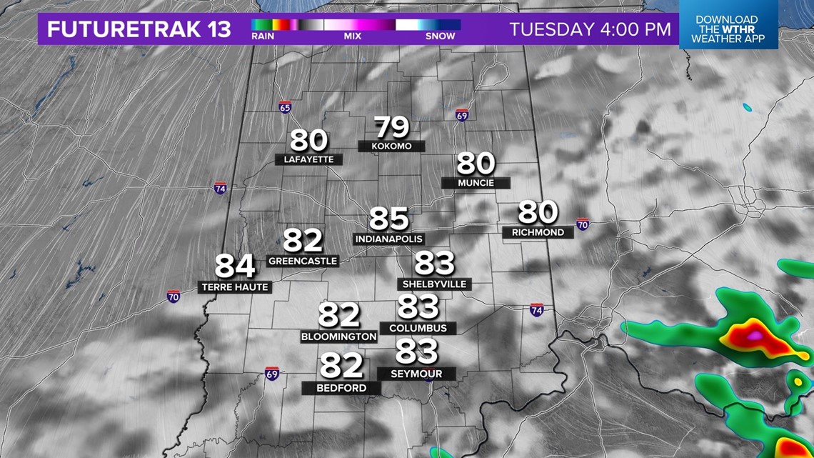
That axis slowly drifts southward throughout the day with the expectation that south of I-70 will be the area with greatest probability of downpours/storms Tuesday afternoon.
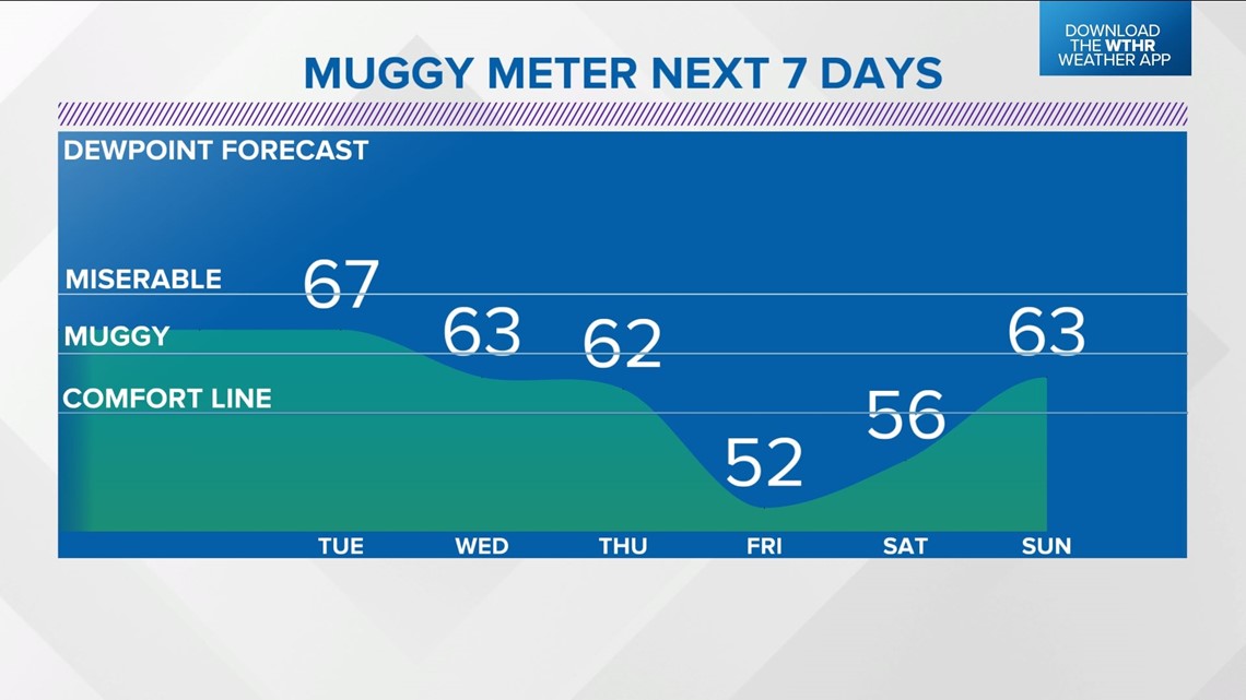
Tuesday will be still be humid with dewpoints well in the 60s, but not nearly as oppressive as this past weekend and today. This is the beginning of a step-down towards pleasant air arriving for this weekend.