INDIANAPOLIS — As expected, it was an eventful three to four hours across central Indiana with multiple rotating thunderstorms, several severe thunderstorm and tornado warnings, and possibly a tornado with damage around McCordsville
We detected the possible tornado on Live Doppler 13 Radar during live coverage on WTHR when a Tornado Debris Signature (TDS) appeared around that area.
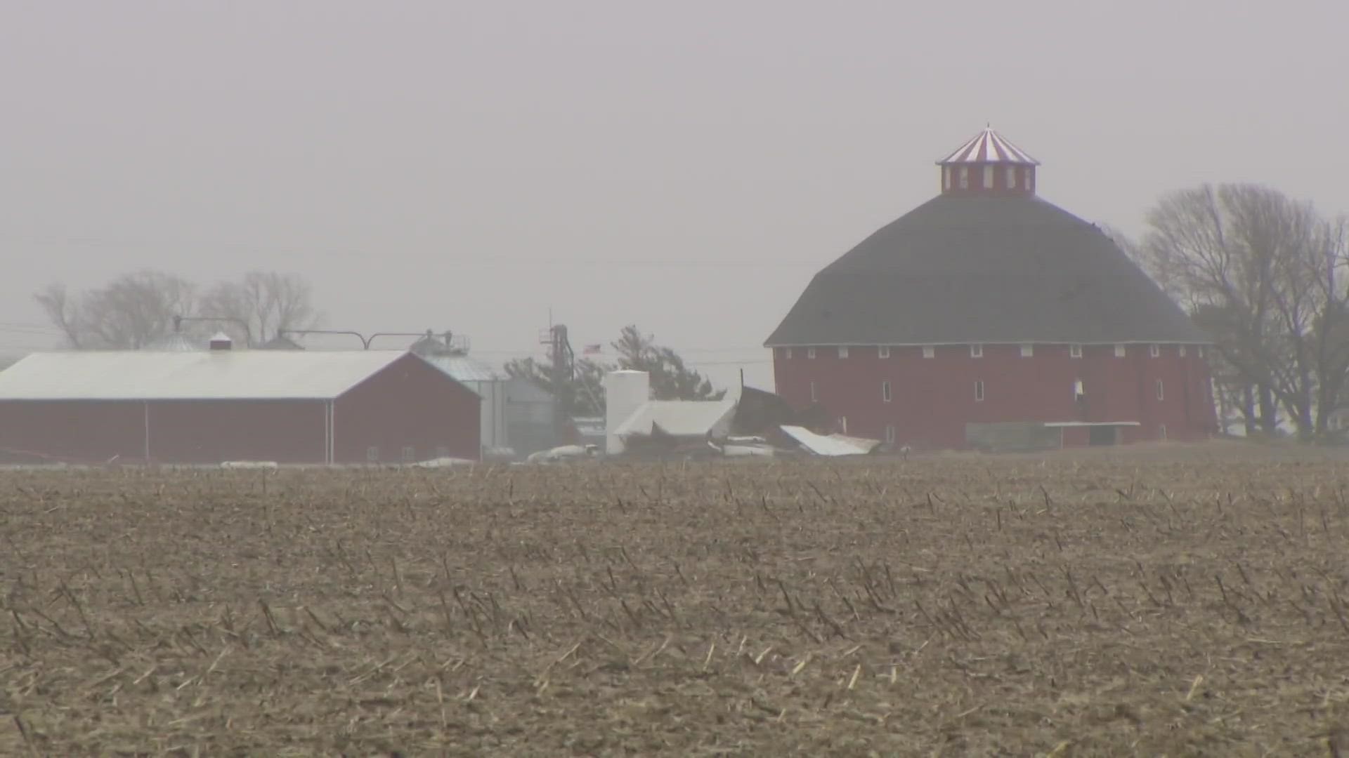
Pictures show damage just north of Mt. Comfort Airport that could be caused by that potential tornado.
National Weather Service crews are expected to be coordinating with Hancock County EMA to survey potential damage locations.
The threat of severe weather is over and well into Ohio now. However, until the sun sets, strong non-thunderstorm gusts of 45-50+ mph will wrap around the center of the intense area of low pressure.
Gusts well over 50 mph have already been recorded at the Indianapolis International Airport.
Thousands of power outages were reported as of 4:30 p.m. from thunderstorms and non-thunderstorms.
Outage numbers may continue to increase until the wind settles down overnight as the storm system moves away from us.
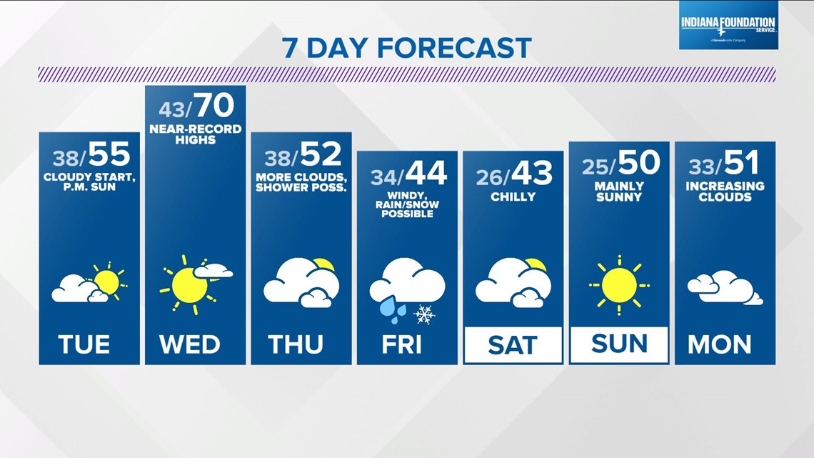
We'll have a chillier start in the 30s Tuesday morning. Clouds will hang tough for much of the day. The best chance of sun and thinning of the low cloud deck will occur later in the day, but should be enough to boost temperatures into the 50s.
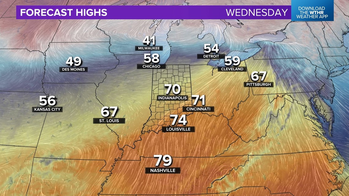
Much better prospects for a brighter sky and much warmer temperatures arrive Wednesday for the opening day of March.
Highs will surge to near 70° and near-record warm levels (71°) for March 1st. Make plans accordingly.

Modeling remains very bullish with another strong storm system moving through the Great Lakes/Ohio Valley on Friday.
This will bring more high, non-thunderstorm gusts possibly over 50 mph in addition to heavy rain, thunderstorms, and possibly a band of heavy snow to the north-northwest of the uncertain storm track.

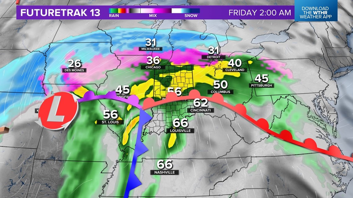
Follow the forecast closely for this storm the remainder of the week for local impacts and regional travel problems.