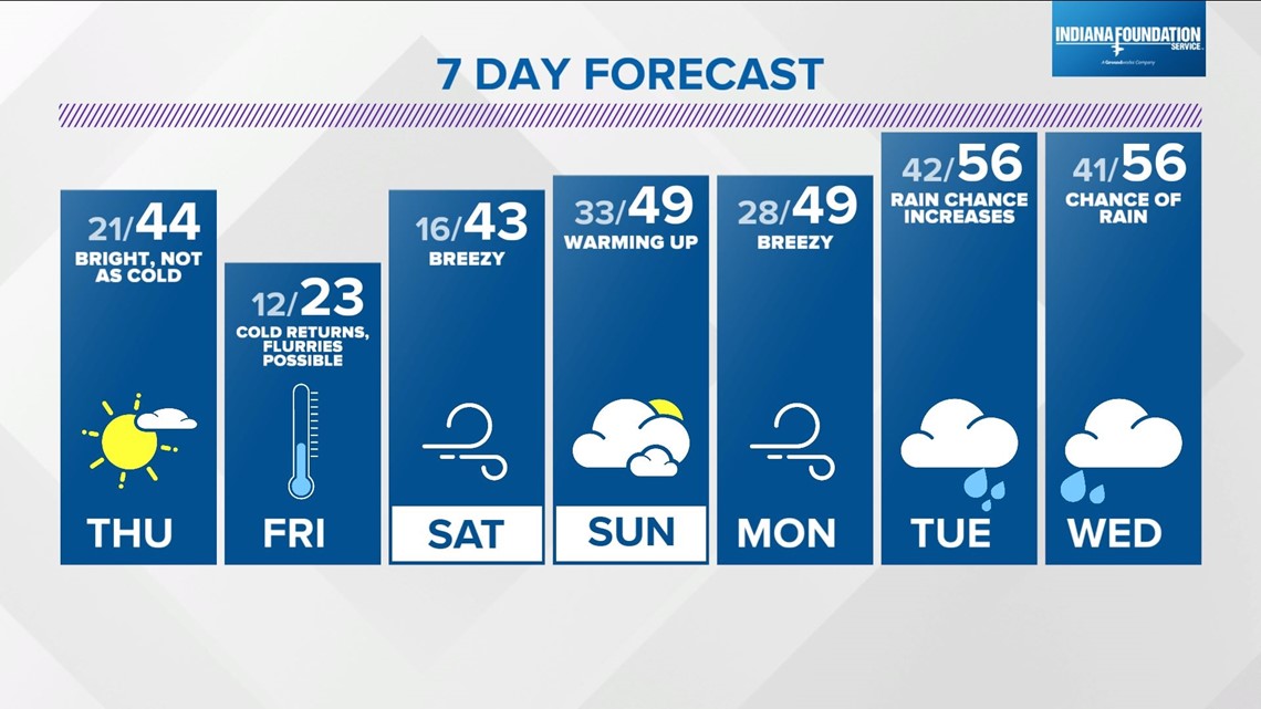
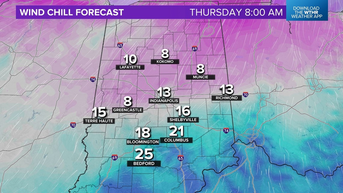
INDIANAPOLIS — There's plenty of sunshine today and with a nice recovery in temperatures from 5° to 15° this morning to 30° to 35° this afternoon. Temperatures won't be as cold tonight thanks to strengthening southwest wind, but wind chills will drop into the single digits to lower teens, and that's what you'll have to dress for in the morning.
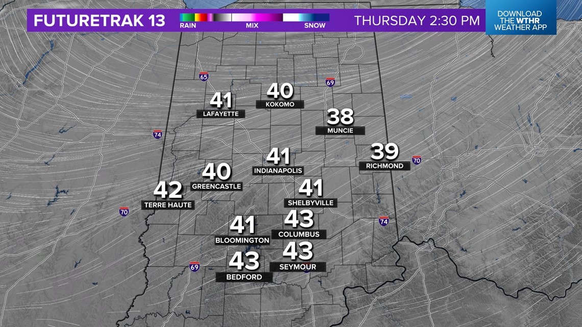
The "warmer" wind teams up with more sunshine to quickly boost temperatures into the 40s Thursday afternoon. Unfortunately, it comes with gusts over 25 mph. Expect a rapid wind shift Thursday evening and rapid temperature drop with the latest Arctic front sweeping through the state, setting the stage for a stinger of a Friday.


The front won't have a lot of moisture to squeeze out of the atmosphere, but the cold air advection could be enough to trigger some snow showers. Its bigger impact will be the rapid drop in temperatures as it will "feel" over 40° colder in a just a few hours.

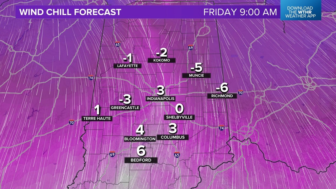

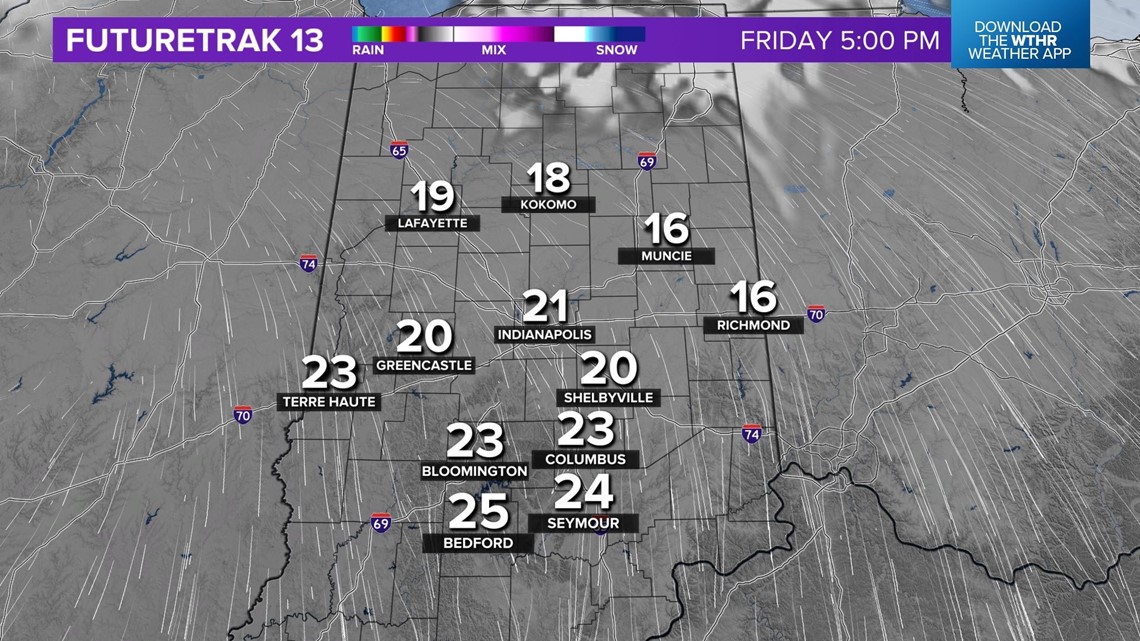
Low temperatures Friday morning dip into the lower teens with wind chills near/below zero. We're still expecting some lake effect flurries and/or snow showers from the much colder air flowing over Lake Michigan. "High" temperatures struggle to reach the lower/mid 20s, and likely won't in some locations.
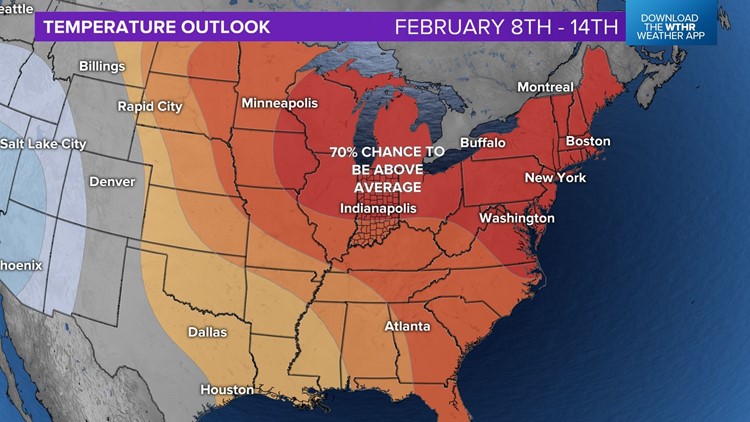
That will be our coldest day for a while with medium to long-range guidance remaining bullish on above to much above average temperatures heading into next week.
This equates to highs near 50° beginning as early as Sunday and more likely Monday/Tuesday of next week. A pattern that's modeled would not be good for winter weather lovers and definitely puts the kibosh on snow chances for perhaps at least a couple of weeks. Stay tuned.