INDIANAPOLIS — What a wintry stretch run it's been for central Indiana.
After dealing with lake effect snow and slickness Tuesday morning, clouds gradually cleared as anticipated to finish the day with increasing blue sky.
While sun was a welcomed sight, there's going to be a price to pay for not having the "blanket on the bed"... i.e., no clouds acting as insulation.
The center of high pressure nearby leads to the perfect, for what's called, "maximum radiational cooling" which consists of a clear sky and calm wind that allows any "heat" from the day to radiate from the surface at a rapid rate.

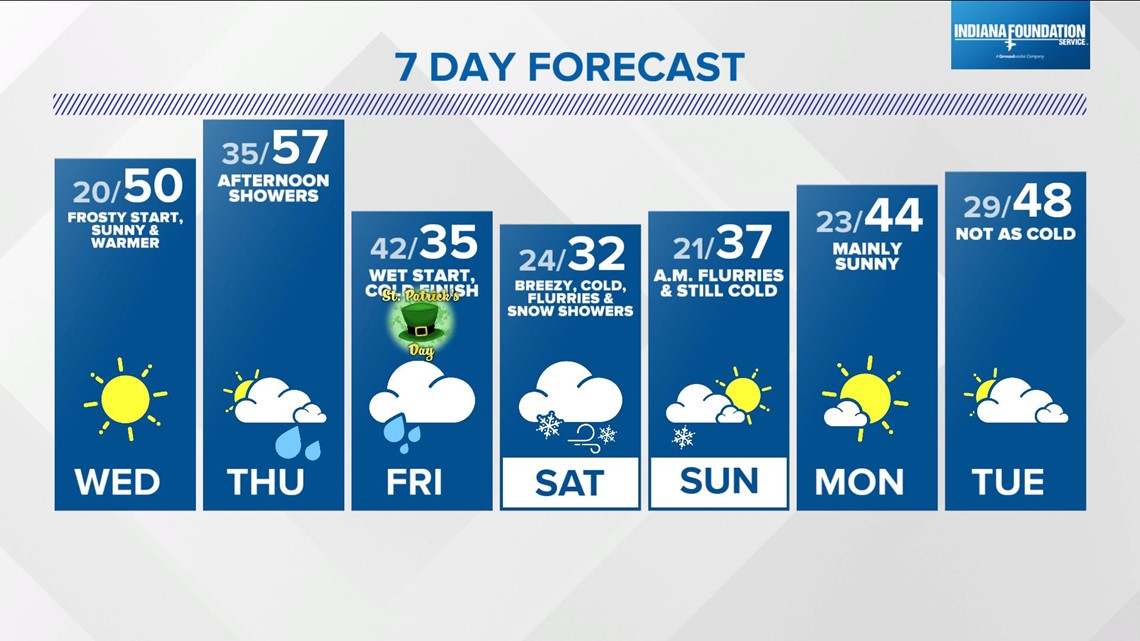
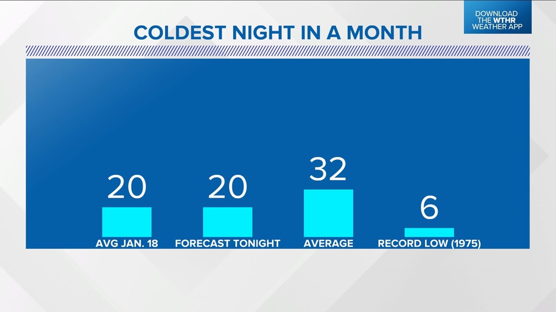
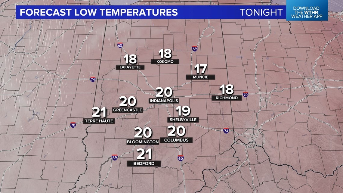
This results in low temperatures Wednesday morning in the 15°-20° range.

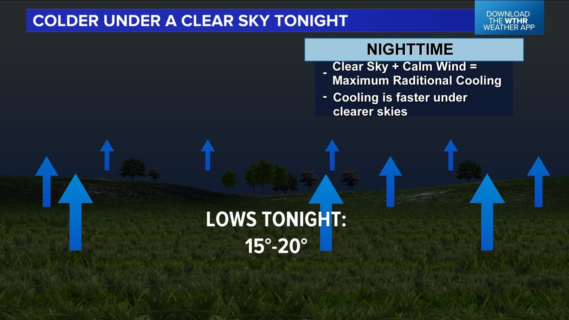
That's good for the coldest since the middle of February.
If you're car is parked outside, plan on scraping windshields in the morning.


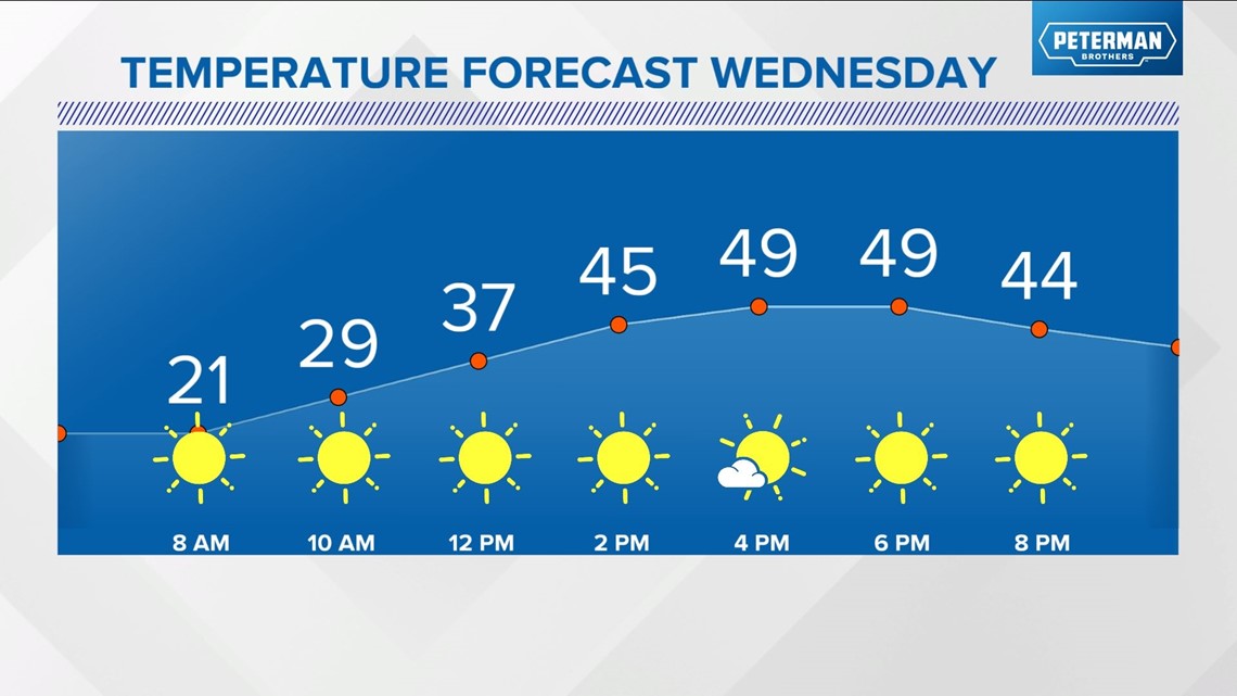
Despite the January-like cold start, Wednesday is my pick of the week due to the sunny sky from start to finish and highs near 50 will feel so much better than the past 48 hours.
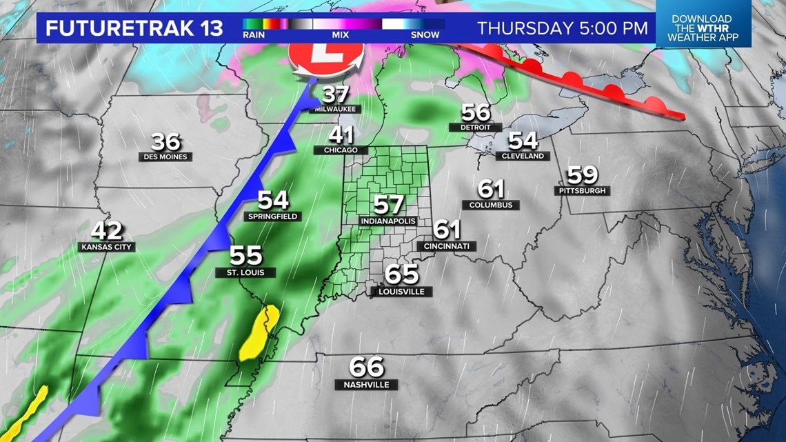
Enjoy the sunshine before it becomes soggy heading into Thursday afternoon.

The rain coming from an approaching cold front doesn't arrive quick enough to slow "warming" in central/eastern Indiana on Thursday, where highs should reach the 55 to the 60-plus range.
Rain expands over central Indiana quickly the later into Thursday we go. Our time spent in the "milder" airmass will be short-lived.

The latest modeling suggests FROPA (front passage) around the Indy metro area will occur between 5 a.m. and 7 a.m. Friday, when temperatures rapidly drop from the 40s to the 30s.

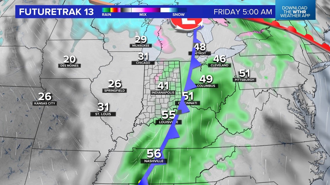

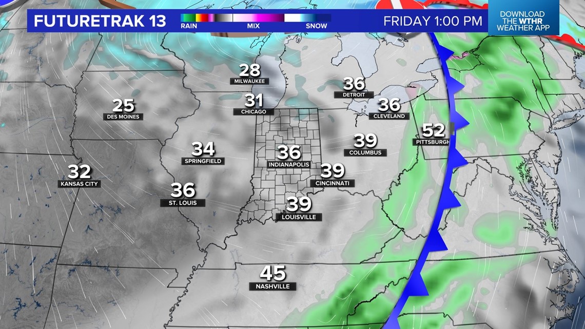
In addition to the temperature tumble, rain may mix with and/or change over to flurries and snow showers late morning into Friday afternoon.
In addition to the temperature tumble, rain may mix with and/or changeover to flurries and snow showers late morning into Friday afternoon. This isn't great news for St. Patrick's Day plans.


A combination of falling temperatures and strong wind of 20-30 mph produces wind chills in the upper teens/lower 20s.
You'll want to dress in layers if you're planning to attend the parade in downtown Indianapolis and heavy winter gear is recommended.

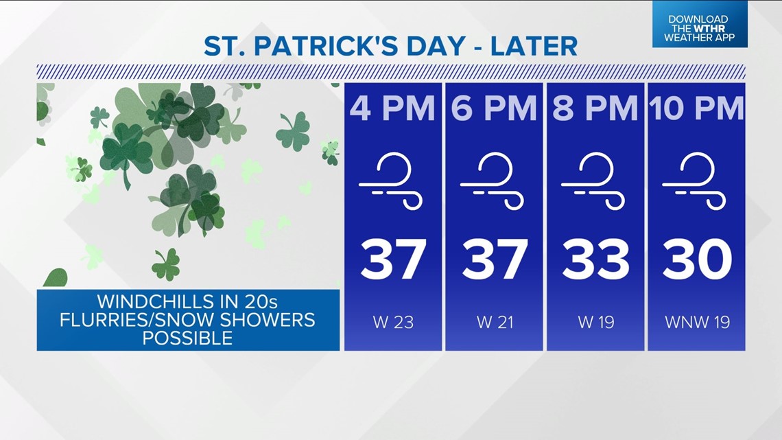
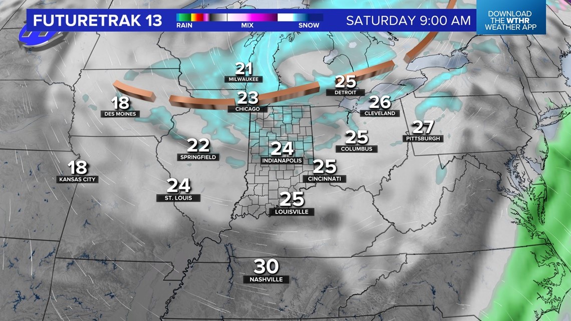
This storm system unleashing another shot of unseasonably cold air will spin upper disturbances into central Indiana Friday night into Saturday, resulting in scattered to, at times, numerous flurries/snow showers.
Plan on a rather cold Saturday with highs struggling to hit freezing.