INDIANAPOLIS — A potent storm system will impact central Indiana over the next few days. Starting today, a Wind Advisory will be in effect through 7 p.m.

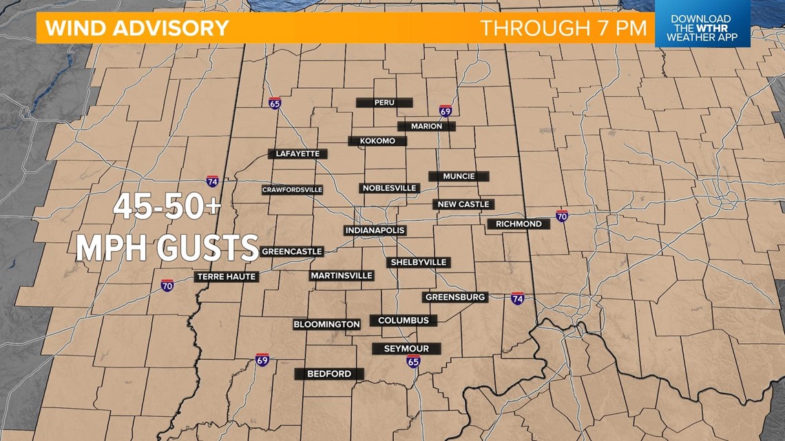
These strong, southerly winds will gust to 45-50 mph at times starting this morning and lasting through this evening. These winds could cause some downed branches, leading to isolated power outages. Travel will become difficult on east/west oriented roads, especially for high profile vehicles.

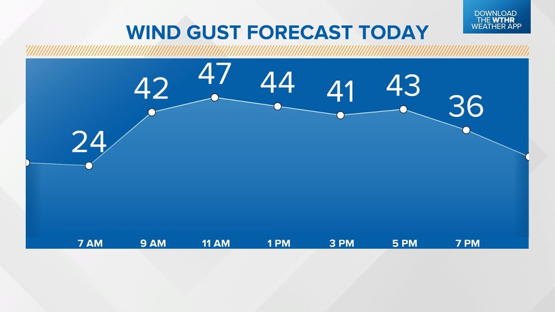
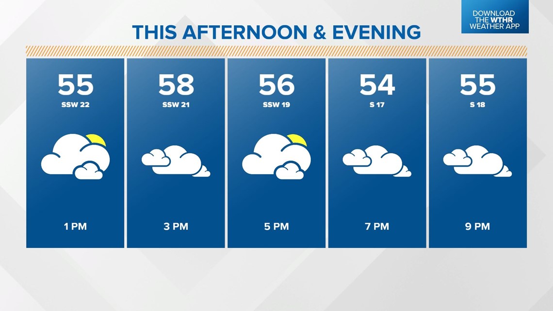
The wind will also be the source of the major warming trend as temperatures climb into the upper 50s by late in the day.

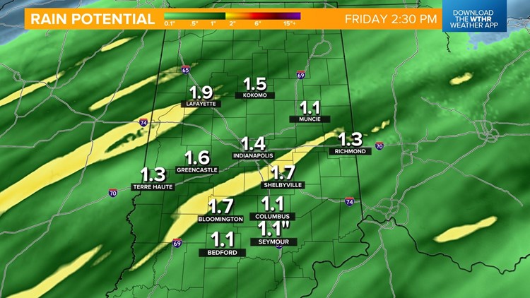
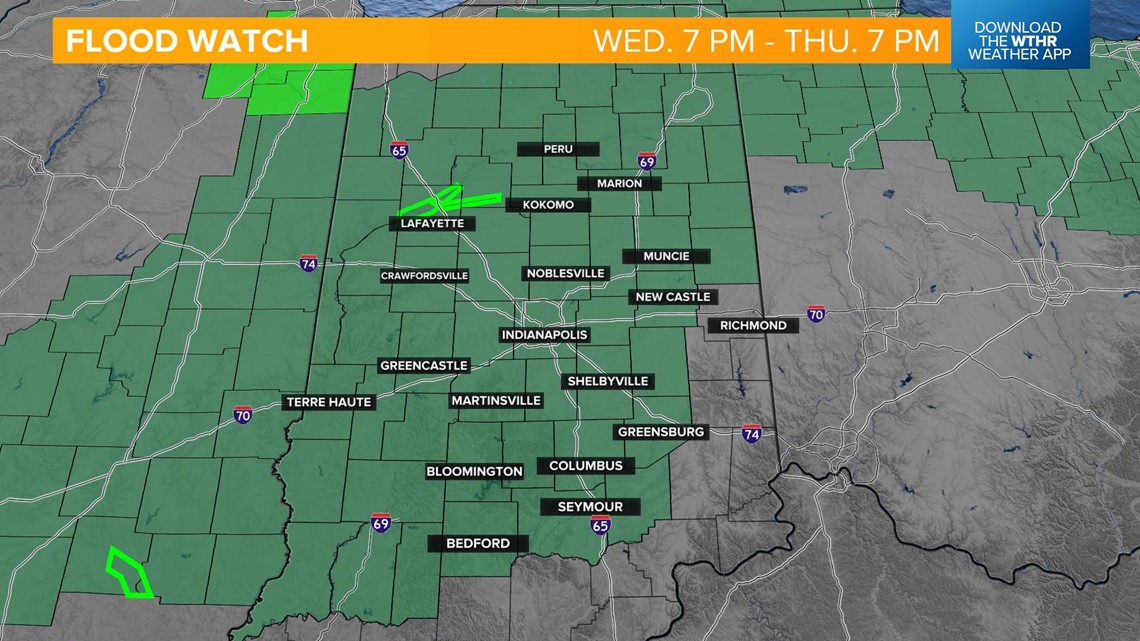
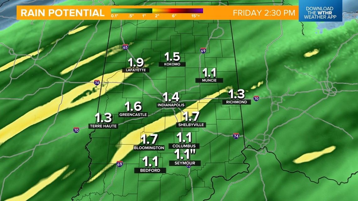
Rain will begin to push in along a cold front overnight and become widespread during the day Thursday. The rain looks to be heavy at times, which will bring a flooding risk, especially around our local rivers and waterways, as ice jamming could become an issue.
Due to this, the National Weather Service has issued a Flood Watch for all of central Indiana from 7 p.m. today through 7 p.m. Thursday as 1-3 inches of rainfall will be possible.


Timeline:
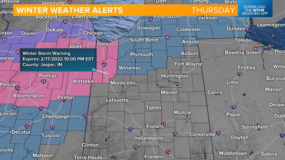
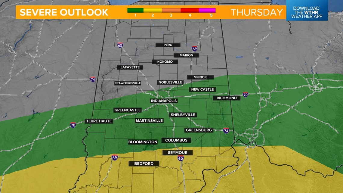
The warmth will come crashing down along this cold front during the day Thursday, which brings everything from snow accumulation in northern Indiana to a risk of stronger storms in the southern tier of the state.


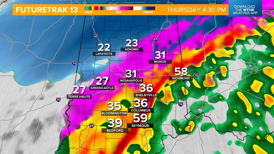
We'll still be in the 50s for most of the state early Thursday morning as rain moves in.

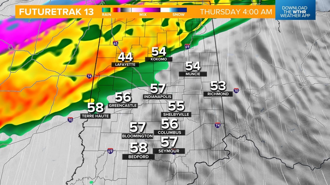
Heavy rain with the potential of damaging wind gusts will impact the Indy metro during the morning rush hour.

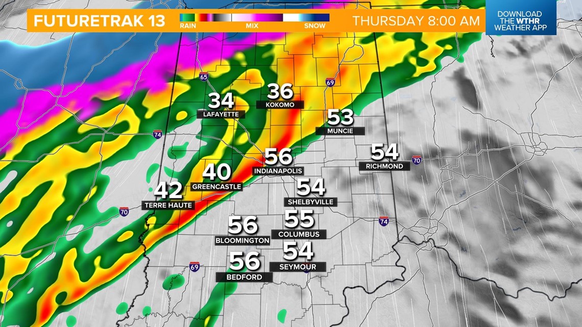
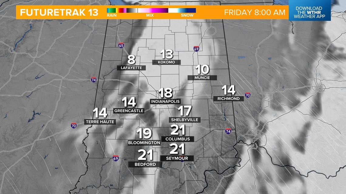
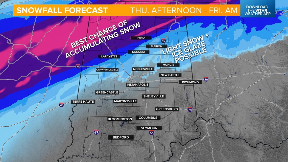
The freezing line will track southeast in northwest Indiana, bringing a snow/ice mix from Lafayette to Peru by mid-morning. Accumulating snow will begin in the northwest.

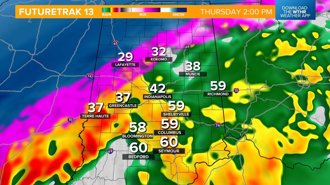
The freezing line will make its way into the metro closer to the evening rush hour. This brings a fairly rapid transition from rain to sleet and then snow over the course of a few hours. At the same time, southern Indiana will be experiencing heavy rainfall and thunderstorms with damaging wind gusts possible.

Much colder, dry air will take over on the backside of this storm system, bringing a brief wave of snow before precipitation exits the state in the late evening.

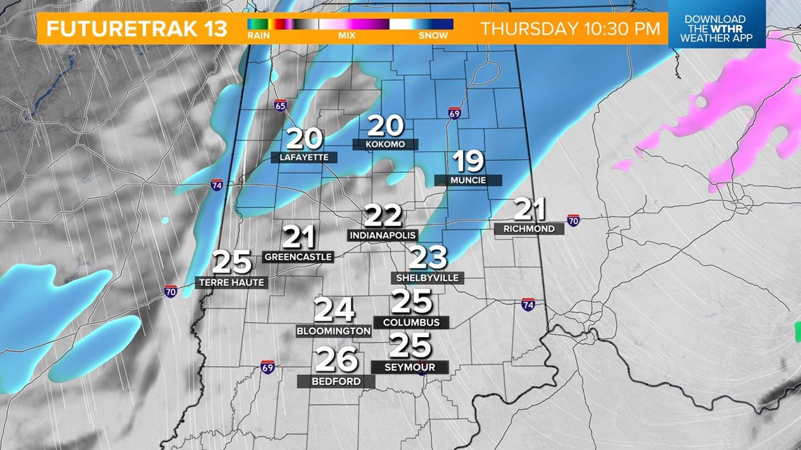
Since this front will be moving rather quickly, wintry accumulation will be limited for most of central Indiana. Minor snow accumulation will be most likely in the far northwestern part of central Indiana with a light glaze of ice possible elsewhere with the wintry precipitation.

Temperatures will plummet overnight into Friday morning as the sky clears. Morning temperatures will be in the teens with afternoon highs near freezing.