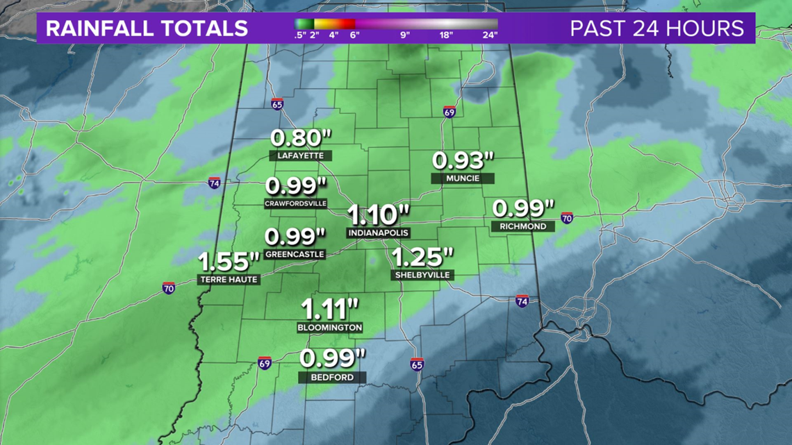
INDIANAPOLIS — It was quite a soggy Sunday in central Indiana with many gauges getting near 1" of rain and several exceeding that.
While it was mainly a cold rain for most of the area, snow was reported in Lafayette and Monticello, and it was a winter wonderland in northeast Indiana, northwest Ohio and southern lower Michigan.

This system was the first of several to cut across the Ohio Valley/Great Lakes over the next week.
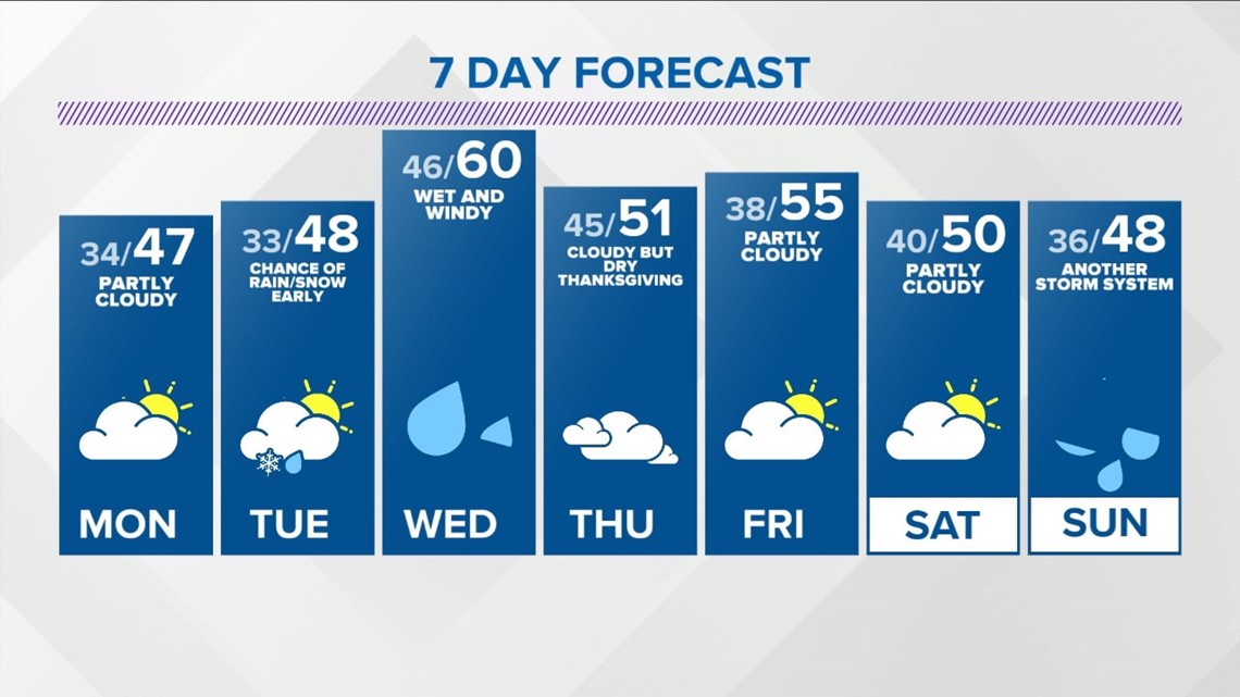
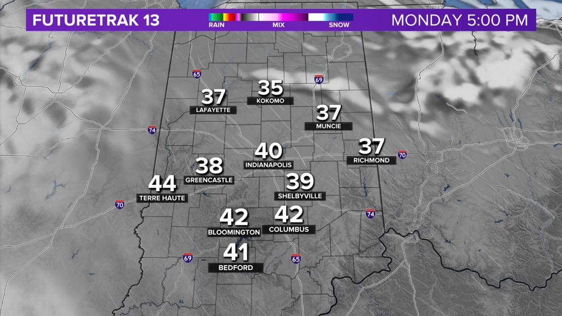
We're in between systems on Monday with a mix of sun and clouds, in addition to seasonably chilly temperatures in the 40s.

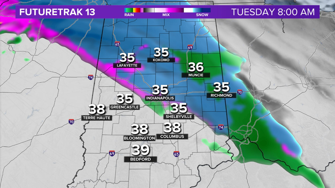
A warm front moves across the state early Tuesday morning and moves enough moisture and cold air to produce a quick burst of rain/sleet/snow before the boundary lifts north of the region by Tuesday afternoon. Snow accumulation is not likely, but would be notable if it does occur as the first snow of the season for some places.

It also precedes a wet and windy Wednesday as low pressure moves across the state. Within the warm sector on Wednesday, highs will be near 60°.
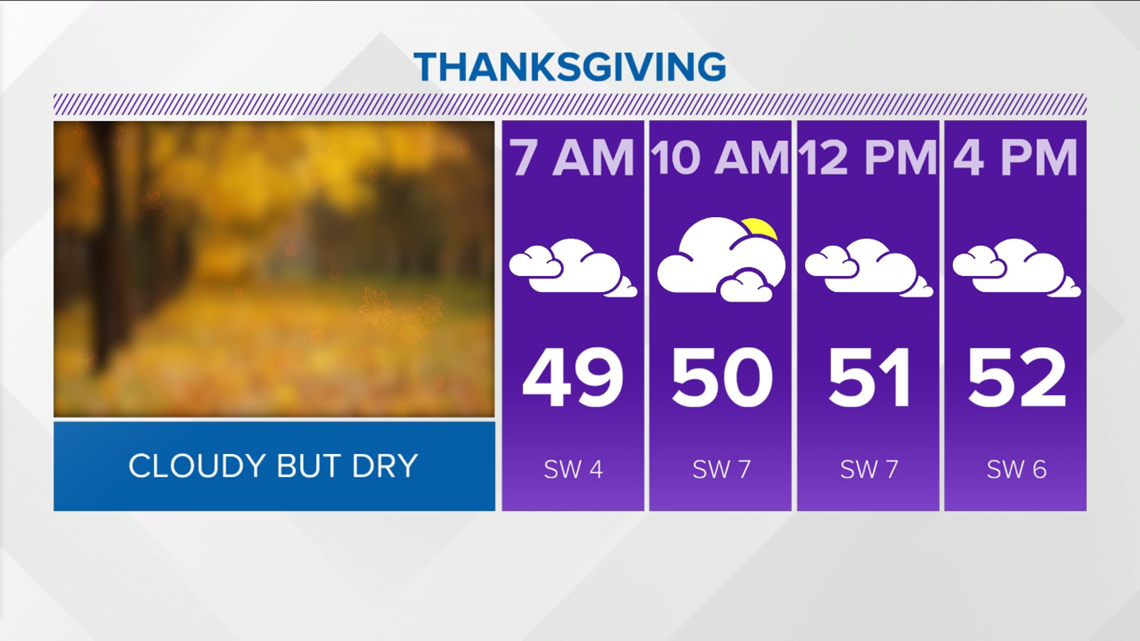
In the wake of this system, there will be abundant low clouds around for Thanksgiving and near-normal temperatures in the upper 40s/lower 50s.

The third, and perhaps strongest, system is expected next Sunday and could deliver rain changing to snow to finish November. Check back for updates.