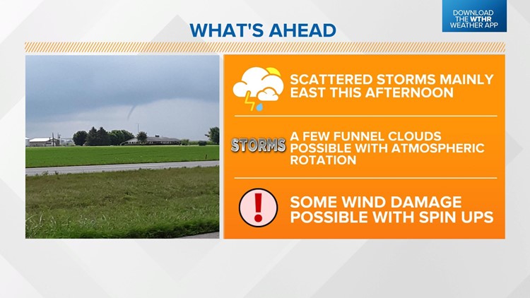
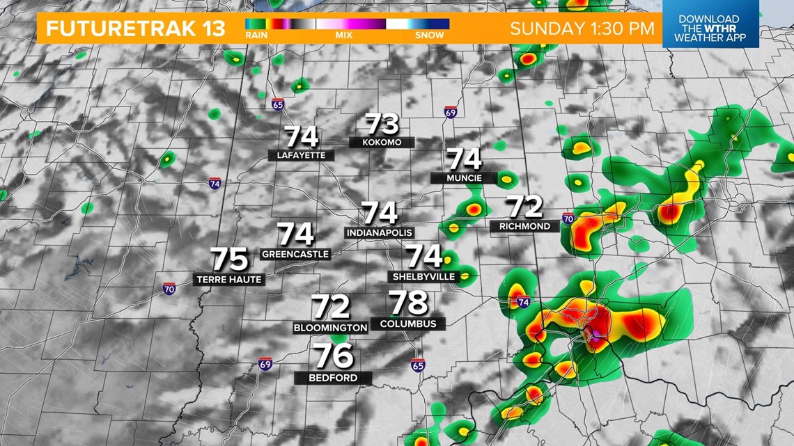
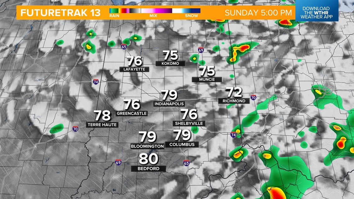
INDIANAPOLIS — As a cold front stalls on the eastern side of the state, pop-up storms will develop between 1 p.m. and 5 p.m.


Severe weather is not expected but a few cold air funnels will be possible, given the changing air mass and spin in the atmosphere. These can cause minor damage with downed small trees and branches.
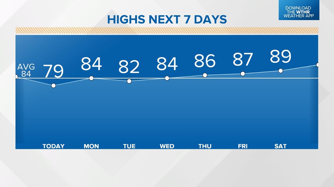
Highs will be in the upper 70s or low 80s Sunday afternoon.


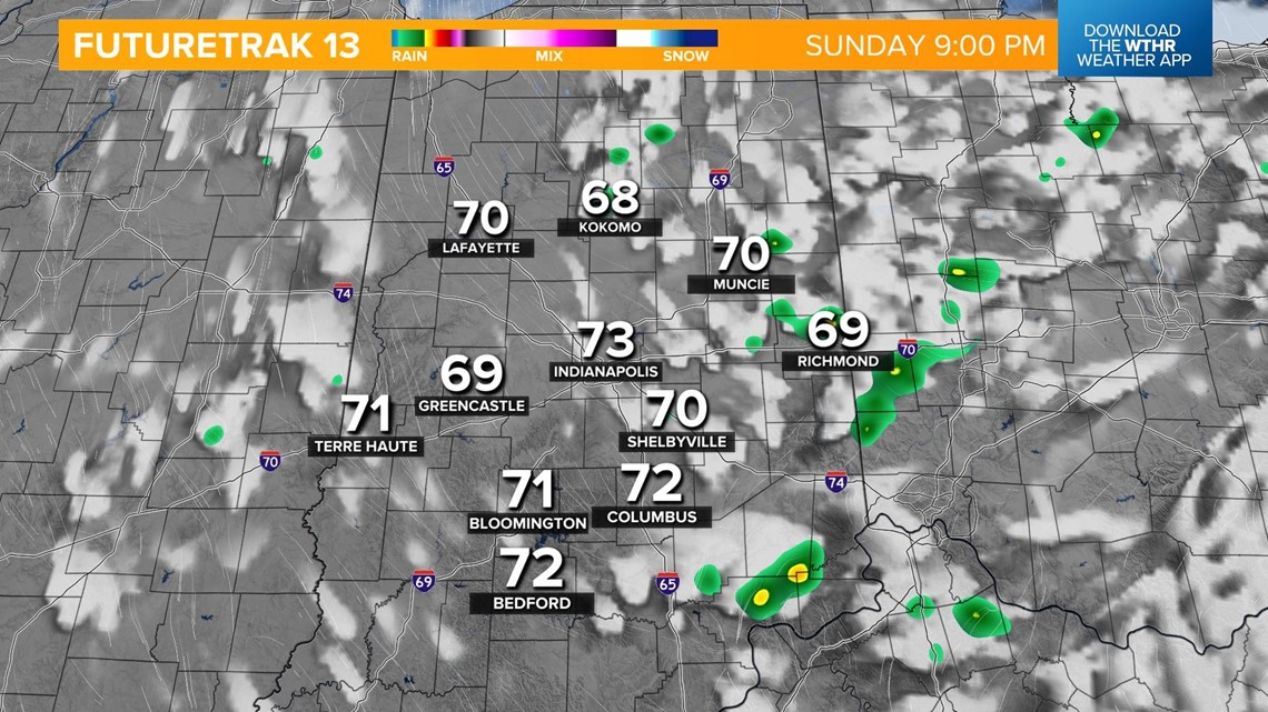
This storm system continues to exit to the east this evening as dry air takes over.

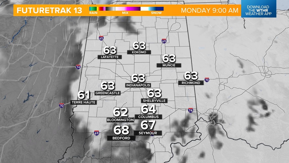
Areas of fog will be possible Monday morning as temperatures drop into the low 60s.

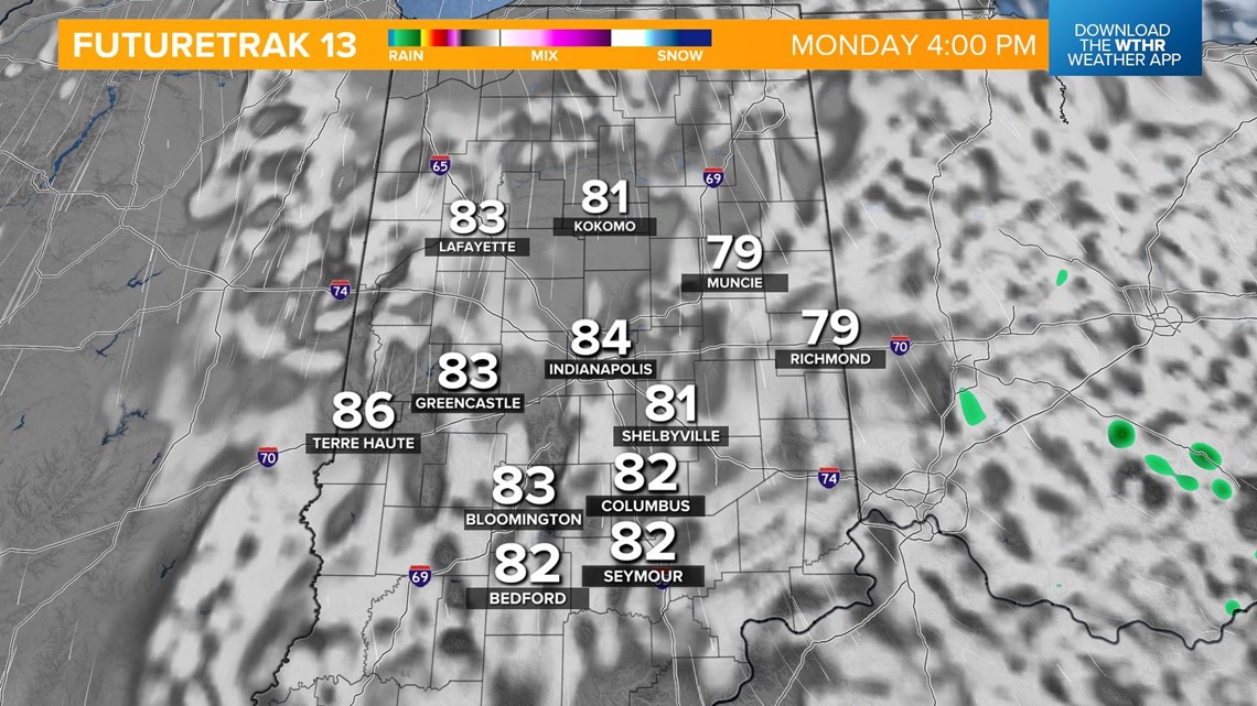
Skies become partly cloudy in the afternoon with a stray shower possible - especially east once again. Highs will be in the low-to-mid 80s.

Another dry stretch begins on Tuesday and lasts through the rest of the work week. Tuesday will be the coolest day of the week with highs in the low 80s. We'll heat back up to the mid-80s for highs starting on Wednesday.

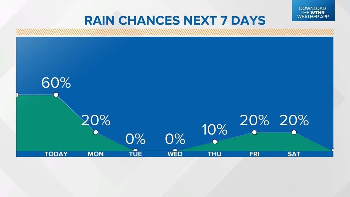
The air turns hotter by Friday with highs in the upper 80s. Friday will be mainly dry with a stray storm possible.
This hotter, more unsettled pattern keeps highs in the upper 80s with spotty storm chances through next weekend.