
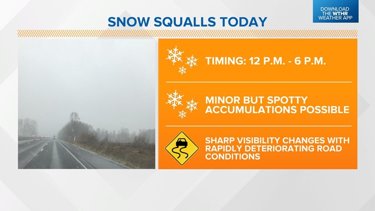
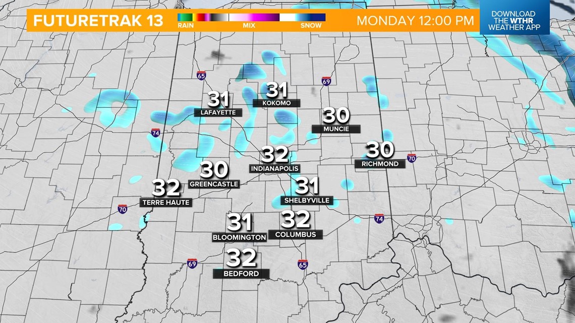
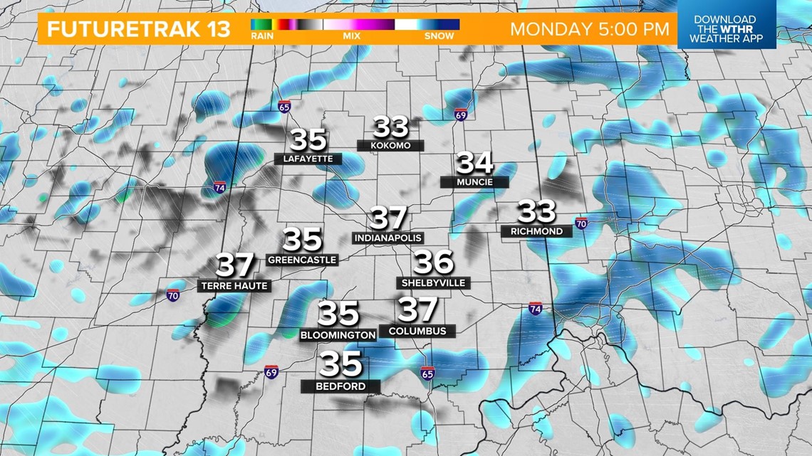
INDIANAPOLIS — Another weak disturbance will track across the Great Lakes region today prompting scattered snow showers through the afternoon. In fact, the setup for today supports the development of snow squalls. These are intense bursts of snow and wind that only last a few minutes. While they don't bring heavy snow accumulation, they can rapidly reduce visibility and cause brief whiteout conditions and dangerous travel.


This setup will be most likely between lunch time and the evening commute.


These snow showers taper off after sunset and the sky will begin to clear. Temperatures remain unseasonally cold with highs in the upper 30s. While snow exits the forecast and is replaced by sunshine on Tuesday, we'll still be cold with highs in the upper 30s.

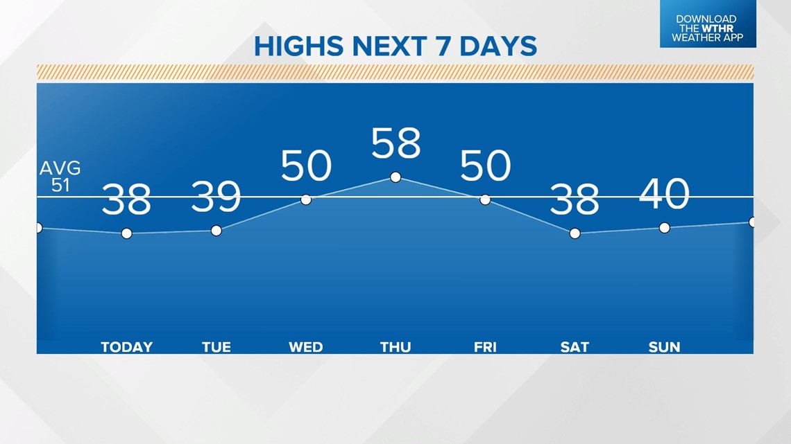
A warming trend by mid-week takes high temperatures up to near 50 on Wednesday under a mostly sunny sky, and near 60 on Thursday. This will be a brief warming trend as rain and a few storms come along a cold front late Thursday night into the first part of the day Friday.

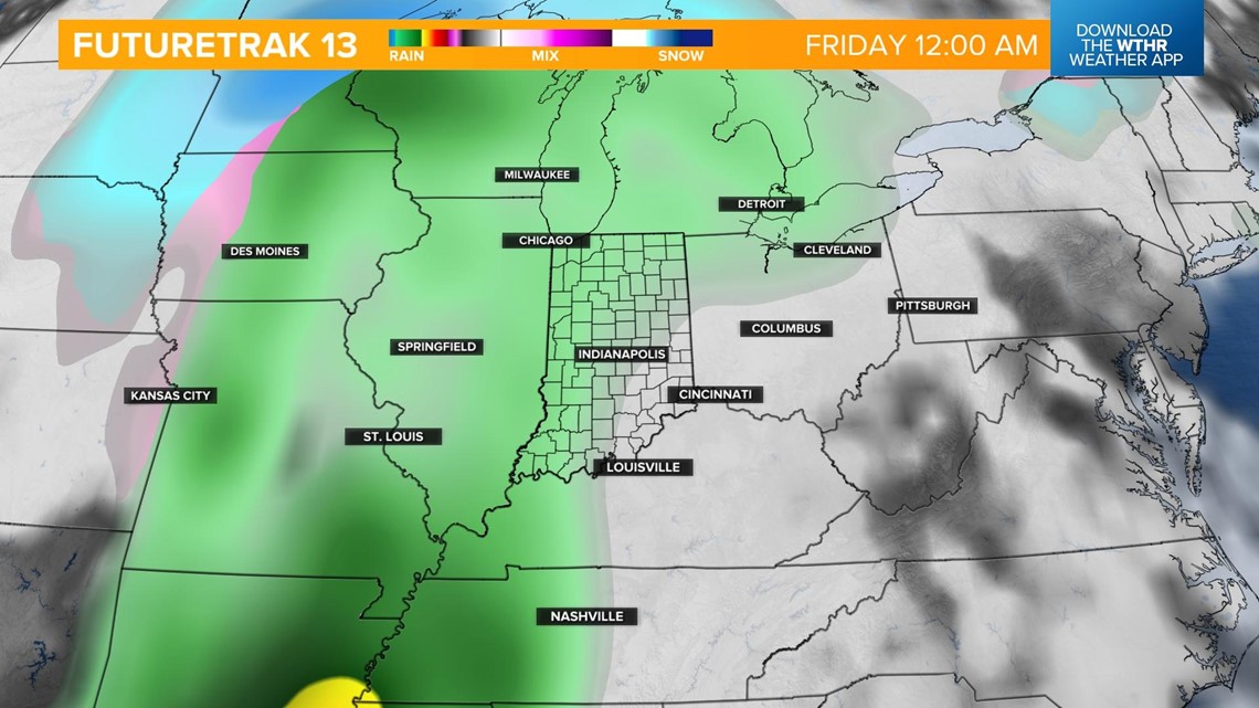
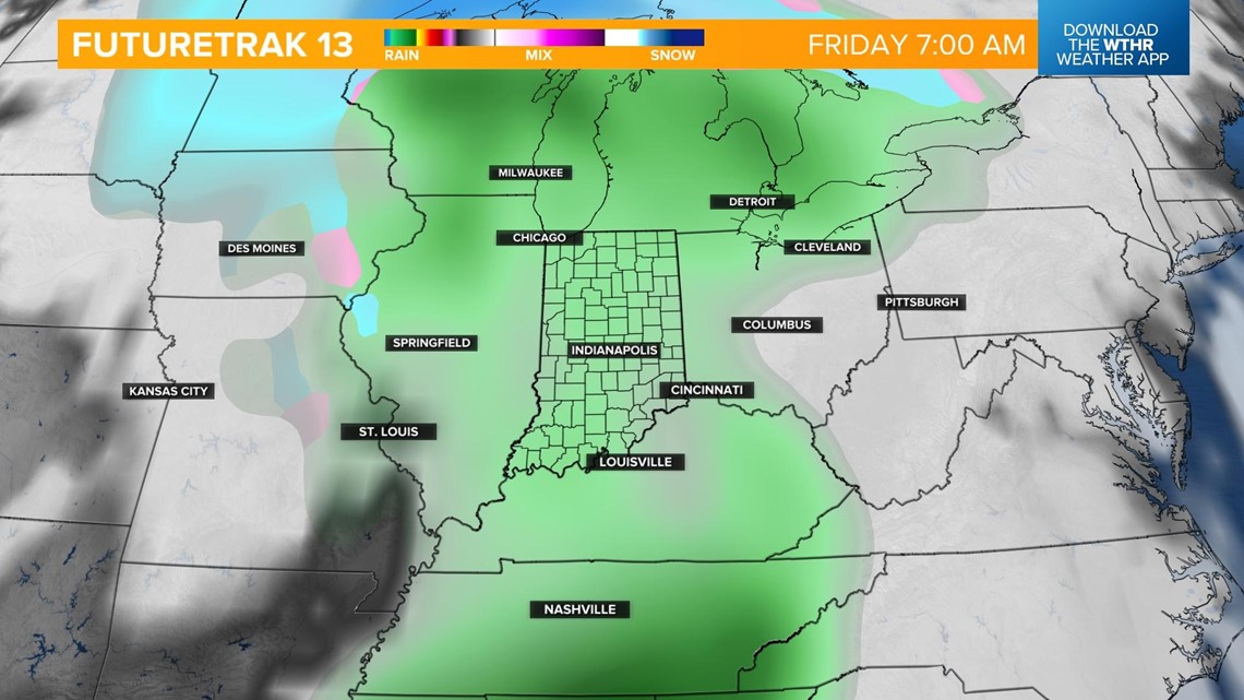
Temperatures start in the low 50s early Friday morning and will fall into the 40s during the day for St. Patrick's Day festivities. Rain will likely linger through the early afternoon before clearing out Friday night.

Colder air settles in for the weekend with highs only in the upper 30s Saturday and pushing 40 on Sunday. Most areas stay mainly dry with only a stray flurry chance early Sunday.
