
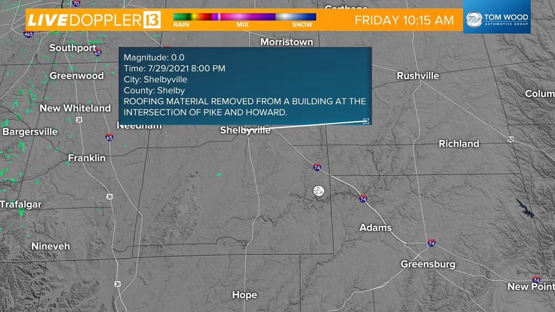
INDIANAPOLIS — A severe thunderstorm caused some damage in Shelby County Thursday night.
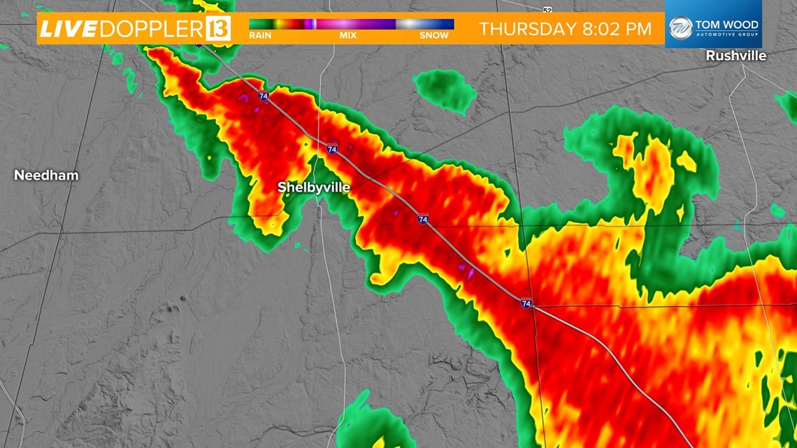
The storms were very intense when they moved through around 8 p.m.
The National Weather Service in Indianapolis will be visiting Shelby County today to see if the storm damage was due to a tornado. If it was, indeed, a tornado, the NWS will track the tornado path and width and also rate it on the EF scale.
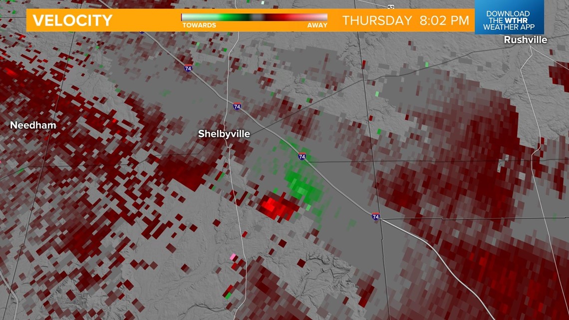
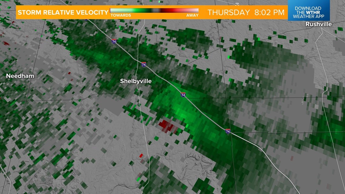
Radar from last night did look like there was rotation. Here is a look at the base velocity and storm relative velocity. Look for the pixels of red and green. That is the area where there was possibly a tornado.


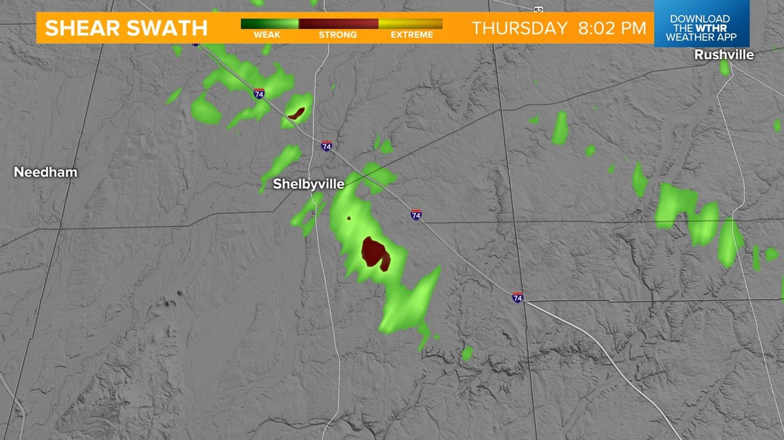
And here is a look at our shear swath product, showing that there was likely some rotating winds within the storm.

Radar reflectivity showed how the area to the southeast of Shelbyville was creating a tornado ball on radar.

There was a couple of reports of wind damage in Shelby County last night.

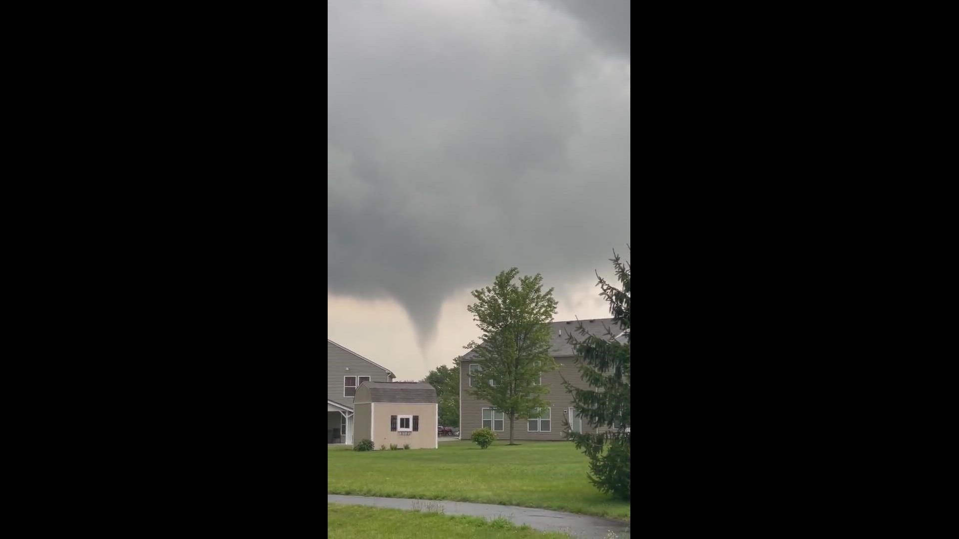
13News viewers Curtis and Maria Lewis captured video of a funnel cloud near Shelbyville.