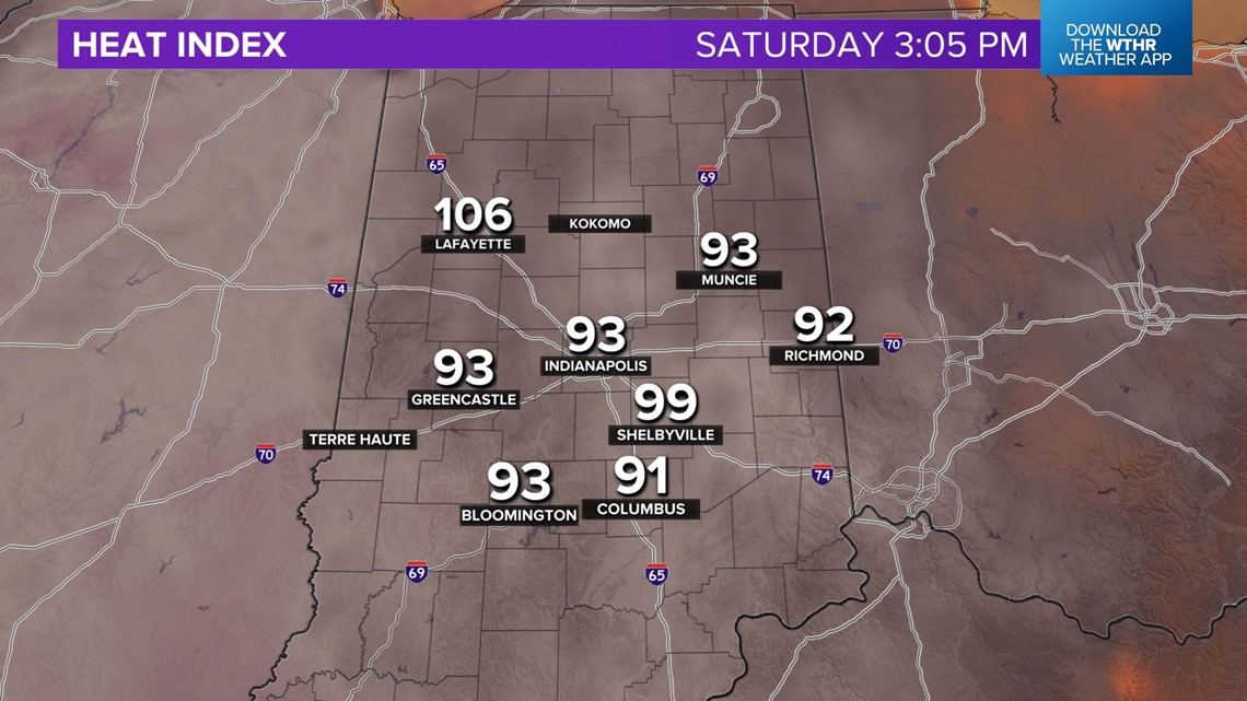
It was 290 days between 90°+ high temperatures in Indianapolis but it took less than 24 hours for the city to do it again. As expected, this afternoon became the hottest day of the year thus far and it may become our hottest day since last July.

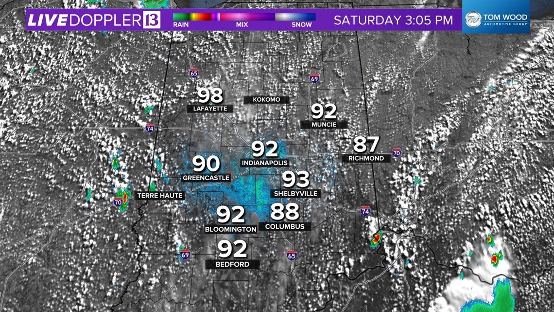
Either way, it's very uncomfortable and will be dangerous if you don't take heat precautions as heat indices peak near 100° for several hours this afternoon.

Storms have initiated near the Illinois/Indiana border and we expect additional locally heavy storms between now and midnight.
It's not a guarantee your outdoor event will be impacted, but you should remain weather aware and be prepared to go indoors if you hear thunder roaring.
Lightning and downpours are main storm risks, but a few severe wind gusts and/or hail are possible.
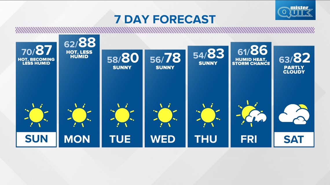
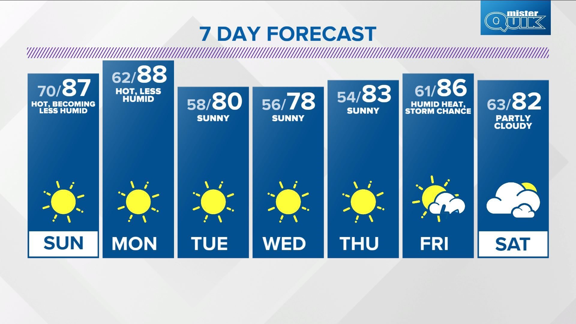
Our string of miserably muggy air gradually comes to an end on Sunday, but not before waking up to dewpoints again near 70°.

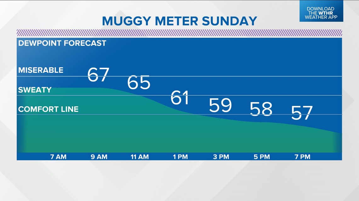
Drier air will be noticeable by sunset Sunday and it marks the beginning of a prolonged stretch of comfortable dewpoints in the 50s.

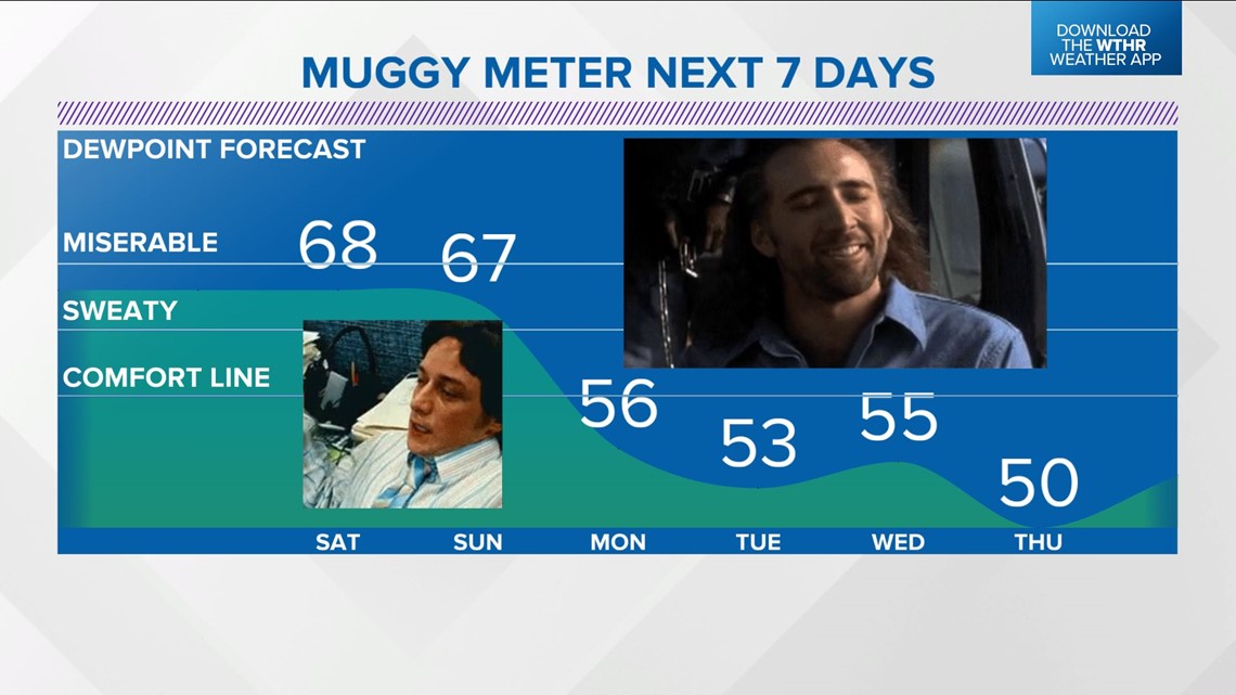
With that said, the drier air will still be hot on Sunday and Monday with highs in the upper 80s.