

INDIANAPOLIS —
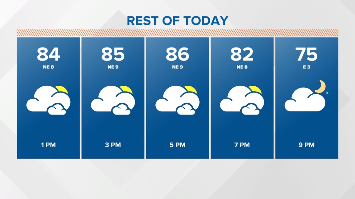
(WTHR) — The warm summer conditions continue again today with temperatures back above average into the mid-80s.

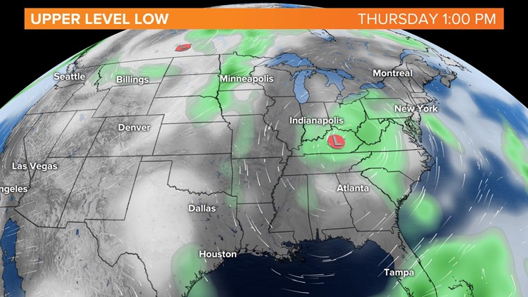
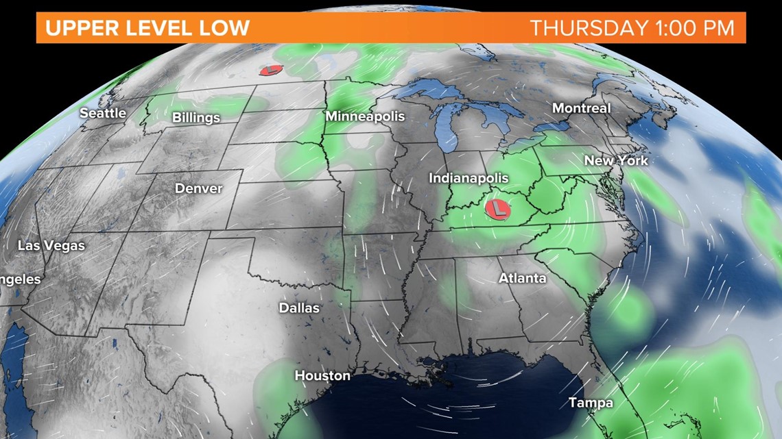
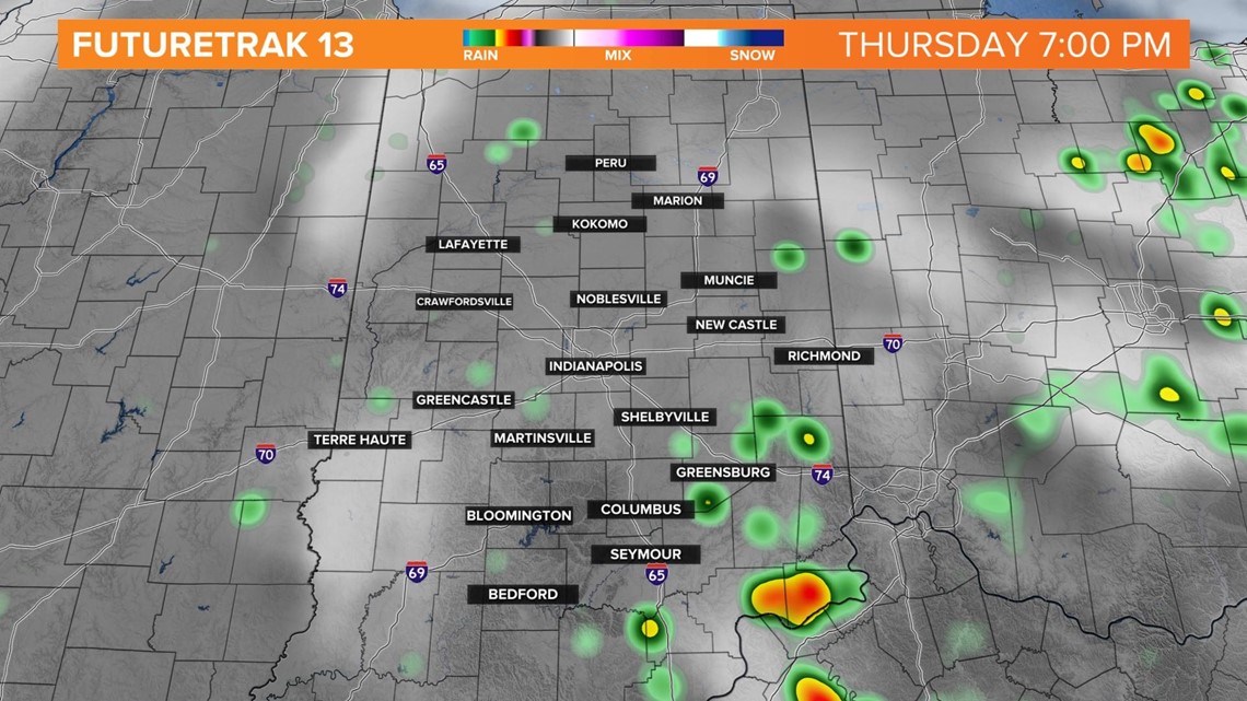
An upper level low will retrograde west this afternoon, bringing a good chance of a few scattered showers and thunderstorms, mainly in southeast central Indiana.


Otherwise, it will be partly sunny with a wind out of the east.
Skies stay partly cloudy this evening for most with the exception of southwest Indiana, where showers and storm chances continue. Temperatures fall into the mid-60s.
Friday will be mainly dry, sunny and hot. Indianapolis could record it’s first 90° of the year.


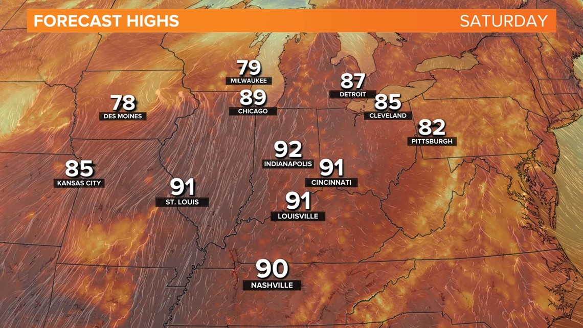
A ridge in the upper levels will build in on Saturday. This will allow even more heat and humidity to arrive. Afternoon highs will climb into the low 90s.

By Saturday night, a few scattered showers and thunderstorms will be possible.
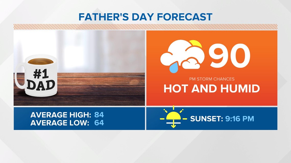
Father’s Day will be hot and humid and possibly stormy by afternoon, as a cold front arrives. Storms become likely by Sunday evening. Sunday will still be hot with highs in the upper-80s to near 90 degrees.

More unsettled weather will be around for the start of the work with cooler air returning behind the cold front by mid week.
