
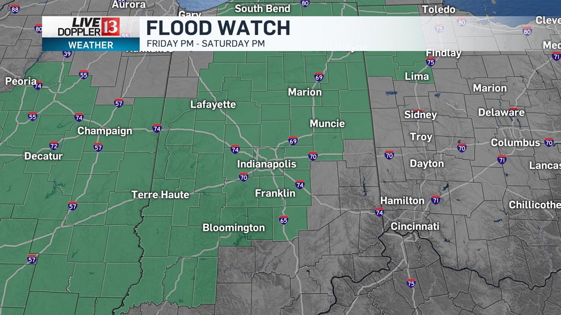
A flood watch has been issued for Friday night through Saturday night, due to the threat for 2-4 inches of rain.

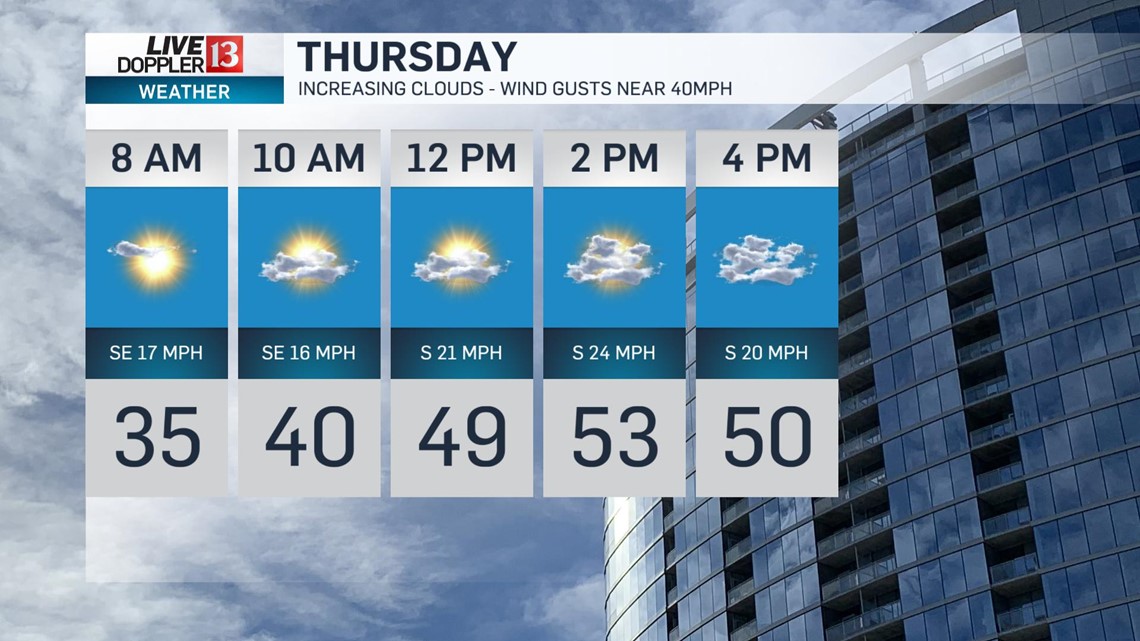
Skies will be clear tonight and it will be a cold evening, with temperatures in the middle and upper 20s. As a southerly flow of air begins to increase, temperatures will actually climb a few degrees overnight and be in the lower 30s for Thursday morning. Thursday will be windy and milder, with highs in the lower 50s. Winds will be SSE 15-25 with gusts near 40mph. Thursday will start with some sun. Clouds will increase Thursday afternoon and there is a chance for a few showers by Thursday evening.

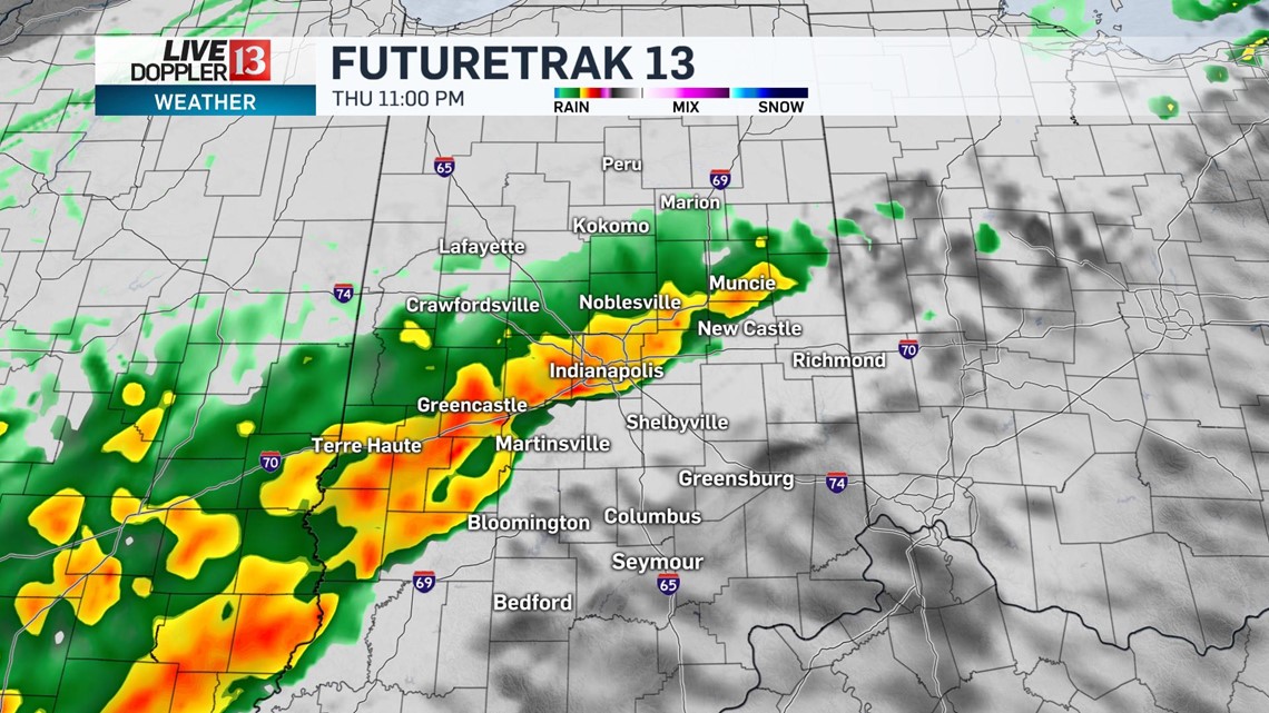
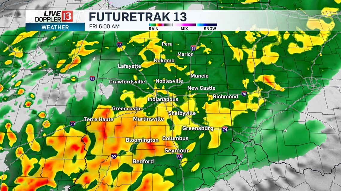
We are tracking a high impact storm system for Thursday night through Saturday night. We are forecasting several waves of heavy rain, with rainfall potential 1-3 inches. There will be a few higher totals near 4 inches. The first wave of steadier rain is in the forecast for Thursday night and early Friday.


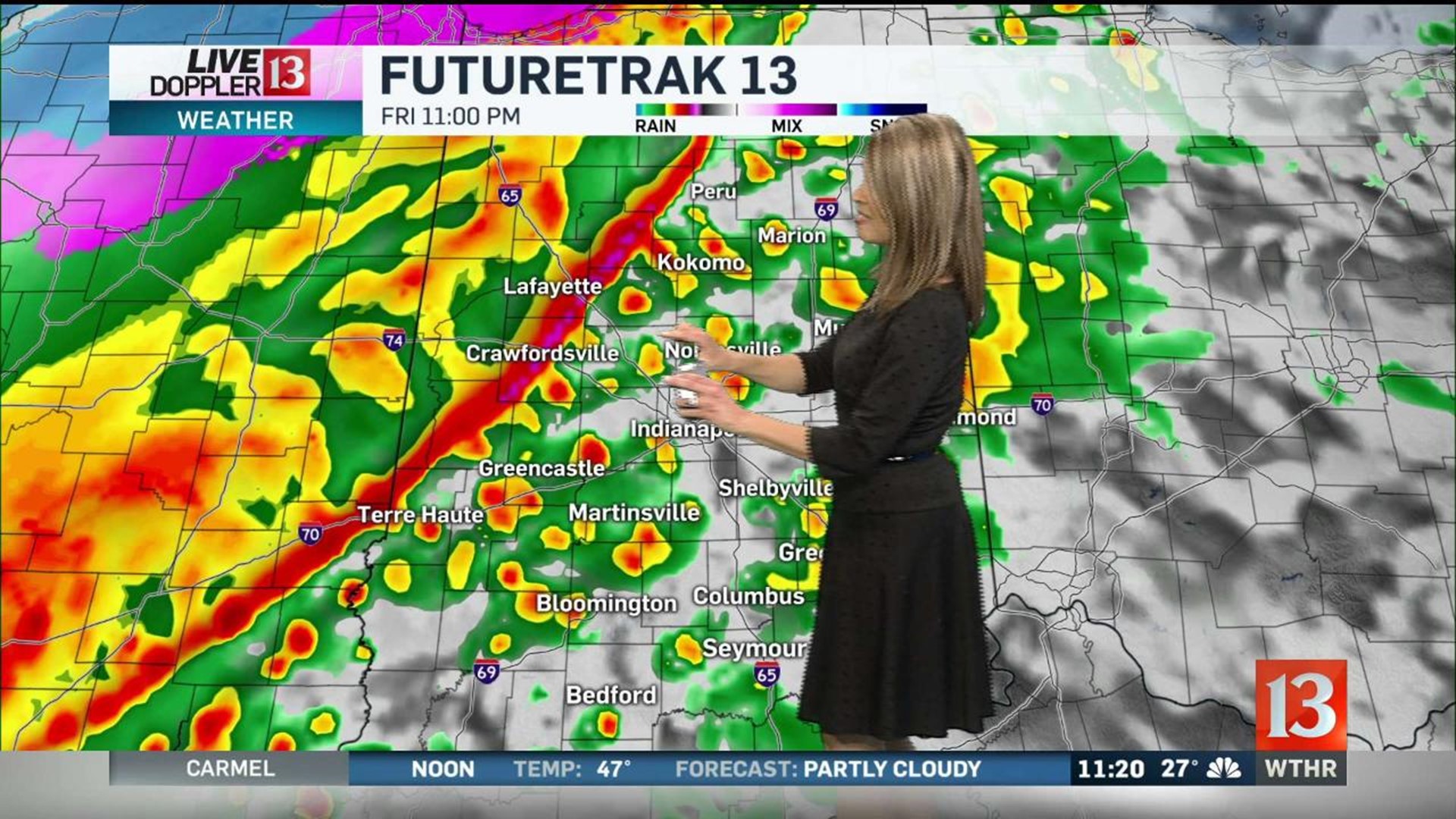
The next wave arrives Friday night into early Saturday.

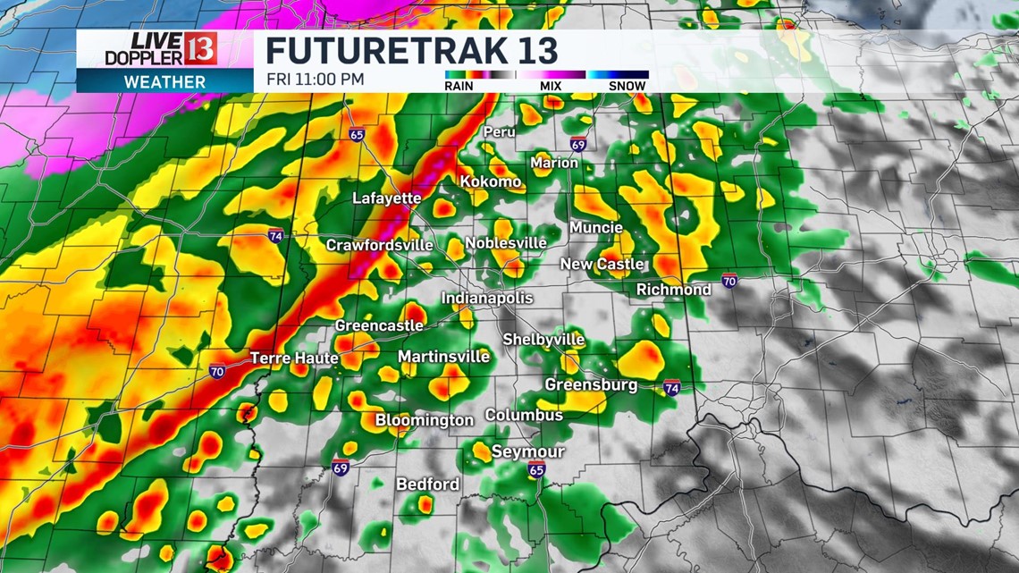
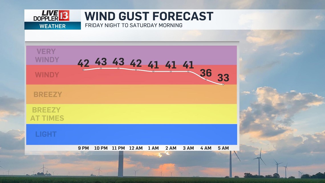
Some gusty storms will be possible with that wave Friday night and winds may gust over 50mph. Here is the wind forecast.

There is some colder air with this storm system too. We are forecasting to stay on the warm side, but if you have travel plans to Michigan, Wisconsin and northern Illinois be aware there is the threat for ice and heavy snow. We may see our rain change to a wintry mix and snow later Saturday. Stay tuned for updates.