
INDIANAPOLIS — Storms moved through central Indiana on Monday, with Hoosiers urged to Stay Weather Aware as tornado watches and warnings were in effect for areas.
A tornado watch is issued when the ingredients are perfect for a tornado. You've got wind shear, or fast changes in wind speed or direction over a short period of time or distance. There's also moisture in the atmosphere.
But a warning means the tornado is here. That's the time to get to a safe shelter as fast as possible.

Please Stay Weather Aware Monday and follow live updates below:
Monday updates
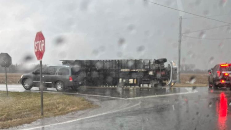
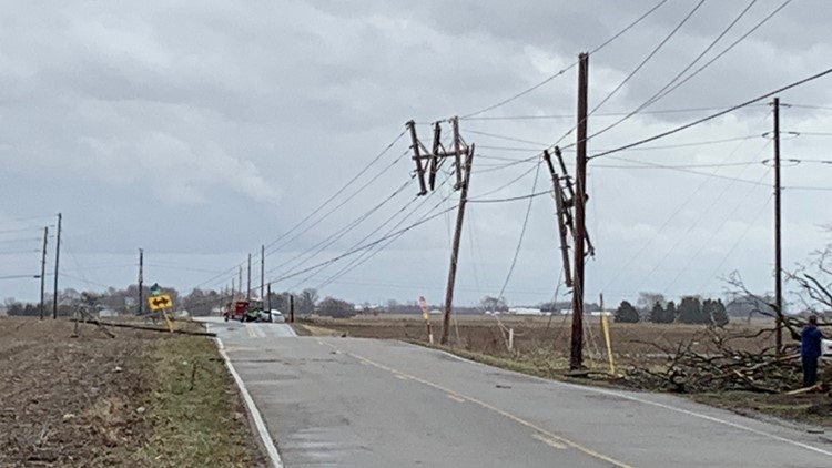
3:47 p.m. - A truck was blown on its side in Fortville. The Hancock County Sheriff's Department said the driver and passenger said they were at a stop sign when the wind picked up and blew their truck on its side. No injuries were reported.
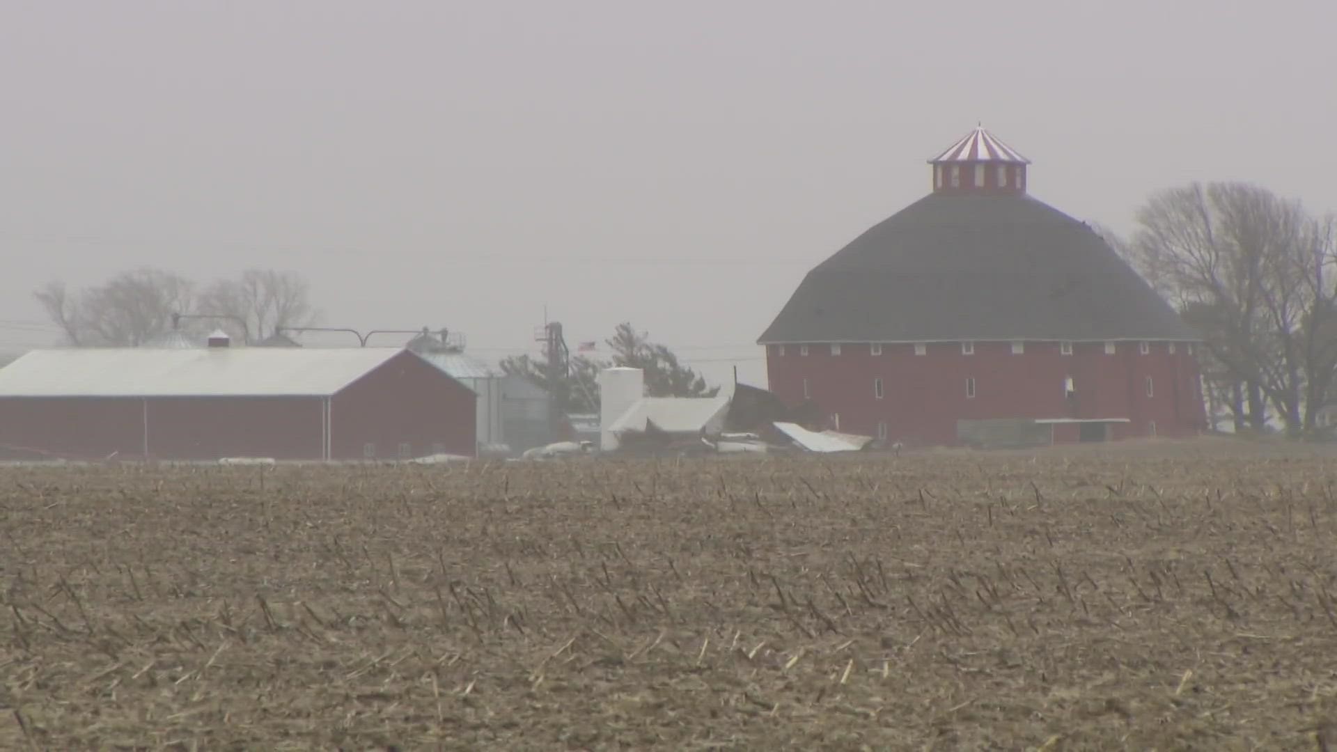
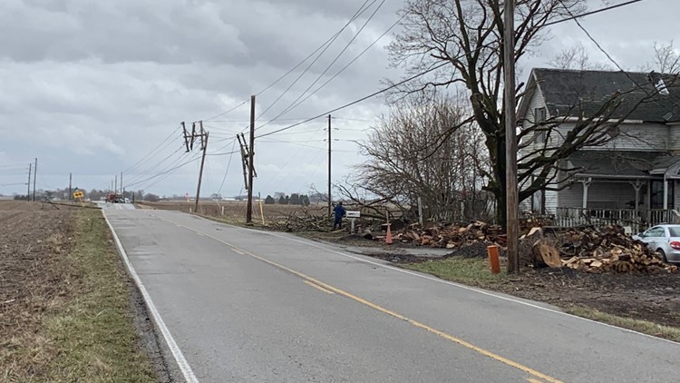
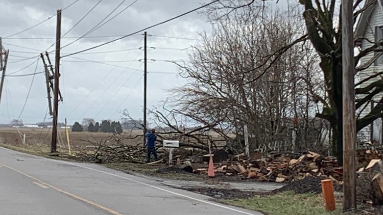
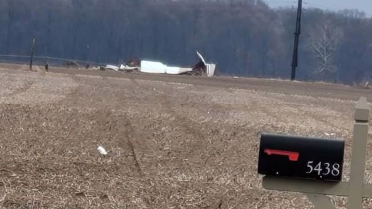
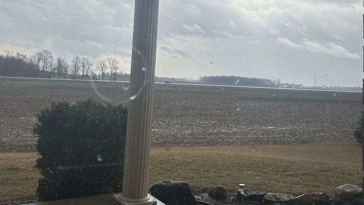
GALLERY: Storm damage Monday, Feb. 27, 2023


2:22 p.m. - Storms are still around, but the severe weather has settled for awhile.
2:15 p.m. - Sean says areas from Marion County west are clear of the severe weather threat.
2:11 p.m. - East central Indiana continues to have the threat of severe storms until about 3 p.m.
2:10 p.m. - AES is reporting 235 customers without power. Duke Energy is reporting nearly 9,000 outages.
2:06 p.m. - Severe storms are moving toward Abington.
2:03 p.m. - Possible rotation over Waterloo.
1:59 p.m. - Please seek shelter if you are in Wayne County.
1:54 p.m. - All counties west of Indianapolis have been dropped from the Tornado Watch.
1:50 p.m. - A Tornado Warning is in effect for Franklin, Ripley and Dearborn counties until 2:15 p.m.
1:48 p.m. - The Tornado Warning for Hamilton County was canceled.
1:46 p.m. - Staff and students at all Noblesville schools are being moved to safe areas in buildings.
1:43 p.m. - The Tornado Warning for Howard and Tipton counties was canceled.
1:38 p.m. - Sean Ash is seeing possible debris from the tornado on radar in Hancock County.
1:34 p.m. - A Tornado Warning is in effect for Hamilton, Hancock, and Madison counties until 2 p.m.
1:25 p.m. - Parts of Decatur and Jennings counties are under a Tornado Warning until 2 p.m.
1:20 p.m. - A Tornado Warning is in effect for Howard and Tipton counties until 2 p.m.
1:15 p.m. - A severe thunderstorm warning is in effect for Marion, Hamilton, Hancock, Hendricks and Madison until 1:45 p.m.
1:13 p.m. - A severe thunderstorm warning is in effect for Marion and Hamilton counties until 1:45 p.m.
1:01 p.m. - Please Stay Weather Aware through the afternoon.
12:57 p.m. - Strong storms are moving into Hendricks and Marion counties.
12:55 p.m. - A severe thunderstorm warning is in effect for areas including Seymour, Brownstown and Vallonia until 1:30 p.m.
12:48 p.m. - A severe thunderstorm warning remains in effect for parts of Lawrence and Monroe counties until 1 p.m. and Brown County until 1:15 p.m.
12:43 p.m. - There will be a risk for strong to severe storms for central Indiana for the next few hours. The National Weather Service warns Hoosiers could see damaging winds and isolated tornadoes along with heavy rain and lightning.
12:40 p.m. - The National Weather Service is keeping an eye on storms developing in the Lafayette and Covington areas until 1 p.m.
12:35 p.m. - The Tornado Warning for Putnam County has ended. The area remains under a tornado watch.
12:33 p.m. - A Severe Thunderstorm Warning is in effect for Lawrence and Monroe counties until 1 p.m. Areas could see damaging winds and pea-sized hail.
12:15 p.m. - The National Weather Service issued a Tornado Warning for Putnam County in western Indiana until 1 p.m.
12:15 p.m. - The National Weather Service issued a Tornado Warning for Benton County in northwestern Indiana until 12:45 p.m.
12:10 p.m. - Many central Indiana counties, including Marion, are under a Tornado Watch until 4 p.m.
11:50 a.m. - We are keeping an eye on storm popping up in the Terre Haute area.