
A warm front will bring a brisk southwest wind today pushing temperatures into the lower 70s. Clouds increase in the late afternoon and stray showers develop as a cold front approaches. Widespread rain chances will be likely after 5 p.m. through the early overnight hours. Rain will be out of central Indiana by 4 a.m. early Wednesday.
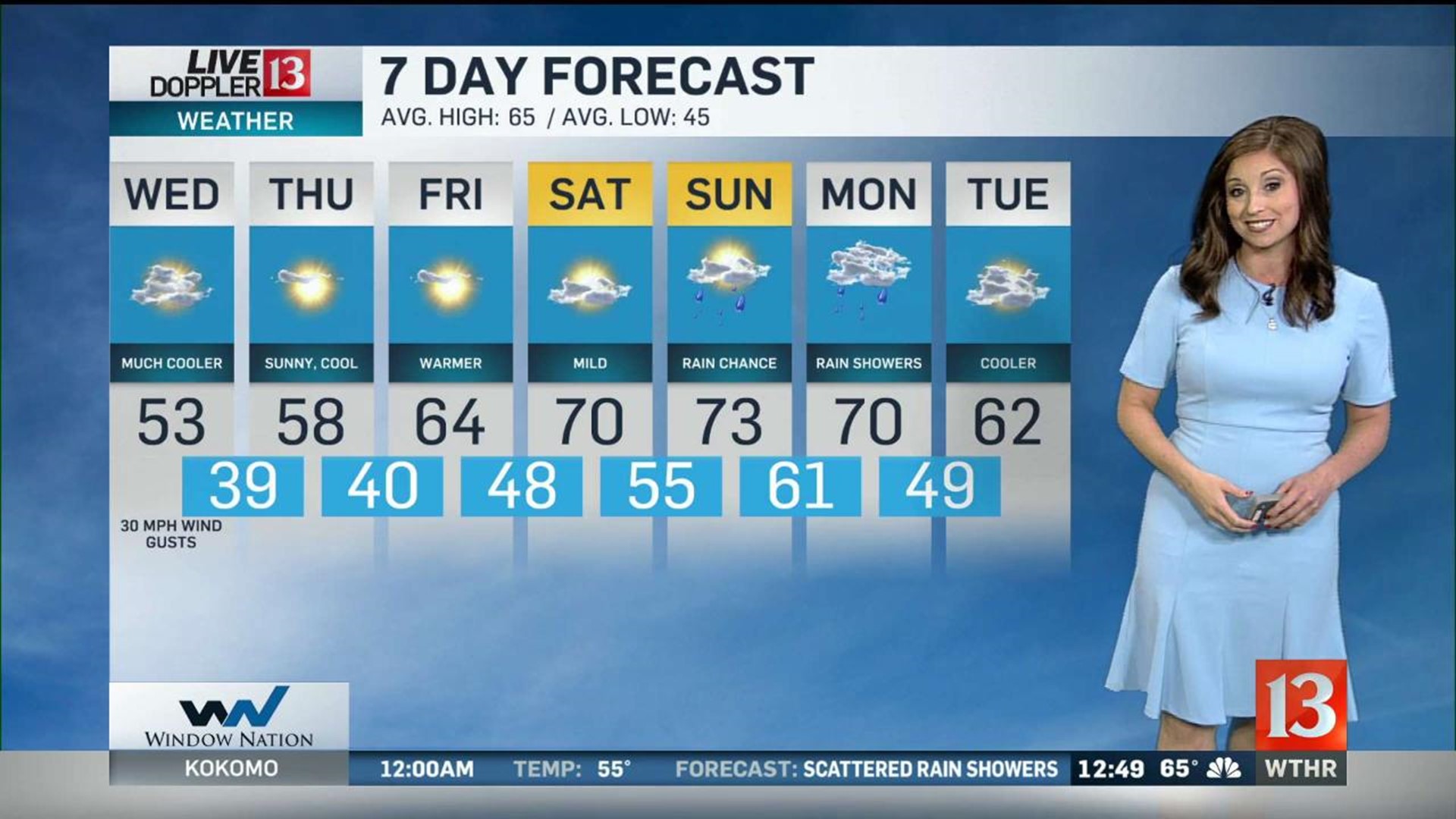
Temperatures will fall drastically behind this system with morning lows Wednesday in the lower 40s and highs only in the lower 50s. It stays breezy with 30 mph wind gusts from the northwest under a mostly to partly cloudy sky.
Sunshine returns for Thursday but it remains unseasonably cool with highs in the upper 50s. Dry weather continues into Friday with slightly warmer highs in the mid 60s.
Temperatures look to stay more moderate with highs in the lower 70s for the weekend. Saturday looks to be a dry day with increasing rain chances for Sunday and Monday.
Our next temperature drop will be behind the wet pattern next Tuesday. - Lindsey Monroe