
Weather today requires a wardrobe change from light clothing and rain gear to winter layers. This is due to a well-advertised sharp cold front that moves across the state between 2 PM and 8 PM.
Before it arrives, temperatures hover around 70°-75° for much of the day... despite rounds of rain and thunderstorms. Rain will be heavy at times over the next 12 hours and stronger cells may produce some hail. However, we don't anticipate any severe weather.
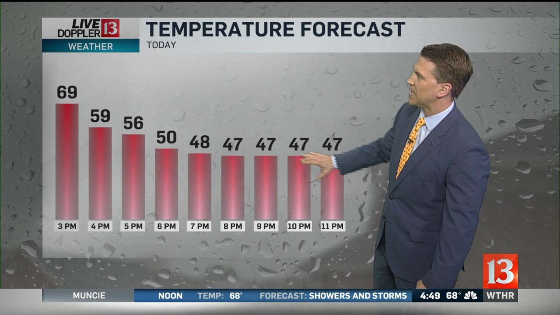
The front moves across the Indy metro area between 4 - 6 PM... sending temperatures from near 70° down to near 50° by 7 PM. Temperatures fall into the 30s/40s by 10 PM with wind chills even lower. We highly recommend you layer-up, have rain boots, gloves, and hats if you'll be outside for Operation Football games this evening. The same applies for those attending the make-up Luke Bryan concert at Ruoff Music Center. Though the heaviest rain rates likely move east after 6 PM... a steady drizzle is expected to continue to around midnight. The falling temperatures and dampness make for a raw evening outside.
Overnight clouds clear but a brisk northwest wind continues... sending temperatures to their coldest levels locally since April. We're forecasting lows of 32° to 37° which likely leads to Freeze Watches for parts of the viewing area heading into Saturday morning. Wind may be strong enough to prevent widespread frost, temperatures will be cold enough that you'll want to cover-up or bring in your plants.
A rather brisk and cold Saturday morning featuring a bright sky. But despite the early day sunshine, afternoon temperatures only manage the mid to upper 50s... with wind gusts exceeding 40 mph at times.
Sunday will be warmer with highs in the 60s but remaining windy with gusts again near/above 40 mph.