
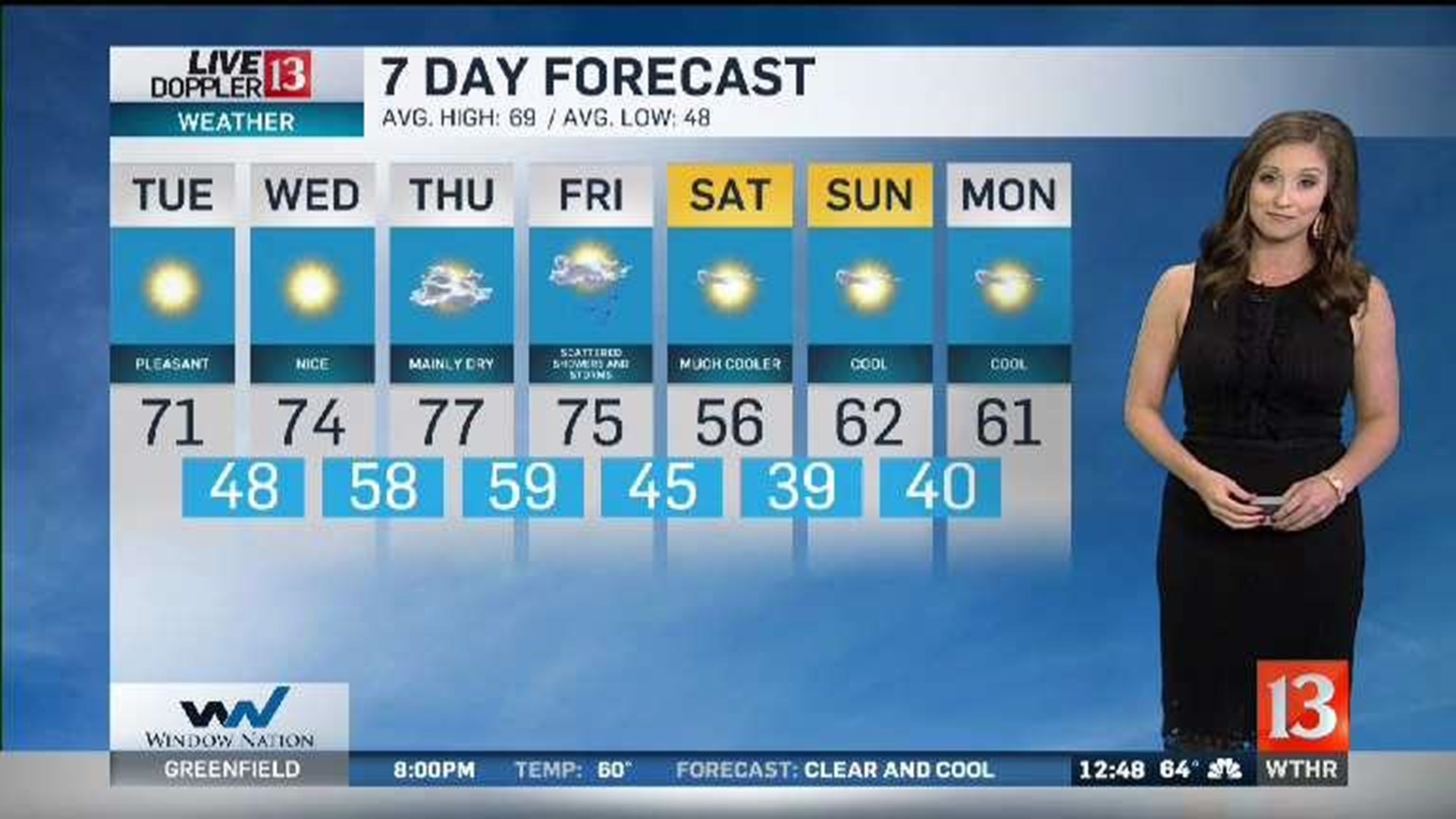
If you're a fan of seasonably chilly nights, sunny days, mild afternoons, and a light breeze... then you're going to love our weather from today and much of the week ahead.
A little leftover cloud cover from the most recent front continues to depart to the east... setting the stage for a crystal clear night. This bodes well for an International Space Station flyover between 8:47-8:49 PM.
Light jackets needed in the morning at the bus stop and when you head into work as lows drop into the low and mid 40s. Even some 30s possible in rural areas Tuesday morning with dewpoints currently in the 30s.
The chilly start quickly gives way to a afternoon highs near 70 with abundant sunshine. Highs temperatures moderate the rest of the week with highs in the mid-70s Wednesday, upper 70s Thursday, and near 80 Friday.
All signs point toward another front impacting the Ohio Valley between Friday afternoon and midday Saturday... with the exact timing of associated precipitation uncertain to modeling differences.
But it does appear to bring a decent shot of cool air for the weekend with highs going from near 80 Friday into mid-50s for Saturday afternoon. In addition, a powerhouse storm system in the northern plains/upper midwest will be a weekend wind-maker for Central Indiana.
At this time it appears gusts of 30+ mph Saturday and 40+ Sunday seem possible. We'll monitor in the days ahead with the potential of Wind Advisories. It looks breezy but mainly bright this weekend though with the center of the aforementioned storm remaining well north of us.