

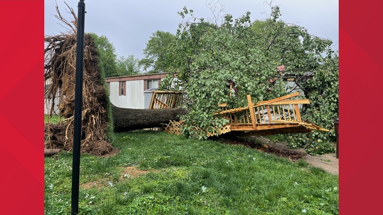
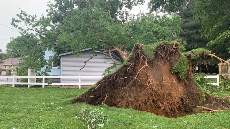
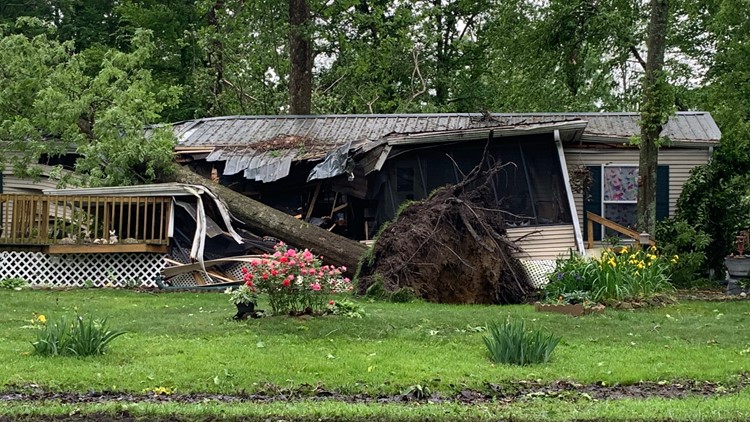
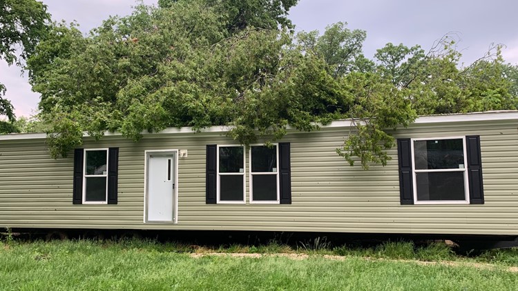
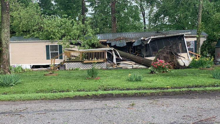
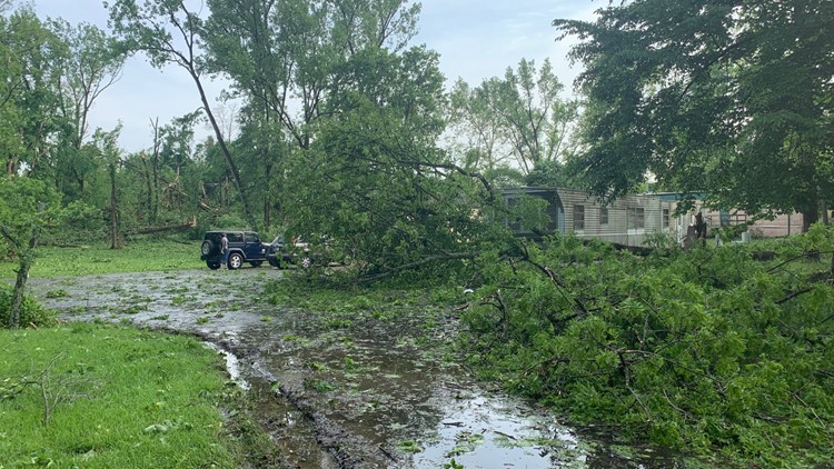
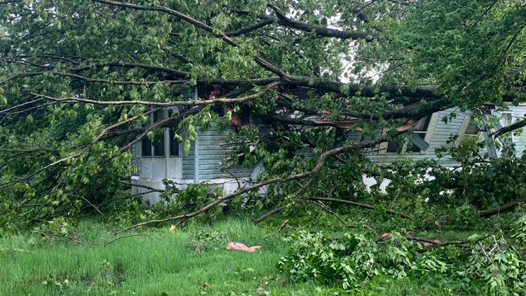
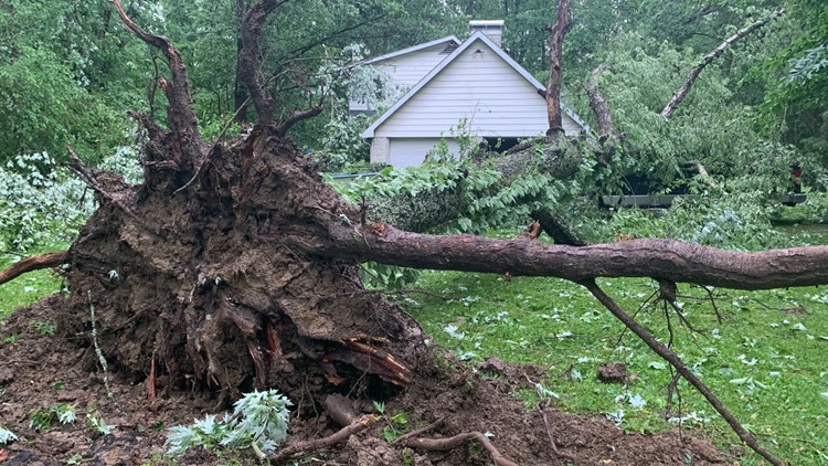
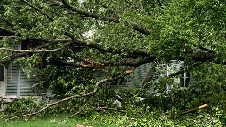
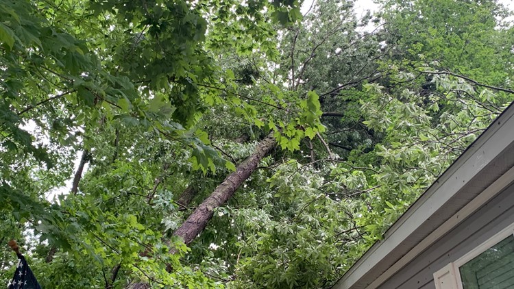
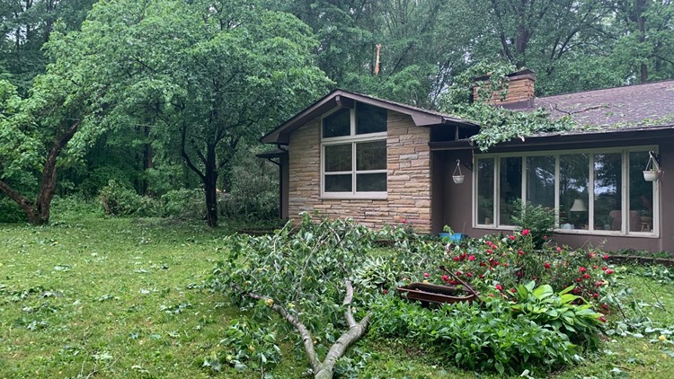
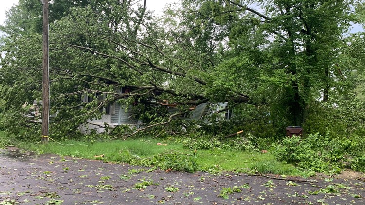
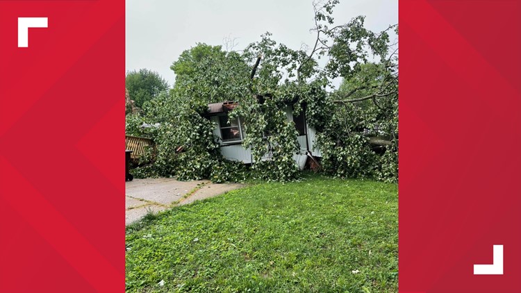
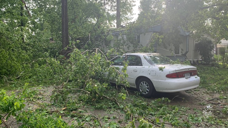
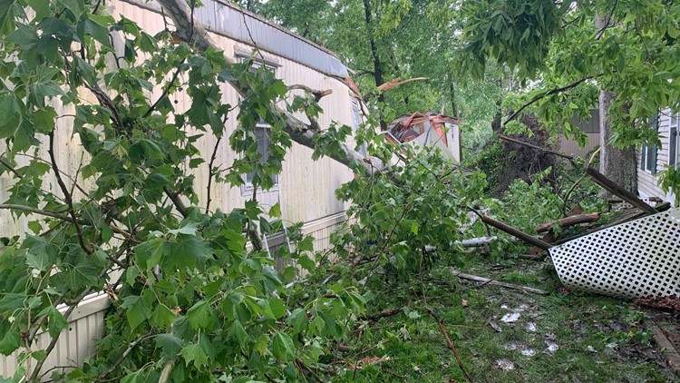
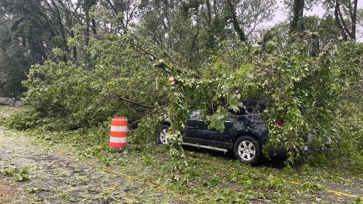
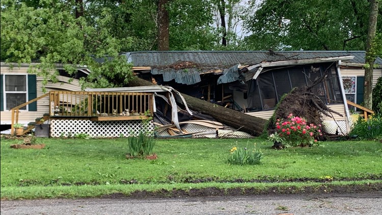
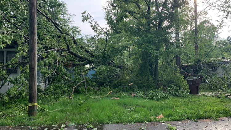
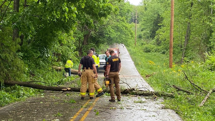
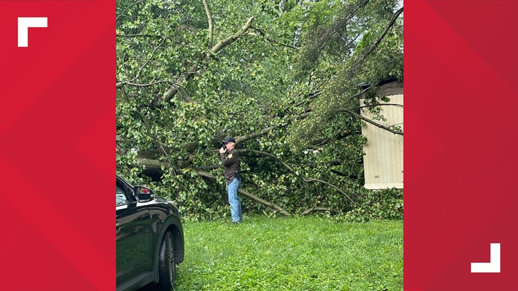
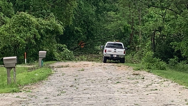
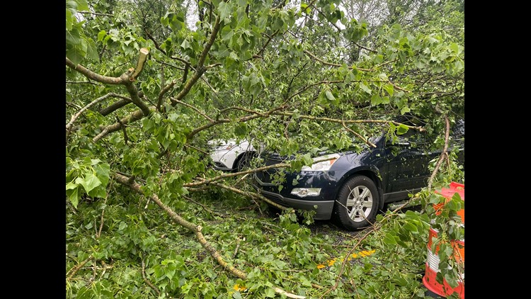
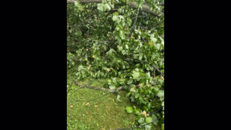
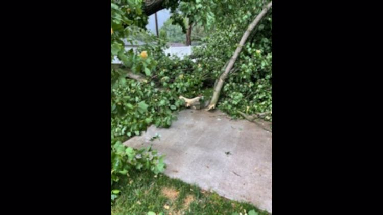
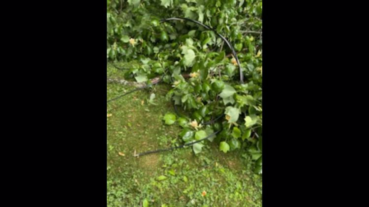
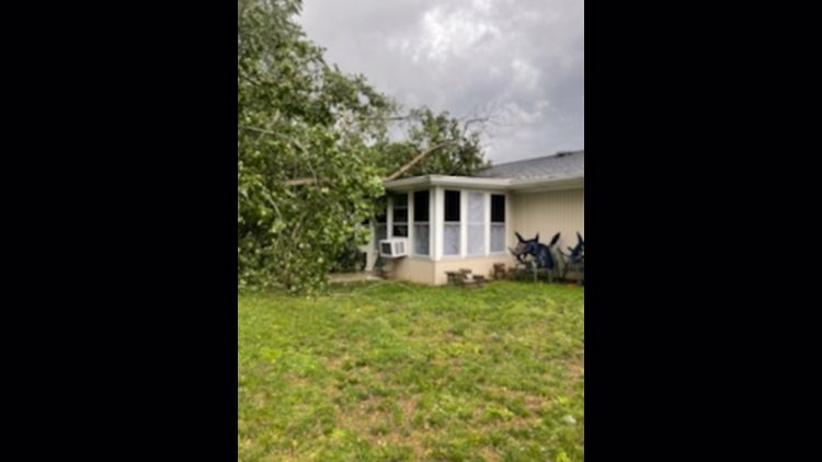
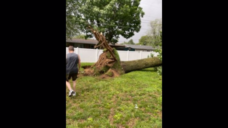
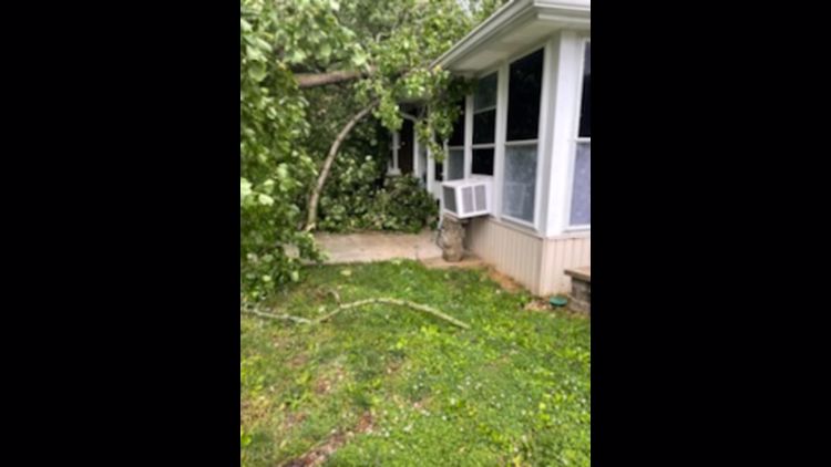
INDIANAPOLIS — Strong storms prompted a handful of tornado warnings in parts of central Indiana on Saturday. Downed powerlines caused widespread power outages and, in some areas, powerful winds ripped trees from the ground, some of which landed on homes and crushed them.
A Severe Thunderstorm Watch was issued for most of central and all of southern Indiana through 7 p.m. Strong storms developed ahead of the main line of storms that prompted the risk of severe weather with damaging wind gusts and large hail as the primary threats.
Tornado Warnings were issued for a handful of counties, including Wayne, Fayette, Union, Rush and Shelby Counties. Those warnings expired just before 5 p.m.

Temperatures will be cooler on the backside of this frontal system with lows in the mid 50s. The sky clears through Sunday morning with sunshine in the afternoon. Cooler temperatures and it will be way less humid with highs only in the upper 60s. It should be a great day out at the Indianapolis Motor Speedway for Top 12 qualifying.
GALLERY: Strong storms strike Indiana on Saturday, May 21, 2022


Live Storm Blog:
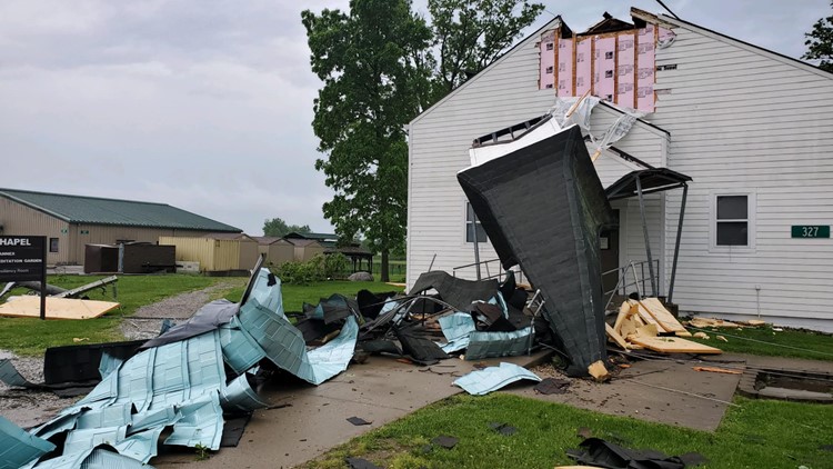
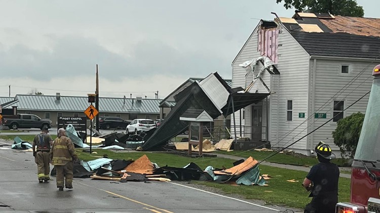
7:46 p.m. - The Trafalgar Fire Department shared photos of the Camp Atterbury Post Chapel, which had part of its roof fly off.
7:00 p.m. - Nashville Police say power is back on for most parts of Nashville, Indiana.
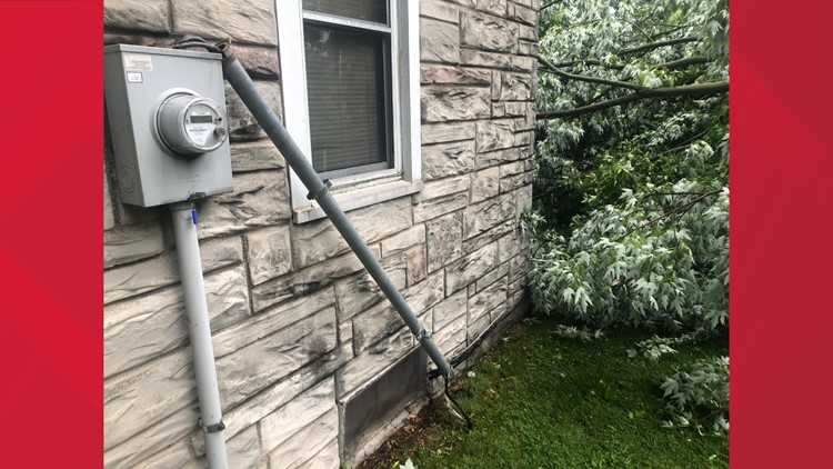
5:52 p.m. - Columbus firefighters are responding to multiple power lines down across the area.
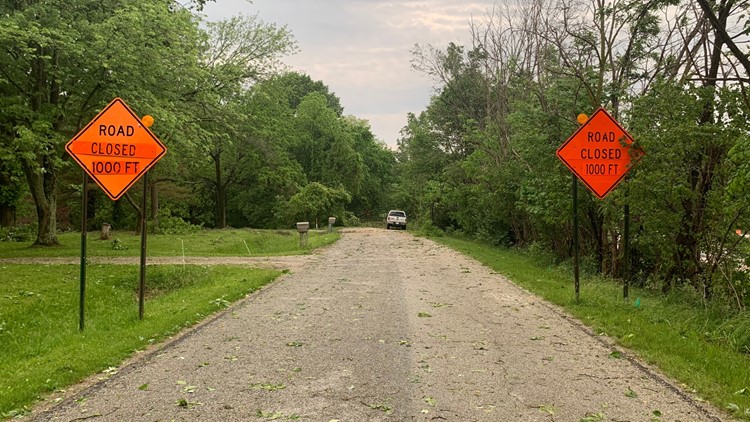
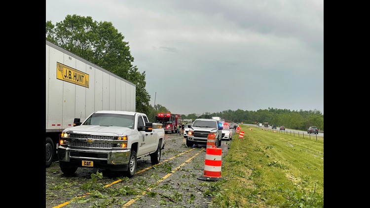
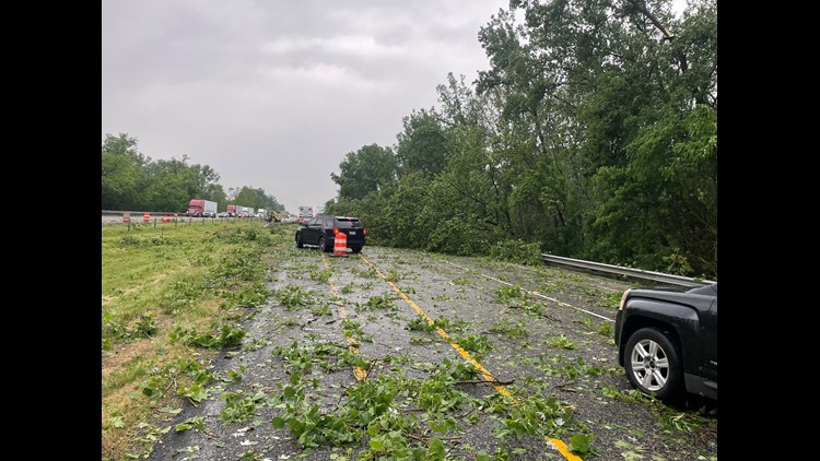
5:35 p.m. - Here is a look courtesy of Whiteland FD of the storm damage causing issues on I-65 between Edinburgh and Franklin.
5:29 p.m. - Napoleon firefighters responded to multiple utility poles and power lines down along the highway between County Road 1050N and the Decatur County line.
5:20 p.m. - Bartholomew County REMC says it has about 2,016 outages.
5:01 p.m. - Duke Energy is reporting about 47,143 customers without power. Nearly 19,000 of those are in the Edinburgh area.
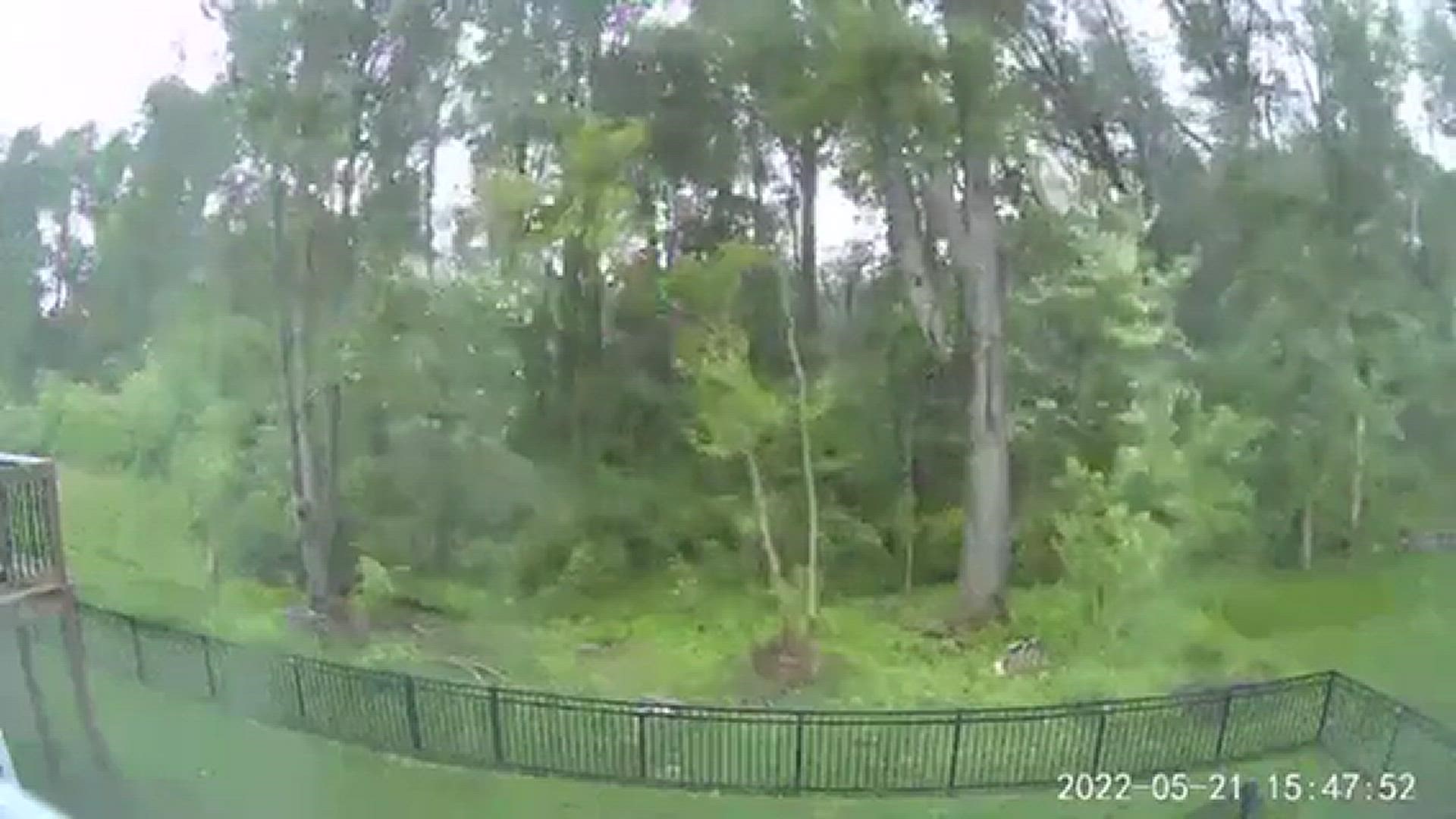
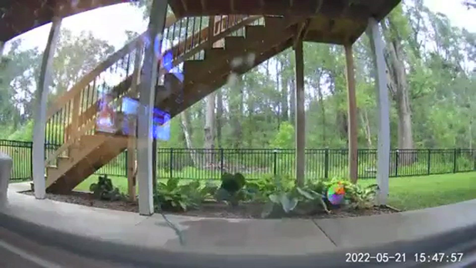
4:51 p.m. - Here's a look at the strong winds that his Columbus, Indiana courtesy of Robert Rauchfuss.
4:45 p.m. - The Tornado Warnings have all been canceled. Severe Thunderstorm Warnings remain in effect for several counties.
4:43 p.m. - All lanes of I-65 south are closed for an overturned semi between County Line and US-31. INDOT expects the closure to last for the next three hours.
4:40 p.m. - Dave says everyone got in for qualifications at the track before the storms.
4:39 p.m. - Severe Thunderstorm Warnings are still in effect for Fayette, Union, Wayne, Decatur and Rush counties.
4:38 p.m. - Hail is likely with these storms along with the strong winds.
4:30 p.m. - The Tornado Warning now includes Wayne, Fayette and Union counties until 5 p.m.
4:28 p.m. - The town of Nashville, Indiana is out of power due to strong storms in the area. Authorities are working to get power back up and running as soon as possible.
4:28 p.m. - Parts of Wayne and Fayette counties are under a Tornado Warning until 5 p.m.
4:21 p.m. - Images of storm damage are coming in from Columbus Indiana.
4:16 p.m. - Sean Ash says whether there is a tornado on the ground or not, high winds likely 70+ mph are heading into St. Paul. Take cover until it passes.
4:10 p.m. - A Tornado Warning is in effect for parts of Rush and Shelby counties until 4:30 p.m. If you are in those areas, seek shelter immediately.
3:41 p.m. - Most central Indiana counties are at risk of severe weather through 7 p.m. with more storms expected this evening.
3:14 p.m. - Torrential downpour on I-65 near Franklin.
3:06 p.m. - A Severe Thunderstorm Warning was issued for Monroe, Greene and Lawrence counties until 3:30 p.m. Damaging wind/large hail are the main threat. The storm is tracking northeast at 40 mph toward Guthrie, Clear Creek, Bloomington and Lake Monroe.
3 p.m. - A Severe Thunderstorm Warning was issued for Owen, northern Monroe and Morgan counties until 3:30 p.m. The storm is tracking northeast at 40 mph toward Martinsville.
2:58 p.m. - The main line of storms is about an hour from the Indianapolis Motor Speedway.
2:28 p.m. - A Severe Thunderstorm Warning has been issued for Clay, Greene, Owen and Sullivan counties until 3 p.m.
2:20 p.m. - Rain is falling at Indianapolis Motor Speedway, which has put qualifying on hold. All 33 cars had at least one attempt at qualifying. In doing that, the top 12 is set and will advance.